


<< Text Pages >> Pyramid of Ahmose - Pyramid / Mastaba in Egypt in Upper Egypt (South)
Submitted by ChengYingYu on Tuesday, 14 July 2020 Page Views: 519
Multi-periodSite Name: Pyramid of AhmoseCountry: Egypt
NOTE: This site is 0.532 km away from the location you searched for.
Region: Upper Egypt (South) Type: Pyramid / Mastaba
Nearest Town: Abydos Nearest Village: Nagaa Al Ghabat
Latitude: 26.175100N Longitude: 31.937700E
Condition:
| 5 | Perfect |
| 4 | Almost Perfect |
| 3 | Reasonable but with some damage |
| 2 | Ruined but still recognisable as an ancient site |
| 1 | Pretty much destroyed, possibly visible as crop marks |
| 0 | No data. |
| -1 | Completely destroyed |
| 5 | Superb |
| 4 | Good |
| 3 | Ordinary |
| 2 | Not Good |
| 1 | Awful |
| 0 | No data. |
| 5 | Can be driven to, probably with disabled access |
| 4 | Short walk on a footpath |
| 3 | Requiring a bit more of a walk |
| 2 | A long walk |
| 1 | In the middle of nowhere, a nightmare to find |
| 0 | No data. |
| 5 | co-ordinates taken by GPS or official recorded co-ordinates |
| 4 | co-ordinates scaled from a detailed map |
| 3 | co-ordinates scaled from a bad map |
| 2 | co-ordinates of the nearest village |
| 1 | co-ordinates of the nearest town |
| 0 | no data |
Internal Links:
External Links:
Pyramid in Upper Egypt (South)
Pyramid of Ahmose / a cenotaph for pharaoh Ahmose I
You may be viewing yesterday's version of this page. To see the most up to date information please register for a free account.
Do not use the above information on other web sites or publications without permission of the contributor.
Nearby Images from Flickr
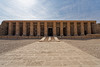
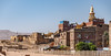
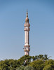
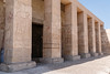
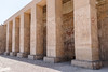
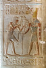
The above images may not be of the site on this page, but were taken nearby. They are loaded from Flickr so please click on them for image credits.
Click here to see more info for this site
Nearby sites
Click here to view sites on an interactive map of the areaKey: Red: member's photo, Blue: 3rd party photo, Yellow: other image, Green: no photo - please go there and take one, Grey: site destroyed
Download sites to:
KML (Google Earth)
GPX (GPS waypoints)
CSV (Garmin/Navman)
CSV (Excel)
To unlock full downloads you need to sign up as a Contributory Member. Otherwise downloads are limited to 50 sites.
Turn off the page maps and other distractions
Nearby sites listing. In the following links * = Image available
1.3km WSW 251° Abydos Senusret III Funerary Complex Rock Cut Tomb
2.1km WNW 298° Osirieon* Ancient Temple
2.1km WNW 303° Abydos Temple of Seti I* Ancient Temple
2.5km WNW 301° Abydos Temple of Ramses II Ancient Temple
3.4km WNW 298° Shunet ez Zebib* Ancient Temple
3.4km SE 124° Sinki Pyramid Pyramid / Mastaba
21.3km NW 309° Djoser Netjerikhef Mastaba Pyramid / Mastaba
21.6km N 350° Naga el-Deir Necropolis Barrow Cemetery
22.3km NW 307° Sanakht's Mastaba Pyramid / Mastaba
73.1km E 93° Dendara Temple of Isis* Ancient Temple
73.2km E 93° Dendara Temple of Hathor* Ancient Temple
73.2km E 93° Dendara Mammisi of Nectanabo I* Ancient Temple
73.2km E 93° Dendara Mammisi of Trajan* Ancient Temple
81.0km SE 125° Theban Quarries Ancient Mine, Quarry or other Industry
81.1km SE 124° Sankhkare Temple of Mentuhotep III* Ancient Temple
81.3km SE 126° Tomb of Aye* Rock Cut Tomb
81.6km SE 126° Tomb of Amenhotep III* Rock Cut Tomb
82.1km SE 126° Tomb of Tutankhamun* Rock Cut Tomb
82.1km SE 126° Tomb of Ramses IV* Rock Cut Tomb
82.1km SE 126° Tomb of Ramses VI* Rock Cut Tomb
82.1km SE 126° Tomb of Ramses II* Rock Cut Tomb
82.1km SE 126° Tomb of Ramses III* Rock Cut Tomb
82.1km SE 126° Tomb of Ramses IX* Rock Cut Tomb
82.1km SE 126° Tomb of the Sons of Ramses II* Rock Cut Tomb
82.1km SE 127° Valley of the Queens Chambered Tomb
View more nearby sites and additional images


 We would like to know more about this location. Please feel free to add a brief description and any relevant information in your own language.
 Wir möchten mehr über diese Stätte erfahren. Bitte zögern Sie nicht, eine kurze Beschreibung und relevante Informationen in Deutsch hinzuzufügen.
 Nous aimerions en savoir encore un peu sur les lieux. S'il vous plaît n'hesitez pas à ajouter une courte description et tous les renseignements pertinents dans votre propre langue.
 Quisieramos informarnos un poco más de las lugares. No dude en añadir una breve descripción y otros datos relevantes en su propio idioma.