


<< Text Pages >> Gebel Barkal Temple B700 - Ancient Temple in Sudan
Submitted by Andy B on Sunday, 17 January 2010 Page Views: 5234
Multi-periodSite Name: Gebel Barkal Temple B700 Alternative Name: Temple B700, Jebel Barkal, Gebel BarkalCountry: Sudan
NOTE: This site is 0.403 km away from the location you searched for.
Type: Ancient Temple
Latitude: 18.529729N Longitude: 31.816241E
Condition:
| 5 | Perfect |
| 4 | Almost Perfect |
| 3 | Reasonable but with some damage |
| 2 | Ruined but still recognisable as an ancient site |
| 1 | Pretty much destroyed, possibly visible as crop marks |
| 0 | No data. |
| -1 | Completely destroyed |
| 5 | Superb |
| 4 | Good |
| 3 | Ordinary |
| 2 | Not Good |
| 1 | Awful |
| 0 | No data. |
| 5 | Can be driven to, probably with disabled access |
| 4 | Short walk on a footpath |
| 3 | Requiring a bit more of a walk |
| 2 | A long walk |
| 1 | In the middle of nowhere, a nightmare to find |
| 0 | No data. |
| 5 | co-ordinates taken by GPS or official recorded co-ordinates |
| 4 | co-ordinates scaled from a detailed map |
| 3 | co-ordinates scaled from a bad map |
| 2 | co-ordinates of the nearest village |
| 1 | co-ordinates of the nearest town |
| 0 | no data |
Be the first person to rate this site - see the 'Contribute!' box in the right hand menu.
Internal Links:
External Links:
Ancient Temple in Nubia
Temple B700 at Gebel Barkal was constructed about 650-640 BCE by two Kushite kings about whom little is known: Atlanersa, who died when the temple was only partly finished, and Senkamanisken, who completed the work. These kings were the two immediate successors of the last Kushite pharaohs of Egypt, and thus the temple is clearly Egyptian in its architectural and decorative styles. B700 is quite small, only about 20 X 33m, comprising a porch, pylon, two main inner rooms, and a small space added to the rear possibly in the first century BCE.
More at Learning Sites, including a 3D model
IMPORTANT NOTE: Location is approximate, please let us know if you have an accurate coordinates for this site
You may be viewing yesterday's version of this page. To see the most up to date information please register for a free account.
Do not use the above information on other web sites or publications without permission of the contributor.
Nearby Images from Flickr

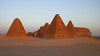
The above images may not be of the site on this page, but were taken nearby. They are loaded from Flickr so please click on them for image credits.
Click here to see more info for this site
Nearby sites
Click here to view sites on an interactive map of the areaKey: Red: member's photo, Blue: 3rd party photo, Yellow: other image, Green: no photo - please go there and take one, Grey: site destroyed
Download sites to:
KML (Google Earth)
GPX (GPS waypoints)
CSV (Garmin/Navman)
CSV (Excel)
To unlock full downloads you need to sign up as a Contributory Member. Otherwise downloads are limited to 50 sites.
Turn off the page maps and other distractions
Nearby sites listing. In the following links * = Image available
nankm 0° Gebel Barkal Temple of Mut Ancient Temple
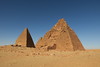
1.1km NE 34° Karima Pyramids* Pyramid / Mastaba
1.5km ENE 58° Gebel Barkal Mountain and Rock Formation* Natural Stone / Erratic / Other Natural Feature
1.6km ENE 68° Gebel Barkal Temple of Amon* Ancient Temple
5.3km S 178° Sanam Temple Ancient Temple
11.2km ENE 70° Nuri Pyramids* Pyramid / Mastaba
16.1km SSW 203° El-Kurru Pyramids* Pyramid / Mastaba
16.8km SSW 203° El-Kurru Tumuli Round Barrow(s)
19.5km SSW 204° Zuma Tumuli Round Barrow(s)
98.3km SSW 212° Wadi Abu Dom Rock Art Rock Art
220.8km NW 323° Sesebi* Ancient Village or Settlement
233.0km E 101° Statue of Taharqa Carving
262.6km NW 324° Soleb* Ancient Temple
266.8km SE 140° El Kadada Neolithic Tomb Burial Chamber or Dolmen
267.7km SE 131° Meroë* Ancient Village or Settlement
270.6km SE 131° Meroë Pyramids* Pyramid / Mastaba
275.9km NW 325° Sedeinga* Pyramid / Mastaba
276.5km SE 132° Abu Erteila Ancient Temple
333.3km SSE 167° Sudan National Museum Museum
379.4km N 352° Buhen Stone Fort or Dun
423.8km N 357° Abu Simbel Temple of Ramses II* Ancient Temple
423.9km N 357° Abu Simbel Temple of Nefertari* Ancient Temple
456.4km NNW 346° Nabta Playa* Stone Circle
469.5km N 6° Temple of Amada* Ancient Temple
469.6km N 6° Temple of Derr* Ancient Temple
View more nearby sites and additional images


 We would like to know more about this location. Please feel free to add a brief description and any relevant information in your own language.
 Wir möchten mehr über diese Stätte erfahren. Bitte zögern Sie nicht, eine kurze Beschreibung und relevante Informationen in Deutsch hinzuzufügen.
 Nous aimerions en savoir encore un peu sur les lieux. S'il vous plaît n'hesitez pas à ajouter une courte description et tous les renseignements pertinents dans votre propre langue.
 Quisieramos informarnos un poco más de las lugares. No dude en añadir una breve descripción y otros datos relevantes en su propio idioma.