

<< Our Photo Pages >> Tanis - Ancient Village or Settlement in Egypt in Lower Egypt (North)
Submitted by AlexHunger on Wednesday, 25 May 2011 Page Views: 9595
Multi-periodSite Name: TanisCountry: Egypt
NOTE: This site is 21.283 km away from the location you searched for.
Region: Lower Egypt (North) Type: Ancient Village or Settlement
Nearest Town: Alexandria Nearest Village: Zagazig
Latitude: 30.977260N Longitude: 31.879980E
Condition:
| 5 | Perfect |
| 4 | Almost Perfect |
| 3 | Reasonable but with some damage |
| 2 | Ruined but still recognisable as an ancient site |
| 1 | Pretty much destroyed, possibly visible as crop marks |
| 0 | No data. |
| -1 | Completely destroyed |
| 5 | Superb |
| 4 | Good |
| 3 | Ordinary |
| 2 | Not Good |
| 1 | Awful |
| 0 | No data. |
| 5 | Can be driven to, probably with disabled access |
| 4 | Short walk on a footpath |
| 3 | Requiring a bit more of a walk |
| 2 | A long walk |
| 1 | In the middle of nowhere, a nightmare to find |
| 0 | No data. |
| 5 | co-ordinates taken by GPS or official recorded co-ordinates |
| 4 | co-ordinates scaled from a detailed map |
| 3 | co-ordinates scaled from a bad map |
| 2 | co-ordinates of the nearest village |
| 1 | co-ordinates of the nearest town |
| 0 | no data |
Internal Links:
External Links:
I have visited· I would like to visit
ilsignorstano has visited here
")
Note: Seventeen lost pyramids are among the buildings identified in a new satellite survey
You may be viewing yesterday's version of this page. To see the most up to date information please register for a free account.
")
")
Do not use the above information on other web sites or publications without permission of the contributor.
Nearby Images from Flickr
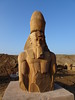
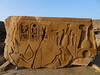
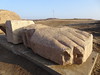
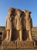
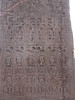
The above images may not be of the site on this page, but were taken nearby. They are loaded from Flickr so please click on them for image credits.
Click here to see more info for this site
Nearby sites
Click here to view sites on an interactive map of the areaKey: Red: member's photo, Blue: 3rd party photo, Yellow: other image, Green: no photo - please go there and take one, Grey: site destroyed
Download sites to:
KML (Google Earth)
GPX (GPS waypoints)
CSV (Garmin/Navman)
CSV (Excel)
To unlock full downloads you need to sign up as a Contributory Member. Otherwise downloads are limited to 50 sites.
Turn off the page maps and other distractions
Nearby sites listing. In the following links * = Image available
19.6km SSW 192° Pi-Ramesse Ancient Village or Settlement
20.6km SSW 192° Ezbet Rushdi Temple Ancient Temple
21.8km SSW 195° Avaris* Ancient Village or Settlement
57.1km SW 218° Bubastis* Ancient Village or Settlement
63.5km E 83° Pelusium* Ancient Village or Settlement
91.3km SSW 213° Leontopolis Ancient Village or Settlement
105.3km SSW 206° Cairo Airport Obelisk* Standing Stone (Menhir)
106.2km W 270° Sais* Ancient Temple
109.1km SSW 210° Heliopolis* Ancient Village or Settlement
110.8km WNW 283° Buto Ancient Village or Settlement
120.7km SSW 211° Museum of Egyptian Antiquities* Museum
120.8km W 266° Naucratis* Ancient Village or Settlement
120.8km SSW 211° El Zadalek Island Obelisk* Standing Stone (Menhir)
123.8km W 261° Imau Temple of Sekhmet Ancient Temple
130.4km SW 216° Djedefre's Pyramid Pyramid / Mastaba
131.9km SSW 213° Khufu's Pyramid* Pyramid / Mastaba
132.0km SSW 213° Senegemid Mastabas* Chambered Cairn
132.1km SSW 213° Seschemnofer III. Mastaba* Pyramid / Mastaba
132.1km SSW 213° Giza Plateau* Pyramid / Mastaba
132.2km SSW 213° Giza Valley Temple* Ancient Temple
132.2km SSW 213° Giza Mastaba Cemetery* Pyramid / Mastaba
132.2km SSW 213° Great Sphinx* Ancient Temple
132.5km SSW 213° Heit el-Ghurab* Ancient Village or Settlement
132.5km SSW 213° Khafre's Pyramid* Pyramid / Mastaba
133.0km SSW 213° Menkaure's Pyramid* Pyramid / Mastaba
View more nearby sites and additional images


 We would like to know more about this location. Please feel free to add a brief description and any relevant information in your own language.
 Wir möchten mehr über diese Stätte erfahren. Bitte zögern Sie nicht, eine kurze Beschreibung und relevante Informationen in Deutsch hinzuzufügen.
 Nous aimerions en savoir encore un peu sur les lieux. S'il vous plaît n'hesitez pas à ajouter une courte description et tous les renseignements pertinents dans votre propre langue.
 Quisieramos informarnos un poco más de las lugares. No dude en añadir una breve descripción y otros datos relevantes en su propio idioma.