 with our Megalithic Portal iPhone app")

<< Text Pages >> Bithynium - Ancient Village or Settlement in Turkey
Submitted by AlexHunger on Sunday, 07 October 2007 Page Views: 4957
Multi-periodSite Name: Bithynium Alternative Name: ClaudiopolisCountry: Turkey
NOTE: This site is 0.167 km away from the location you searched for.
Type: Ancient Village or Settlement
Nearest Town: Bolu Nearest Village: Bolu
Latitude: 40.734240N Longitude: 31.612210E
Condition:
| 5 | Perfect |
| 4 | Almost Perfect |
| 3 | Reasonable but with some damage |
| 2 | Ruined but still recognisable as an ancient site |
| 1 | Pretty much destroyed, possibly visible as crop marks |
| 0 | No data. |
| -1 | Completely destroyed |
| 5 | Superb |
| 4 | Good |
| 3 | Ordinary |
| 2 | Not Good |
| 1 | Awful |
| 0 | No data. |
| 5 | Can be driven to, probably with disabled access |
| 4 | Short walk on a footpath |
| 3 | Requiring a bit more of a walk |
| 2 | A long walk |
| 1 | In the middle of nowhere, a nightmare to find |
| 0 | No data. |
| 5 | co-ordinates taken by GPS or official recorded co-ordinates |
| 4 | co-ordinates scaled from a detailed map |
| 3 | co-ordinates scaled from a bad map |
| 2 | co-ordinates of the nearest village |
| 1 | co-ordinates of the nearest town |
| 0 | no data |
Be the first person to rate this site - see the 'Contribute!' box in the right hand menu.
Internal Links:
External Links:
Ancient Settlement in Bolu Province, Turkey.
Foundations of large temple found in 1964 believed to have been built by Hadrian for his boyfriend Antinous who was born here.
You may be viewing yesterday's version of this page. To see the most up to date information please register for a free account.
Do not use the above information on other web sites or publications without permission of the contributor.
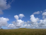
Nearby Images from Flickr


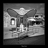
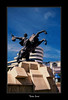


The above images may not be of the site on this page, but were taken nearby. They are loaded from Flickr so please click on them for image credits.
Click here to see more info for this site
Nearby sites
Click here to view sites on an interactive map of the areaKey: Red: member's photo, Blue: 3rd party photo, Yellow: other image, Green: no photo - please go there and take one, Grey: site destroyed
Download sites to:
KML (Google Earth)
GPX (GPS waypoints)
CSV (Garmin/Navman)
CSV (Excel)
To unlock full downloads you need to sign up as a Contributory Member. Otherwise downloads are limited to 50 sites.
Turn off the page maps and other distractions
Nearby sites listing. In the following links * = Image available
99.5km NNE 21° Tios Ancient Village or Settlement
107.5km ENE 57° Göztepe Tumulus* Artificial Mound
124.5km SSE 165° Midas Tumulus* Artificial Mound
124.5km SSE 165° Gordion* Ancient Village or Settlement
124.6km SSE 165° Gordion Museum Museum
125.3km SSE 155° Hacitugrul Tumulus Ancient Village or Settlement
125.6km SSE 160° Beycegiz Tumulus* Chambered Tomb
135.5km SE 133° Middle East Technical University Museum Museum
137.3km SE 131° Ankara Tumuli* Round Barrow(s)
137.3km SE 129° Ankara Temple of Augustus and Roma* Ancient Temple
138.0km SE 129° Ankara Museum of Anatolian Civilizations* Museum
139.4km SE 134° Kocumbeli Ancient Village or Settlement
150.3km SSW 210° Kulluoba Hoyuk Ancient Village or Settlement
150.4km SW 230° Demircihoyuk Ancient Village or Settlement
151.9km S 171° Yagri* Ancient Village or Settlement
152.5km WSW 245° Bilecik* Ancient Village or Settlement
156.0km S 181° Pessinous* Ancient Temple
156.1km SSE 149° Gavurkale* Ancient Village or Settlement
159.3km ENE 69° Kahin Tepe* Ancient Village or Settlement
161.7km W 261° Dört Tepeler Chambered Tomb
161.7km WSW 258° Berberkayasi Rock Cut Tomb
177.7km WSW 254° Barcin Tumulus Ancient Village or Settlement
185.0km SSW 205° Gerdek Kaya* Rock Cut Tomb
185.0km SSW 204° Pismis Kale Hillfort
185.3km SSW 205° Areyastis Monument* Sculptured Stone
View more nearby sites and additional images


 We would like to know more about this location. Please feel free to add a brief description and any relevant information in your own language.
 Wir möchten mehr über diese Stätte erfahren. Bitte zögern Sie nicht, eine kurze Beschreibung und relevante Informationen in Deutsch hinzuzufügen.
 Nous aimerions en savoir encore un peu sur les lieux. S'il vous plaît n'hesitez pas à ajouter une courte description et tous les renseignements pertinents dans votre propre langue.
 Quisieramos informarnos un poco más de las lugares. No dude en añadir una breve descripción y otros datos relevantes en su propio idioma.