


<< Text Pages >> Merenre Nemtyemzaf Pyramid - Pyramid / Mastaba in Egypt in Lower Egypt (North)
Submitted by AlexHunger on Monday, 03 April 2006 Page Views: 3165
Multi-periodSite Name: Merenre Nemtyemzaf PyramidCountry: Egypt Region: Lower Egypt (North) Type: Pyramid / Mastaba
Nearest Town: Cairo Nearest Village: Sakkara
Latitude: 29.850240N Longitude: 31.214950E
Condition:
| 5 | Perfect |
| 4 | Almost Perfect |
| 3 | Reasonable but with some damage |
| 2 | Ruined but still recognisable as an ancient site |
| 1 | Pretty much destroyed, possibly visible as crop marks |
| 0 | No data. |
| -1 | Completely destroyed |
| 5 | Superb |
| 4 | Good |
| 3 | Ordinary |
| 2 | Not Good |
| 1 | Awful |
| 0 | No data. |
| 5 | Can be driven to, probably with disabled access |
| 4 | Short walk on a footpath |
| 3 | Requiring a bit more of a walk |
| 2 | A long walk |
| 1 | In the middle of nowhere, a nightmare to find |
| 0 | No data. |
| 5 | co-ordinates taken by GPS or official recorded co-ordinates |
| 4 | co-ordinates scaled from a detailed map |
| 3 | co-ordinates scaled from a bad map |
| 2 | co-ordinates of the nearest village |
| 1 | co-ordinates of the nearest town |
| 0 | no data |
Internal Links:
External Links:
Pyramid in Lower Egypt (North)
Deteriorated Pyramid of 3th Pharao of the 6th Dynasty in South Sakkara desert. While egyptologists are not completely certain of the identity, a mummy was found intact in the pyramid.
You may be viewing yesterday's version of this page. To see the most up to date information please register for a free account.
Do not use the above information on other web sites or publications without permission of the contributor.
Nearby Images from Flickr
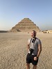
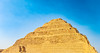
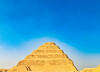
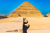
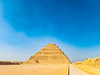
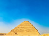
The above images may not be of the site on this page, but were taken nearby. They are loaded from Flickr so please click on them for image credits.
Click here to see more info for this site
Nearby sites
Click here to view sites on an interactive map of the areaKey: Red: member's photo, Blue: 3rd party photo, Yellow: other image, Green: no photo - please go there and take one, Grey: site destroyed
Download sites to:
KML (Google Earth)
GPX (GPS waypoints)
CSV (Garmin/Navman)
CSV (Excel)
To unlock full downloads you need to sign up as a Contributory Member. Otherwise downloads are limited to 50 sites.
Turn off the page maps and other distractions
Nearby sites listing. In the following links * = Image available
565m NE 39° Pepy I Pyramid* Pyramid / Mastaba
579m E 81° Djedkare Izezi Pyramid Pyramid / Mastaba
962m SSE 165° Ibi I Pyramid Pyramid / Mastaba
1.1km S 189° Pepy II Pyramid* Pyramid / Mastaba
1.2km S 179° Shepseskaf's Mastaba* Pyramid / Mastaba
1.8km N 356° Sekhemkhet's Pyramid Pyramid / Mastaba
1.9km NNE 23° Unas Valley Temple* Ancient Temple
2.0km NNW 335° Gisr el-Mudir Causewayed Enclosure
2.0km N 360° Unas Pyramid* Pyramid / Mastaba
2.0km N 7° Irukaptah Tomb* Chambered Tomb
2.1km N 7° Sakkara Djoser Complex* Ancient Temple
2.2km N 7° Sakkara Temple of Heb-Sed* Ancient Temple
2.3km SSE 163° Khendjer's Pyramid Pyramid / Mastaba
2.3km N 3° Sakkara Pyramid* Pyramid / Mastaba
2.6km N 357° Ptah Hotep Mastaba* Chambered Cairn
2.7km N 8° Userkaf's Pyramid* Pyramid / Mastaba
2.8km N 354° Serapeum at Sakkara* Ancient Temple
2.8km N 2° Knuhmhotep and Niankhkhnum Mastaba* Chambered Cairn
2.9km NNE 12° Mereruka Mastaba* Chambered Cairn
2.9km NNE 13° Teti I Pyramid* Pyramid / Mastaba
2.9km NNE 13° Kagemni Mastaba* Chambered Cairn
3.6km SSE 163° Senusret III Pyramid Pyramid / Mastaba
3.8km E 91° Memphis Museum* Museum
4.6km S 190° Red Pyramid* Pyramid / Mastaba
4.8km S 172° Amenmenhat II Pyramid Pyramid / Mastaba
View more nearby sites and additional images


 We would like to know more about this location. Please feel free to add a brief description and any relevant information in your own language.
 Wir möchten mehr über diese Stätte erfahren. Bitte zögern Sie nicht, eine kurze Beschreibung und relevante Informationen in Deutsch hinzuzufügen.
 Nous aimerions en savoir encore un peu sur les lieux. S'il vous plaît n'hesitez pas à ajouter une courte description et tous les renseignements pertinents dans votre propre langue.
 Quisieramos informarnos un poco más de las lugares. No dude en añadir una breve descripción y otros datos relevantes en su propio idioma.