


<< Our Photo Pages >> Neferirkare's Pyramid - Pyramid / Mastaba in Egypt in Lower Egypt (North)
Submitted by AlexHunger on Monday, 27 March 2006 Page Views: 4427
Multi-periodSite Name: Neferirkare's Pyramid Alternative Name: Abusir PyramidsCountry: Egypt
NOTE: This site is 0.111 km away from the location you searched for.
Region: Lower Egypt (North) Type: Pyramid / Mastaba
Nearest Town: Cairo Nearest Village: Abusir
Latitude: 29.894750N Longitude: 31.202960E
Condition:
| 5 | Perfect |
| 4 | Almost Perfect |
| 3 | Reasonable but with some damage |
| 2 | Ruined but still recognisable as an ancient site |
| 1 | Pretty much destroyed, possibly visible as crop marks |
| 0 | No data. |
| -1 | Completely destroyed |
| 5 | Superb |
| 4 | Good |
| 3 | Ordinary |
| 2 | Not Good |
| 1 | Awful |
| 0 | No data. |
| 5 | Can be driven to, probably with disabled access |
| 4 | Short walk on a footpath |
| 3 | Requiring a bit more of a walk |
| 2 | A long walk |
| 1 | In the middle of nowhere, a nightmare to find |
| 0 | No data. |
| 5 | co-ordinates taken by GPS or official recorded co-ordinates |
| 4 | co-ordinates scaled from a detailed map |
| 3 | co-ordinates scaled from a bad map |
| 2 | co-ordinates of the nearest village |
| 1 | co-ordinates of the nearest town |
| 0 | no data |
Internal Links:
External Links:
")
Neferirkare Kakai was the 3rd Pharao of the 5th Dynasty. His pyramid is one of the 4 in Abusir.
It is made of rough irregular blocks and is in relatively poor shape, though a stepped pyramid shape seems to show through.
You may be viewing yesterday's version of this page. To see the most up to date information please register for a free account.
")
")
Do not use the above information on other web sites or publications without permission of the contributor.
Nearby Images from Flickr
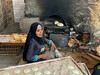
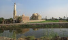

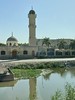
The above images may not be of the site on this page, but were taken nearby. They are loaded from Flickr so please click on them for image credits.
Click here to see more info for this site
Nearby sites
Click here to view sites on an interactive map of the areaKey: Red: member's photo, Blue: 3rd party photo, Yellow: other image, Green: no photo - please go there and take one, Grey: site destroyed
Download sites to:
KML (Google Earth)
GPX (GPS waypoints)
CSV (Garmin/Navman)
CSV (Excel)
To unlock full downloads you need to sign up as a Contributory Member. Otherwise downloads are limited to 50 sites.
Turn off the page maps and other distractions
Nearby sites listing. In the following links * = Image available
120m E 88° Neferefra Sun Temple Ancient Temple
278m NE 38° Ptah Shepses Mastaba* Chambered Cairn
333m N 3° Sahure's Pyramid* Pyramid / Mastaba
344m NNE 22° Niuserra Sun Temple* Ancient Temple
1.4km NW 319° Niuserra's Pyramid* Pyramid / Mastaba
2.4km SSE 158° Serapeum at Sakkara* Ancient Temple
2.5km SSE 150° Knuhmhotep and Niankhkhnum Mastaba* Chambered Cairn
2.6km SSE 157° Ptah Hotep Mastaba* Chambered Cairn
2.8km SE 140° Mereruka Mastaba* Chambered Cairn
2.8km SE 139° Kagemni Mastaba* Chambered Cairn
2.8km SSE 147° Userkaf's Pyramid* Pyramid / Mastaba
2.8km SE 140° Teti I Pyramid* Pyramid / Mastaba
2.9km SSE 154° Sakkara Pyramid* Pyramid / Mastaba
3.1km SSE 153° Sakkara Temple of Heb-Sed* Ancient Temple
3.2km SSE 159° Unas Pyramid* Pyramid / Mastaba
3.2km S 174° Gisr el-Mudir Causewayed Enclosure
3.2km SSE 153° Sakkara Djoser Complex* Ancient Temple
3.3km SSE 154° Irukaptah Tomb* Chambered Tomb
3.3km SSE 162° Sekhemkhet's Pyramid Pyramid / Mastaba
3.7km SSE 150° Unas Valley Temple* Ancient Temple
4.8km SSE 161° Pepy I Pyramid* Pyramid / Mastaba
5.1km SSE 167° Merenre Nemtyemzaf Pyramid Pyramid / Mastaba
5.2km SSE 160° Djedkare Izezi Pyramid Pyramid / Mastaba
5.7km NW 316° Khaba's Pyramid Pyramid / Mastaba
6.0km SSE 166° Ibi I Pyramid Pyramid / Mastaba
View more nearby sites and additional images


 We would like to know more about this location. Please feel free to add a brief description and any relevant information in your own language.
 Wir möchten mehr über diese Stätte erfahren. Bitte zögern Sie nicht, eine kurze Beschreibung und relevante Informationen in Deutsch hinzuzufügen.
 Nous aimerions en savoir encore un peu sur les lieux. S'il vous plaît n'hesitez pas à ajouter une courte description et tous les renseignements pertinents dans votre propre langue.
 Quisieramos informarnos un poco más de las lugares. No dude en añadir una breve descripción y otros datos relevantes en su propio idioma.