

<< Our Photo Pages >> Senegemid Mastabas - Chambered Cairn in Egypt in Lower Egypt (North)
Submitted by AlexHunger on Monday, 27 March 2006 Page Views: 4214
Neolithic and Bronze AgeSite Name: Senegemid Mastabas Alternative Name: Tomb of the SenegemidsCountry: Egypt
NOTE: This site is 4.389 km away from the location you searched for.
Region: Lower Egypt (North) Type: Chambered Cairn
Nearest Town: Cairo Nearest Village: Giza
Latitude: 29.980600N Longitude: 31.132680E
Condition:
| 5 | Perfect |
| 4 | Almost Perfect |
| 3 | Reasonable but with some damage |
| 2 | Ruined but still recognisable as an ancient site |
| 1 | Pretty much destroyed, possibly visible as crop marks |
| 0 | No data. |
| -1 | Completely destroyed |
| 5 | Superb |
| 4 | Good |
| 3 | Ordinary |
| 2 | Not Good |
| 1 | Awful |
| 0 | No data. |
| 5 | Can be driven to, probably with disabled access |
| 4 | Short walk on a footpath |
| 3 | Requiring a bit more of a walk |
| 2 | A long walk |
| 1 | In the middle of nowhere, a nightmare to find |
| 0 | No data. |
| 5 | co-ordinates taken by GPS or official recorded co-ordinates |
| 4 | co-ordinates scaled from a detailed map |
| 3 | co-ordinates scaled from a bad map |
| 2 | co-ordinates of the nearest village |
| 1 | co-ordinates of the nearest town |
| 0 | no data |
Internal Links:
External Links:
")
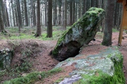
Mastabas of the Senegemid (Enti and Mehi) Chief Justices and Viziers on Giza Plateau near Khufu's pyramid.
60 meters altitude.
You may be viewing yesterday's version of this page. To see the most up to date information please register for a free account.
")
")
")
Do not use the above information on other web sites or publications without permission of the contributor.
Nearby Images from Flickr
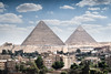
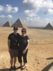
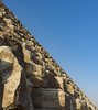
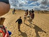
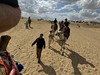
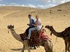
The above images may not be of the site on this page, but were taken nearby. They are loaded from Flickr so please click on them for image credits.
Click here to see more info for this site
Nearby sites
Click here to view sites on an interactive map of the areaKey: Red: member's photo, Blue: 3rd party photo, Yellow: other image, Green: no photo - please go there and take one, Grey: site destroyed
Download sites to:
KML (Google Earth)
GPX (GPS waypoints)
CSV (Garmin/Navman)
CSV (Excel)
To unlock full downloads you need to sign up as a Contributory Member. Otherwise downloads are limited to 50 sites.
Turn off the page maps and other distractions
Nearby sites listing. In the following links * = Image available
104m SW 226° Seschemnofer III. Mastaba* Pyramid / Mastaba
152m ESE 109° Khufu's Pyramid* Pyramid / Mastaba
240m SW 222° Giza Mastaba Cemetery* Pyramid / Mastaba
267m WSW 256° Giza Plateau* Pyramid / Mastaba
569m SSW 203° Khafre's Pyramid* Pyramid / Mastaba
746m SE 142° Great Sphinx* Ancient Temple
850m SE 139° Giza Valley Temple* Ancient Temple
1.0km SSW 207° Menkaure's Pyramid* Pyramid / Mastaba
1.1km SSE 154° Heit el-Ghurab* Ancient Village or Settlement
6.1km SSE 152° Khaba's Pyramid Pyramid / Mastaba
8.0km NW 316° Djedefre's Pyramid Pyramid / Mastaba
10.3km SE 145° Niuserra's Pyramid* Pyramid / Mastaba
11.4km SE 144° Sahure's Pyramid* Pyramid / Mastaba
11.5km SE 143° Niuserra Sun Temple* Ancient Temple
11.6km SE 143° Ptah Shepses Mastaba* Chambered Cairn
11.7km SE 145° Neferirkare's Pyramid* Pyramid / Mastaba
11.8km SE 144° Neferefra Sun Temple Ancient Temple
11.8km NE 51° El Zadalek Island Obelisk* Standing Stone (Menhir)
12.1km NE 53° Museum of Egyptian Antiquities* Museum
14.0km SSE 147° Serapeum at Sakkara* Ancient Temple
14.2km SE 146° Knuhmhotep and Niankhkhnum Mastaba* Chambered Cairn
14.2km SSE 147° Ptah Hotep Mastaba* Chambered Cairn
14.5km SE 144° Mereruka Mastaba* Chambered Cairn
14.5km SE 144° Kagemni Mastaba* Chambered Cairn
14.5km SE 145° Userkaf's Pyramid* Pyramid / Mastaba
View more nearby sites and additional images


 We would like to know more about this location. Please feel free to add a brief description and any relevant information in your own language.
 Wir möchten mehr über diese Stätte erfahren. Bitte zögern Sie nicht, eine kurze Beschreibung und relevante Informationen in Deutsch hinzuzufügen.
 Nous aimerions en savoir encore un peu sur les lieux. S'il vous plaît n'hesitez pas à ajouter une courte description et tous les renseignements pertinents dans votre propre langue.
 Quisieramos informarnos un poco más de las lugares. No dude en añadir una breve descripción y otros datos relevantes en su propio idioma.