

<< Text Pages >> Asyut - Ancient Village or Settlement in Egypt in Lower Egypt (North)
Submitted by AlexHunger on Saturday, 08 April 2006 Page Views: 4347
Multi-periodSite Name: AsyutCountry: Egypt
NOTE: This site is 8.31 km away from the location you searched for.
Region: Lower Egypt (North) Type: Ancient Village or Settlement
Nearest Town: Asyut Nearest Village: Asyut
Latitude: 27.167240N Longitude: 31.179320E
Condition:
| 5 | Perfect |
| 4 | Almost Perfect |
| 3 | Reasonable but with some damage |
| 2 | Ruined but still recognisable as an ancient site |
| 1 | Pretty much destroyed, possibly visible as crop marks |
| 0 | No data. |
| -1 | Completely destroyed |
| 5 | Superb |
| 4 | Good |
| 3 | Ordinary |
| 2 | Not Good |
| 1 | Awful |
| 0 | No data. |
| 5 | Can be driven to, probably with disabled access |
| 4 | Short walk on a footpath |
| 3 | Requiring a bit more of a walk |
| 2 | A long walk |
| 1 | In the middle of nowhere, a nightmare to find |
| 0 | No data. |
| 5 | co-ordinates taken by GPS or official recorded co-ordinates |
| 4 | co-ordinates scaled from a detailed map |
| 3 | co-ordinates scaled from a bad map |
| 2 | co-ordinates of the nearest village |
| 1 | co-ordinates of the nearest town |
| 0 | no data |
Internal Links:
External Links:
Ancient Village or Settlement in Lower Egypt (North)
Briefly the capital of Egypt during the first Intermediate Period (7th to 9th Dynasty). There are numerous tombs in the area.
The Michelin Guide suggests the area is not safe to visit due to fundamentalist insurgency.
You may be viewing yesterday's version of this page. To see the most up to date information please register for a free account.
Do not use the above information on other web sites or publications without permission of the contributor.
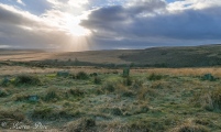
Nearby Images from Flickr

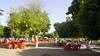
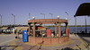

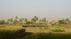

The above images may not be of the site on this page, but were taken nearby. They are loaded from Flickr so please click on them for image credits.
Click here to see more info for this site
Nearby sites
Click here to view sites on an interactive map of the areaKey: Red: member's photo, Blue: 3rd party photo, Yellow: other image, Green: no photo - please go there and take one, Grey: site destroyed
Download sites to:
KML (Google Earth)
GPX (GPS waypoints)
CSV (Garmin/Navman)
CSV (Excel)
To unlock full downloads you need to sign up as a Contributory Member. Otherwise downloads are limited to 50 sites.
Turn off the page maps and other distractions
Nearby sites listing. In the following links * = Image available
7.4km S 187° Khnum-Nakht and Nekht-Ankh Tomb Rock Cut Tomb
17.6km ESE 110° Tjebu tombs Barrow Cemetery
39.9km SE 130° El-Hammamiya Tombs Rock Cut Tomb
42.0km SE 131° Tjebu Governor Tombs Rock Cut Tomb
44.7km SE 132° Tjebu Temple Ancient Temple
62.2km NNW 334° Al Amarna* Ancient Palace
77.7km NNW 332° Hermopolis Temple of Thoth* Ancient Temple
103.6km NNW 341° Zawyet el-Amwat Pyramid Pyramid / Mastaba
112.7km SSE 149° Sanakht's Mastaba Pyramid / Mastaba
113.4km SSE 149° Djoser Netjerikhef Mastaba Pyramid / Mastaba
114.2km SE 141° Naga el-Deir Necropolis Barrow Cemetery
130.6km SE 146° Shunet ez Zebib* Ancient Temple
131.4km SE 146° Abydos Temple of Ramses II Ancient Temple
131.6km SE 146° Abydos Temple of Seti I* Ancient Temple
131.7km SE 146° Osirieon* Ancient Temple
133.3km SE 146° Abydos Senusret III Funerary Complex Rock Cut Tomb
133.6km SE 145° Pyramid of Ahmose Pyramid / Mastaba
136.8km SE 145° Sinki Pyramid Pyramid / Mastaba
181.7km N 352° El Hiba* Ancient Village or Settlement
186.9km SE 127° Dendara Mammisi of Trajan* Ancient Temple
186.9km SE 127° Dendara Mammisi of Nectanabo I* Ancient Temple
186.9km SE 127° Dendara Temple of Hathor* Ancient Temple
187.0km SE 127° Dendara Temple of Isis* Ancient Temple
201.4km SSW 199° Umm El-Mawagir Ancient Village or Settlement
203.5km SE 130° Pyramid of Ombos Pyramid / Mastaba
View more nearby sites and additional images


 We would like to know more about this location. Please feel free to add a brief description and any relevant information in your own language.
 Wir möchten mehr über diese Stätte erfahren. Bitte zögern Sie nicht, eine kurze Beschreibung und relevante Informationen in Deutsch hinzuzufügen.
 Nous aimerions en savoir encore un peu sur les lieux. S'il vous plaît n'hesitez pas à ajouter une courte description et tous les renseignements pertinents dans votre propre langue.
 Quisieramos informarnos un poco más de las lugares. No dude en añadir una breve descripción y otros datos relevantes en su propio idioma.