

<< Text Pages >> Idyros - Ancient Village or Settlement in Turkey
Submitted by davidmorgan on Friday, 26 April 2019 Page Views: 814
Multi-periodSite Name: IdyrosCountry: Turkey
NOTE: This site is 39.617 km away from the location you searched for.
Type: Ancient Village or Settlement
Nearest Town: Kemer
Latitude: 36.596800N Longitude: 30.573200E
Condition:
| 5 | Perfect |
| 4 | Almost Perfect |
| 3 | Reasonable but with some damage |
| 2 | Ruined but still recognisable as an ancient site |
| 1 | Pretty much destroyed, possibly visible as crop marks |
| 0 | No data. |
| -1 | Completely destroyed |
| 5 | Superb |
| 4 | Good |
| 3 | Ordinary |
| 2 | Not Good |
| 1 | Awful |
| 0 | No data. |
| 5 | Can be driven to, probably with disabled access |
| 4 | Short walk on a footpath |
| 3 | Requiring a bit more of a walk |
| 2 | A long walk |
| 1 | In the middle of nowhere, a nightmare to find |
| 0 | No data. |
| 5 | co-ordinates taken by GPS or official recorded co-ordinates |
| 4 | co-ordinates scaled from a detailed map |
| 3 | co-ordinates scaled from a bad map |
| 2 | co-ordinates of the nearest village |
| 1 | co-ordinates of the nearest town |
| 0 | no data |
Internal Links:
External Links:
Ancient Settlement in Antalya Province, Turkey
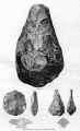
A small Lycian/Greek settlement dating from the 6th century BCE.
Also the site of a new Mediterranean Underwater Museum with a completion date of 2021.
You may be viewing yesterday's version of this page. To see the most up to date information please register for a free account.
Do not use the above information on other web sites or publications without permission of the contributor.
Nearby Images from Flickr
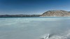


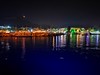

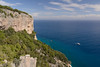
The above images may not be of the site on this page, but were taken nearby. They are loaded from Flickr so please click on them for image credits.
Click here to see more info for this site
Nearby sites
Click here to view sites on an interactive map of the areaKey: Red: member's photo, Blue: 3rd party photo, Yellow: other image, Green: no photo - please go there and take one, Grey: site destroyed
Download sites to:
KML (Google Earth)
GPX (GPS waypoints)
CSV (Garmin/Navman)
CSV (Excel)
To unlock full downloads you need to sign up as a Contributory Member. Otherwise downloads are limited to 50 sites.
Turn off the page maps and other distractions
Nearby sites listing. In the following links * = Image available
8.3km SSW 193° Phaselis* Ancient Village or Settlement
16.4km N 359° Beldibi Cave* Cave or Rock Shelter
21.2km SSW 210° Chimera* Natural Stone / Erratic / Other Natural Feature
24.2km SSW 202° Olympos* Ancient Village or Settlement
32.8km NNE 12° Antalya* Ancient Village or Settlement
33.5km W 262° Idebessos Ancient Village or Settlement
33.5km NNE 17° Antalya Museum* Museum
34.4km NE 36° Magydus Ancient Village or Settlement
36.1km SW 230° Rhodiapolis* Ancient Village or Settlement
44.0km NNW 347° Termessos* Ancient Village or Settlement
45.9km SW 232° Limyra* Ancient Village or Settlement
46.8km W 259° Arykanda* Ancient Village or Settlement
47.6km NNE 32° Perge* Ancient Village or Settlement
53.3km N 360° Karain Cave* Cave or Rock Shelter
57.5km NE 40° Sillyon* Ancient Village or Settlement
64.6km SW 235° Myra Rock Cut Tombs* Rock Cut Tomb
65.5km NE 54° Aspendos* Ancient Village or Settlement
65.6km N 352° Ariassos* Ancient Village or Settlement
66.0km W 275° Hacimusalar Hoyuk* Ancient Village or Settlement
66.0km N 1° Doseme Bogazi* Ancient Trackway
68.6km SW 235° Sura (Lycia)* Ancient Village or Settlement
68.9km SW 233° Andriake* Ancient Village or Settlement
70.0km N 355° Bademagaci Hoyuk* Ancient Village or Settlement
70.4km WSW 239° Trysa Heroon* Chambered Tomb
73.7km N 2° Sia (Pisidia) Ancient Village or Settlement
View more nearby sites and additional images


 We would like to know more about this location. Please feel free to add a brief description and any relevant information in your own language.
 Wir möchten mehr über diese Stätte erfahren. Bitte zögern Sie nicht, eine kurze Beschreibung und relevante Informationen in Deutsch hinzuzufügen.
 Nous aimerions en savoir encore un peu sur les lieux. S'il vous plaît n'hesitez pas à ajouter une courte description et tous les renseignements pertinents dans votre propre langue.
 Quisieramos informarnos un poco más de las lugares. No dude en añadir una breve descripción y otros datos relevantes en su propio idioma.