


<< Text Pages >> Umm El-Mawagir - Ancient Village or Settlement in Egypt in Upper Egypt (South)
Submitted by Andy B on Friday, 27 August 2010 Page Views: 5904
Multi-periodSite Name: Umm El-MawagirCountry: Egypt
NOTE: This site is 4.367 km away from the location you searched for.
Region: Upper Egypt (South) Type: Ancient Village or Settlement
Nearest Town: El Kharga Oasis
Latitude: 25.448900N Longitude: 30.540100E
Condition:
| 5 | Perfect |
| 4 | Almost Perfect |
| 3 | Reasonable but with some damage |
| 2 | Ruined but still recognisable as an ancient site |
| 1 | Pretty much destroyed, possibly visible as crop marks |
| 0 | No data. |
| -1 | Completely destroyed |
| 5 | Superb |
| 4 | Good |
| 3 | Ordinary |
| 2 | Not Good |
| 1 | Awful |
| 0 | No data. |
| 5 | Can be driven to, probably with disabled access |
| 4 | Short walk on a footpath |
| 3 | Requiring a bit more of a walk |
| 2 | A long walk |
| 1 | In the middle of nowhere, a nightmare to find |
| 0 | No data. |
| 5 | co-ordinates taken by GPS or official recorded co-ordinates |
| 4 | co-ordinates scaled from a detailed map |
| 3 | co-ordinates scaled from a bad map |
| 2 | co-ordinates of the nearest village |
| 1 | co-ordinates of the nearest town |
| 0 | no data |
Be the first person to rate this site - see the 'Contribute!' box in the right hand menu.
Internal Links:
External Links:
A large administrative settlement from ancient Egypt's Second Intermediate Period has been discovered. An American-Egyptian mission from Yale University has discovered what is believed to be the remains of a substantial settlement in Kharga Oasis in the Western Desert. The archaeologists were carrying out routine excavation work within the framework of the Theban Desert Road Survey when they made the discovery. The survey aims to investigate and map ancient desert routes in that portion of the Western Desert.
The settlement, which is laid out on a grid pattern, is 1,000 years older than previous ancient remains found in the Umm Mawagir area in Kharga Oasis.
The find was announced by Culture Minister Farouk Hosni, who said that the settlement could be dated to the Second Intermediate period (1664-1569 BC).
Zahi Hawass, secretary-general of the Supreme Council of Antiquities (SCA), said that the newly-discovered settlement was one kilometre long from north to south and 250 metres wide from east to west. It sits astride the bustling trade routes that connected the Nile Valley of Egypt and the desert oases with points as far as Darfur in western Sudan. He continued that archaeological evidence on the site indicated that the inhabitants of the settlement belonged to an administrative and provision centre and were engaged in baking on a massive scale.
More in Al Ahram Weekly
Note: The Lost City - a discovery in the desert could rewrite the history of ancient Egypt.
You may be viewing yesterday's version of this page. To see the most up to date information please register for a free account.
Do not use the above information on other web sites or publications without permission of the contributor.
Nearby Images from Flickr
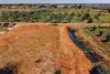


The above images may not be of the site on this page, but were taken nearby. They are loaded from Flickr so please click on them for image credits.
Click here to see more info for this site
Nearby sites
Click here to view sites on an interactive map of the areaKey: Red: member's photo, Blue: 3rd party photo, Yellow: other image, Green: no photo - please go there and take one, Grey: site destroyed
Download sites to:
KML (Google Earth)
GPX (GPS waypoints)
CSV (Garmin/Navman)
CSV (Excel)
To unlock full downloads you need to sign up as a Contributory Member. Otherwise downloads are limited to 50 sites.
Turn off the page maps and other distractions
Nearby sites listing. In the following links * = Image available
154.2km NE 52° Sanakht's Mastaba Pyramid / Mastaba
155.1km NE 52° Djoser Netjerikhef Mastaba Pyramid / Mastaba
159.8km ENE 59° Shunet ez Zebib* Ancient Temple
160.2km ENE 60° Abydos Senusret III Funerary Complex Rock Cut Tomb
160.3km ENE 59° Abydos Temple of Ramses II Ancient Temple
160.4km ENE 59° Osirieon* Ancient Temple
160.5km ENE 59° Abydos Temple of Seti I* Ancient Temple
161.5km ENE 60° Pyramid of Ahmose Pyramid / Mastaba
163.1km ENE 61° Sinki Pyramid Pyramid / Mastaba
169.9km NE 53° Naga el-Deir Necropolis Barrow Cemetery
174.9km W 278° Deir el-Hagar Temple Ancient Temple
188.5km NNE 31° Tjebu Temple Ancient Temple
189.4km NNE 30° Tjebu Governor Tombs Rock Cut Tomb
190.5km NNE 30° El-Hammamiya Tombs Rock Cut Tomb
194.2km NNE 19° Khnum-Nakht and Nekht-Ankh Tomb Rock Cut Tomb
195.6km E 88° Gebelein Ancient Village or Settlement
200.6km E 85° Djerti Temple of Montu* Ancient Temple
201.4km NNE 18° Asyut Ancient Village or Settlement
201.8km NNE 23° Tjebu tombs Barrow Cemetery
202.0km E 84° Iuni Temple of Montu Ancient Temple
203.3km E 94° Temple of Khnum, Esna* Ancient Temple
206.3km E 82° Deir el Shelwit Ancient Temple
208.0km E 81° Valley of the Queens Chambered Tomb
208.3km E 81° Tomb of Aye* Rock Cut Tomb
208.8km E 81° Medinet Habu Palace of Ramses III* Ancient Palace
View more nearby sites and additional images


 We would like to know more about this location. Please feel free to add a brief description and any relevant information in your own language.
 Wir möchten mehr über diese Stätte erfahren. Bitte zögern Sie nicht, eine kurze Beschreibung und relevante Informationen in Deutsch hinzuzufügen.
 Nous aimerions en savoir encore un peu sur les lieux. S'il vous plaît n'hesitez pas à ajouter une courte description et tous les renseignements pertinents dans votre propre langue.
 Quisieramos informarnos un poco más de las lugares. No dude en añadir una breve descripción y otros datos relevantes en su propio idioma.