


<< Our Photo Pages >> Afyon Archaeological Museum - Museum in Turkey
Submitted by davidmorgan on Friday, 20 June 2014 Page Views: 2482
MuseumsSite Name: Afyon Archaeological MuseumCountry: Turkey Type: Museum
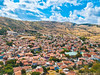
Nearest Town: Afyonkarahisar
Latitude: 38.747598N Longitude: 30.550597E
Condition:
| 5 | Perfect |
| 4 | Almost Perfect |
| 3 | Reasonable but with some damage |
| 2 | Ruined but still recognisable as an ancient site |
| 1 | Pretty much destroyed, possibly visible as crop marks |
| 0 | No data. |
| -1 | Completely destroyed |
| 5 | Superb |
| 4 | Good |
| 3 | Ordinary |
| 2 | Not Good |
| 1 | Awful |
| 0 | No data. |
| 5 | Can be driven to, probably with disabled access |
| 4 | Short walk on a footpath |
| 3 | Requiring a bit more of a walk |
| 2 | A long walk |
| 1 | In the middle of nowhere, a nightmare to find |
| 0 | No data. |
| 5 | co-ordinates taken by GPS or official recorded co-ordinates |
| 4 | co-ordinates scaled from a detailed map |
| 3 | co-ordinates scaled from a bad map |
| 2 | co-ordinates of the nearest village |
| 1 | co-ordinates of the nearest town |
| 0 | no data |
Internal Links:
External Links:
I have visited· I would like to visit
davidmorgan has visited here
")
A good range of prehistory and history displayed in chronological order.
You may be viewing yesterday's version of this page. To see the most up to date information please register for a free account.
")
")
")
")
Do not use the above information on other web sites or publications without permission of the contributor.
Nearby Images from Flickr
The above images may not be of the site on this page, but were taken nearby. They are loaded from Flickr so please click on them for image credits.
Click here to see more info for this site
Nearby sites
Click here to view sites on an interactive map of the areaKey: Red: member's photo, Blue: 3rd party photo, Yellow: other image, Green: no photo - please go there and take one, Grey: site destroyed
Download sites to:
KML (Google Earth)
GPX (GPS waypoints)
CSV (Garmin/Navman)
CSV (Excel)
To unlock full downloads you need to sign up as a Contributory Member. Otherwise downloads are limited to 50 sites.
Turn off the page maps and other distractions
Nearby sites listing. In the following links * = Image available
33.0km N 355° Maltas* Rock Cut Tomb
33.5km N 356° Yilantas* Rock Cut Tomb
33.5km N 356° Aslantas* Carving
41.1km NNW 345° Aslankaya* Carving
51.8km N 5° Kümbet Lion Tomb* Rock Cut Tomb
51.9km N 5° Kümbet Rock Sanctuary* Ancient Temple
52.2km NNE 16° Midas City* Ancient Village or Settlement
52.5km N 5° Kümbet North Tomb* Rock Cut Tomb
54.1km NNE 15° Areyastis Monument* Sculptured Stone
54.2km NNE 16° Pismis Kale Hillfort
54.7km NNE 13° Gerdek Kaya* Rock Cut Tomb
56.4km S 185° Tatarli Tumulus Artificial Mound
74.2km SE 131° Pisidian Antioch* Ancient Village or Settlement
77.5km SE 131° Temple of Men Askaenos* Ancient Temple
91.5km N 10° Kulluoba Hoyuk Ancient Village or Settlement
91.9km SW 234° Beycesultan* Ancient Village or Settlement
95.7km WNW 302° Aizanoi* Ancient Village or Settlement
106.9km SE 135° Arakli Mound Ancient Village or Settlement
110.0km NNW 328° Seyitömer Höyük* Ancient Village or Settlement
110.3km NE 54° Pessinous* Ancient Temple
114.1km SSE 156° Sanctuary of Eurymedon* Cave or Rock Shelter
115.3km SW 231° Eksi Hoyuk Ancient Village or Settlement
116.6km SSW 192° Burdur Museum Museum
119.1km S 181° Sagalassos* Ancient Village or Settlement
125.0km N 349° Demircihoyuk Ancient Village or Settlement
View more nearby sites and additional images


 We would like to know more about this location. Please feel free to add a brief description and any relevant information in your own language.
 Wir möchten mehr über diese Stätte erfahren. Bitte zögern Sie nicht, eine kurze Beschreibung und relevante Informationen in Deutsch hinzuzufügen.
 Nous aimerions en savoir encore un peu sur les lieux. S'il vous plaît n'hesitez pas à ajouter une courte description et tous les renseignements pertinents dans votre propre langue.
 Quisieramos informarnos un poco más de las lugares. No dude en añadir una breve descripción y otros datos relevantes en su propio idioma.