


<< Our Photo Pages >> Son Guillem - Standing Stone (Menhir) in Spain in Balearic Isles (Menorca / Minorca)
Submitted by whoop on Thursday, 10 September 2020 Page Views: 535
Neolithic and Bronze AgeSite Name: Son Guillem Alternative Name: Son GuillermoCountry: Spain
NOTE: This site is 1.631 km away from the location you searched for.
Region: Balearic Isles (Menorca / Minorca) Type: Standing Stone (Menhir)
Nearest Town: Ferreries
Latitude: 39.979560N Longitude: 3.955130E
Condition:
| 5 | Perfect |
| 4 | Almost Perfect |
| 3 | Reasonable but with some damage |
| 2 | Ruined but still recognisable as an ancient site |
| 1 | Pretty much destroyed, possibly visible as crop marks |
| 0 | No data. |
| -1 | Completely destroyed |
| 5 | Superb |
| 4 | Good |
| 3 | Ordinary |
| 2 | Not Good |
| 1 | Awful |
| 0 | No data. |
| 5 | Can be driven to, probably with disabled access |
| 4 | Short walk on a footpath |
| 3 | Requiring a bit more of a walk |
| 2 | A long walk |
| 1 | In the middle of nowhere, a nightmare to find |
| 0 | No data. |
| 5 | co-ordinates taken by GPS or official recorded co-ordinates |
| 4 | co-ordinates scaled from a detailed map |
| 3 | co-ordinates scaled from a bad map |
| 2 | co-ordinates of the nearest village |
| 1 | co-ordinates of the nearest town |
| 0 | no data |
Internal Links:
External Links:
")
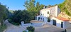
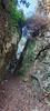
A standing stone described as being in the grounds of San Guillem, a farm at the end of Cami Son Guillermo (Son Guillem in the Menorquin language).
An interesting standing stone with some well-defined circular holes.
Access is probably only by permission of the landowner. If I can get more information, I will return here and add it.
You may be viewing yesterday's version of this page. To see the most up to date information please register for a free account.
")
")
Do not use the above information on other web sites or publications without permission of the contributor.
Nearby Images from Flickr

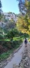
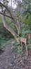
The above images may not be of the site on this page, but were taken nearby. They are loaded from Flickr so please click on them for image credits.
Click here to see more info for this site
Nearby sites
Click here to view sites on an interactive map of the areaKey: Red: member's photo, Blue: 3rd party photo, Yellow: other image, Green: no photo - please go there and take one, Grey: site destroyed
Download sites to:
KML (Google Earth)
GPX (GPS waypoints)
CSV (Garmin/Navman)
CSV (Excel)
To unlock full downloads you need to sign up as a Contributory Member. Otherwise downloads are limited to 50 sites.
Turn off the page maps and other distractions
Nearby sites listing. In the following links * = Image available
2.1km E 92° Beltrana* Ancient Temple
2.7km WNW 293° Torre Trencada* Ancient Village or Settlement
2.8km W 264° Bellaventura Ancient Village or Settlement
3.5km NW 308° Torre Llafuda* Ancient Village or Settlement
3.6km ESE 115° Binicalsitx* Broch or Nuraghe
3.6km ESE 114° Binimassó* Ancient Temple
4.0km ESE 115° Calafi* Ancient Village or Settlement
5.0km ESE 106° Son Mercer de Dalt* Rock Cut Tomb
5.2km ESE 123° Son Mercer de Baix* Ancient Village or Settlement
5.7km WNW 285° Es Tudons taula Standing Stone (Menhir)
6.0km WNW 296° Es Tudons naveta* Chambered Tomb
6.2km NW 307° Ses Arenes de Baix* Chambered Tomb
6.5km N 4° Ses Tanquetes Ancient Village or Settlement
7.3km N 351° Pujol de sa Taula* Ancient Village or Settlement
7.4km WSW 248° Son Catlar* Ancient Village or Settlement
7.4km W 262° Santa Rosa Talayot* Ancient Village or Settlement
8.1km ESE 115° Binicodrell Nou* Standing Stone (Menhir)
8.3km WNW 290° Montefi* Ancient Village or Settlement
8.6km ESE 119° Es Mestall* Broch or Nuraghe
8.7km ESE 117° Binicodrell de Darrera* Broch or Nuraghe
8.9km SE 130° Sant Agustí Vell* Ancient Village or Settlement
9.0km SE 124° Sa Pedrola d'en Magi* Broch or Nuraghe
9.6km WSW 249° Son Olivaret Nou Standing Stone (Menhir)
9.6km WNW 301° Son Angladó* Ancient Village or Settlement
9.7km ESE 121° Santa Mònica* Broch or Nuraghe
View more nearby sites and additional images


 We would like to know more about this location. Please feel free to add a brief description and any relevant information in your own language.
 Wir möchten mehr über diese Stätte erfahren. Bitte zögern Sie nicht, eine kurze Beschreibung und relevante Informationen in Deutsch hinzuzufügen.
 Nous aimerions en savoir encore un peu sur les lieux. S'il vous plaît n'hesitez pas à ajouter une courte description et tous les renseignements pertinents dans votre propre langue.
 Quisieramos informarnos un poco más de las lugares. No dude en añadir una breve descripción y otros datos relevantes en su propio idioma.