


<< Our Photo Pages >> Le Rouve menhir - Standing Stone (Menhir) in France in Languedoc:Lozère (48)
Submitted by TheCaptain on Saturday, 16 April 2005 Page Views: 2483
Neolithic and Bronze AgeSite Name: Le Rouve menhirCountry: France
NOTE: This site is 6.262 km away from the location you searched for.
Département: Languedoc:Lozère (48) Type: Standing Stone (Menhir)
Nearest Town: Alès Nearest Village: Cassagnas
Latitude: 44.283200N Longitude: 3.777280E
Condition:
| 5 | Perfect |
| 4 | Almost Perfect |
| 3 | Reasonable but with some damage |
| 2 | Ruined but still recognisable as an ancient site |
| 1 | Pretty much destroyed, possibly visible as crop marks |
| 0 | No data. |
| -1 | Completely destroyed |
| 5 | Superb |
| 4 | Good |
| 3 | Ordinary |
| 2 | Not Good |
| 1 | Awful |
| 0 | No data. |
| 5 | Can be driven to, probably with disabled access |
| 4 | Short walk on a footpath |
| 3 | Requiring a bit more of a walk |
| 2 | A long walk |
| 1 | In the middle of nowhere, a nightmare to find |
| 0 | No data. |
| 5 | co-ordinates taken by GPS or official recorded co-ordinates |
| 4 | co-ordinates scaled from a detailed map |
| 3 | co-ordinates scaled from a bad map |
| 2 | co-ordinates of the nearest village |
| 1 | co-ordinates of the nearest town |
| 0 | no data |
Internal Links:
External Links:
I have visited· I would like to visit
43559959 would like to visit
johnstone visited on 24th Jun 2008 - their rating: Cond: 4 Amb: 3 Access: 5
")
You may be viewing yesterday's version of this page. To see the most up to date information please register for a free account.
")
Do not use the above information on other web sites or publications without permission of the contributor.
Nearby Images from Flickr

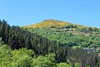
The above images may not be of the site on this page, but were taken nearby. They are loaded from Flickr so please click on them for image credits.
Click here to see more info for this site
Nearby sites
Click here to view sites on an interactive map of the areaKey: Red: member's photo, Blue: 3rd party photo, Yellow: other image, Green: no photo - please go there and take one, Grey: site destroyed
Download sites to:
KML (Google Earth)
GPX (GPS waypoints)
CSV (Garmin/Navman)
CSV (Excel)
To unlock full downloads you need to sign up as a Contributory Member. Otherwise downloads are limited to 50 sites.
Turn off the page maps and other distractions
Nearby sites listing. In the following links * = Image available
2.8km S 189° Col des Laupies Menhir* Standing Stone (Menhir)
4.6km SSW 192° Mont Mars menhir Standing Stone (Menhir)
5.2km SSW 207° Claroudens Dolmen* Burial Chamber or Dolmen
5.3km SSW 207° Claroudens Menhir* Standing Stone (Menhir)
5.7km S 180° Menhir du col de la Pierre Plantée (Galta)* Standing Stone (Menhir)
6.0km NW 310° Bougès pierre gravée Rock Art
6.4km SW 225° Menhir de Plan-de-Fontmort* Standing Stone (Menhir)
6.6km S 173° Dolmen de Galta Burial Chamber or Dolmen
7.0km NW 308° Menhir des Trois Communes* Standing Stone (Menhir)
7.0km NW 322° Altefage menhir* Standing Stone (Menhir)
7.3km SW 221° Tour menhir Standing Stone (Menhir)
8.3km WNW 289° Col-de-l'Agulharon menhir Standing Stone (Menhir)
8.4km WNW 289° Pierre du Baptême Burial Chamber or Dolmen
8.5km NW 323° Menhir dit la Pierre Plantée de Grizac* Standing Stone (Menhir)
8.6km WNW 303° Menhir du Col du Sapet 1* Standing Stone (Menhir)
8.7km WNW 302° Menhir du Col du Sapet 2* Standing Stone (Menhir)
8.8km SSW 202° Dolmen de Casteviel Burial Chamber or Dolmen
9.2km SW 229° Menhir de Fontmort* Standing Stone (Menhir)
9.2km SW 230° Serre-Long Menhir* Standing Stone (Menhir)
10.0km SW 216° Abriguet Menhirs* Standing Stone (Menhir)
10.4km WNW 291° Col-de-la Motte menhir Standing Stone (Menhir)
11.0km SE 137° Dolmen de Combaou 1* Burial Chamber or Dolmen
11.2km SE 137° Dolmen de Combaou 3* Burial Chamber or Dolmen
11.2km SE 136° Dolmen du Plo de Cabanelle 1* Burial Chamber or Dolmen
11.2km SE 125° Necropole du Col de St Michel Barrow Cemetery
View more nearby sites and additional images


 We would like to know more about this location. Please feel free to add a brief description and any relevant information in your own language.
 Wir möchten mehr über diese Stätte erfahren. Bitte zögern Sie nicht, eine kurze Beschreibung und relevante Informationen in Deutsch hinzuzufügen.
 Nous aimerions en savoir encore un peu sur les lieux. S'il vous plaît n'hesitez pas à ajouter une courte description et tous les renseignements pertinents dans votre propre langue.
 Quisieramos informarnos un poco más de las lugares. No dude en añadir una breve descripción y otros datos relevantes en su propio idioma.