 with our Megalithic Portal iPhone app")


<< Other Photo Pages >> Menhir de Pierrefiche (Mende) - Standing Stone (Menhir) in France in Languedoc:Lozère (48)
Submitted by holger_rix on Thursday, 21 April 2016 Page Views: 873
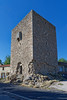
Neolithic and Bronze AgeSite Name: Menhir de Pierrefiche (Mende)Country: France
NOTE: This site is 5.065 km away from the location you searched for.
Département: Languedoc:Lozère (48) Type: Standing Stone (Menhir)
Nearest Town: Mende Nearest Village: Pierrefiche
Latitude: 44.700889N Longitude: 3.722306E
Condition:
| 5 | Perfect |
| 4 | Almost Perfect |
| 3 | Reasonable but with some damage |
| 2 | Ruined but still recognisable as an ancient site |
| 1 | Pretty much destroyed, possibly visible as crop marks |
| 0 | No data. |
| -1 | Completely destroyed |
| 5 | Superb |
| 4 | Good |
| 3 | Ordinary |
| 2 | Not Good |
| 1 | Awful |
| 0 | No data. |
| 5 | Can be driven to, probably with disabled access |
| 4 | Short walk on a footpath |
| 3 | Requiring a bit more of a walk |
| 2 | A long walk |
| 1 | In the middle of nowhere, a nightmare to find |
| 0 | No data. |
| 5 | co-ordinates taken by GPS or official recorded co-ordinates |
| 4 | co-ordinates scaled from a detailed map |
| 3 | co-ordinates scaled from a bad map |
| 2 | co-ordinates of the nearest village |
| 1 | co-ordinates of the nearest town |
| 0 | no data |
Be the first person to rate this site - see the 'Contribute!' box in the right hand menu.
Internal Links:
External Links:
Standing Stone (Menhir) in Languedoc:Lozère (48)
Pierrefiche, Mende, Lozère, Languedoc-Roussillon-Midi-Pyrénées
Source: Wikipedia article
Sites mégalithiques de la Lozère
Picture:
www.t4t35.fr
You may be viewing yesterday's version of this page. To see the most up to date information please register for a free account.
Do not use the above information on other web sites or publications without permission of the contributor.
Nearby Images from Flickr
The above images may not be of the site on this page, but were taken nearby. They are loaded from Flickr so please click on them for image credits.
Click here to see more info for this site
Nearby sites
Click here to view sites on an interactive map of the areaKey: Red: member's photo, Blue: 3rd party photo, Yellow: other image, Green: no photo - please go there and take one, Grey: site destroyed
Download sites to:
KML (Google Earth)
GPX (GPS waypoints)
CSV (Garmin/Navman)
CSV (Excel)
To unlock full downloads you need to sign up as a Contributory Member. Otherwise downloads are limited to 50 sites.
Turn off the page maps and other distractions
Nearby sites listing. In the following links * = Image available
11.1km SSE 149° Pascalou Menhir* Standing Stone (Menhir)
12.1km NNE 30° Menhir des Joncherettes Standing Stone (Menhir)
12.1km SW 219° Menhir du Plot de la Fage 4* Standing Stone (Menhir)
12.4km S 187° Menhir de Montbel* Standing Stone (Menhir)
12.6km NE 45° Pierres à Cupules de Saint-Étienne-du-Vigan Rock Art
12.9km SW 223° Menhir du Plot de la Fage 3* Standing Stone (Menhir)
12.9km SW 223° Menhir du Plot de la Fage 2* Standing Stone (Menhir)
13.0km SW 223° Menhir du Plot de la Fage 5* Standing Stone (Menhir)
13.1km SW 223° Menhir du Plot de la Fage 1* Standing Stone (Menhir)
13.2km SW 217° Dolmen du Chapel Burial Chamber or Dolmen
13.6km SSW 202° Menhir du Col de la Pierre Plantée (Laubert)* Modern Stone Circle etc
14.3km SSW 199° Menhir de Laubert* Standing Stone (Menhir)
14.9km SSW 193° Dolmen de la Prade (Allenc)* Burial Chamber or Dolmen
16.7km SW 215° Dolmen de la Tailladisse* Burial Chamber or Dolmen
17.0km S 178° Menhir dit la Pierre Plantée (Allenc)* Standing Stone (Menhir)
20.1km SW 219° Dolmen du Féron Burial Chamber or Dolmen
21.3km SSW 212° Dolmen de la Rouvière (Pelouse) Burial Chamber or Dolmen
21.4km SE 137° Dolmen dit le Palet de Gargantua (Thort)* Burial Chamber or Dolmen
22.2km WSW 251° Menhir de Savigner Standing Stone (Menhir)
23.3km S 191° Menhir de la Fergère* Standing Stone (Menhir)
23.4km SSW 195° Menhir de l'Oustel-Cremat* Standing Stone (Menhir)
24.0km S 186° Menhir de Cheyroux* Standing Stone (Menhir)
25.3km SSW 208° Mausoleum Lanuéjols* Ancient Temple
25.8km NE 42° Camp Celtique d’Antoune Ancient Village or Settlement
26.4km SSW 209° Menhir du Boy* Standing Stone (Menhir)
View more nearby sites and additional images


 We would like to know more about this location. Please feel free to add a brief description and any relevant information in your own language.
 Wir möchten mehr über diese Stätte erfahren. Bitte zögern Sie nicht, eine kurze Beschreibung und relevante Informationen in Deutsch hinzuzufügen.
 Nous aimerions en savoir encore un peu sur les lieux. S'il vous plaît n'hesitez pas à ajouter une courte description et tous les renseignements pertinents dans votre propre langue.
 Quisieramos informarnos un poco más de las lugares. No dude en añadir una breve descripción y otros datos relevantes en su propio idioma.