


<< Text Pages >> Pierre du Baptême - Burial Chamber or Dolmen in France in Languedoc:Lozère (48)
Submitted by TheCaptain on Saturday, 16 April 2005 Page Views: 1868
Neolithic and Bronze AgeSite Name: Pierre du BaptêmeCountry: France
NOTE: This site is 1.204 km away from the location you searched for.
Département: Languedoc:Lozère (48) Type: Burial Chamber or Dolmen
Nearest Town: Mende Nearest Village: St-Julien-d'Arpaon
Latitude: 44.308000N Longitude: 3.677000E
Condition:
| 5 | Perfect |
| 4 | Almost Perfect |
| 3 | Reasonable but with some damage |
| 2 | Ruined but still recognisable as an ancient site |
| 1 | Pretty much destroyed, possibly visible as crop marks |
| 0 | No data. |
| -1 | Completely destroyed |
| 5 | Superb |
| 4 | Good |
| 3 | Ordinary |
| 2 | Not Good |
| 1 | Awful |
| 0 | No data. |
| 5 | Can be driven to, probably with disabled access |
| 4 | Short walk on a footpath |
| 3 | Requiring a bit more of a walk |
| 2 | A long walk |
| 1 | In the middle of nowhere, a nightmare to find |
| 0 | No data. |
| 5 | co-ordinates taken by GPS or official recorded co-ordinates |
| 4 | co-ordinates scaled from a detailed map |
| 3 | co-ordinates scaled from a bad map |
| 2 | co-ordinates of the nearest village |
| 1 | co-ordinates of the nearest town |
| 0 | no data |
Be the first person to rate this site - see the 'Contribute!' box in the right hand menu.
Internal Links:
External Links:
Possibly a ruined dolmen, perhaps a reused menhir.
IMPORTANT NOTE: Site believed to be near this position.
You may be viewing yesterday's version of this page. To see the most up to date information please register for a free account.
Do not use the above information on other web sites or publications without permission of the contributor.
Nearby Images from Flickr
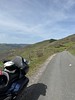
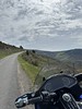
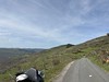
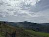

The above images may not be of the site on this page, but were taken nearby. They are loaded from Flickr so please click on them for image credits.
Click here to see more info for this site
Nearby sites
Click here to view sites on an interactive map of the areaKey: Red: member's photo, Blue: 3rd party photo, Yellow: other image, Green: no photo - please go there and take one, Grey: site destroyed
Download sites to:
KML (Google Earth)
GPX (GPS waypoints)
CSV (Garmin/Navman)
CSV (Excel)
To unlock full downloads you need to sign up as a Contributory Member. Otherwise downloads are limited to 50 sites.
Turn off the page maps and other distractions
Nearby sites listing. In the following links * = Image available
159m E 90° Col-de-l'Agulharon menhir Standing Stone (Menhir)
1.9km WNW 301° Col-de-la Motte menhir Standing Stone (Menhir)
2.0km NNE 17° Menhir du Col du Sapet 2* Standing Stone (Menhir)
2.0km NNE 20° Menhir du Col du Sapet 1* Standing Stone (Menhir)
2.9km ENE 58° Menhir des Trois Communes* Standing Stone (Menhir)
3.3km NW 319° Tombeau du Sarrasin Barrow Cemetery
3.6km ENE 72° Bougès pierre gravée Rock Art
3.9km NW 305° Dolmen du Fraysse Burial Chamber or Dolmen
4.6km NE 53° Altefage menhir* Standing Stone (Menhir)
5.0km NE 36° Menhir dit la Pierre Plantée de Grizac* Standing Stone (Menhir)
6.3km NW 317° Cocurès menhirs Standing Stones
7.5km W 270° Tumulus du Mouli del Ben Round Cairn
7.7km W 261° Menhirs des Jalses de Croupillac* Standing Stones
7.8km W 270° Dolmen de la Bastide Burial Chamber or Dolmen
8.1km SSE 154° Menhir de Plan-de-Fontmort* Standing Stone (Menhir)
8.4km ESE 109° Le Rouve menhir* Standing Stone (Menhir)
8.5km SSW 212° Menhirs du Col des Faïsses* Standing Stones
8.7km WNW 285° Relais Menhir* Standing Stone (Menhir)
8.7km S 174° Serre-Long Menhir* Standing Stone (Menhir)
8.8km SSE 159° Tour menhir Standing Stone (Menhir)
8.9km NNW 347° Menhir de la Truc* Standing Stone (Menhir)
8.9km S 173° Menhir de Fontmort* Standing Stone (Menhir)
8.9km SSW 213° Menhir du Col de Solperiére* Standing Stone (Menhir)
9.0km WNW 286° Dolmen dit la Pierre Plate (Florac)* Burial Chamber or Dolmen
9.1km WSW 250° Cabassude menhir Standing Stone (Menhir)
View more nearby sites and additional images


 We would like to know more about this location. Please feel free to add a brief description and any relevant information in your own language.
 Wir möchten mehr über diese Stätte erfahren. Bitte zögern Sie nicht, eine kurze Beschreibung und relevante Informationen in Deutsch hinzuzufügen.
 Nous aimerions en savoir encore un peu sur les lieux. S'il vous plaît n'hesitez pas à ajouter une courte description et tous les renseignements pertinents dans votre propre langue.
 Quisieramos informarnos un poco más de las lugares. No dude en añadir una breve descripción y otros datos relevantes en su propio idioma.