


<< Our Photo Pages >> Col de Pierre Plantée - Standing Stone (Menhir) in France in Languedoc:Gard (30)
Submitted by TheCaptain on Saturday, 16 April 2005 Page Views: 1955
Neolithic and Bronze AgeSite Name: Col de Pierre PlantéeCountry: France Département: Languedoc:Gard (30) Type: Standing Stone (Menhir)
Nearest Town: Le Vigan Nearest Village: Camprieu
Latitude: 44.096000N Longitude: 3.532000E
Condition:
| 5 | Perfect |
| 4 | Almost Perfect |
| 3 | Reasonable but with some damage |
| 2 | Ruined but still recognisable as an ancient site |
| 1 | Pretty much destroyed, possibly visible as crop marks |
| 0 | No data. |
| -1 | Completely destroyed |
| 5 | Superb |
| 4 | Good |
| 3 | Ordinary |
| 2 | Not Good |
| 1 | Awful |
| 0 | No data. |
| 5 | Can be driven to, probably with disabled access |
| 4 | Short walk on a footpath |
| 3 | Requiring a bit more of a walk |
| 2 | A long walk |
| 1 | In the middle of nowhere, a nightmare to find |
| 0 | No data. |
| 5 | co-ordinates taken by GPS or official recorded co-ordinates |
| 4 | co-ordinates scaled from a detailed map |
| 3 | co-ordinates scaled from a bad map |
| 2 | co-ordinates of the nearest village |
| 1 | co-ordinates of the nearest town |
| 0 | no data |
Be the first person to rate this site - see the 'Contribute!' box in the right hand menu.
Internal Links:
External Links:
I have visited· I would like to visit
regina has visited here
")
IMPORTANT NOTE: Site believed to be near this position
You may be viewing yesterday's version of this page. To see the most up to date information please register for a free account.
Do not use the above information on other web sites or publications without permission of the contributor.
Nearby Images from Flickr
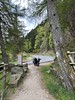
The above images may not be of the site on this page, but were taken nearby. They are loaded from Flickr so please click on them for image credits.
Click here to see more info for this site
Nearby sites
Click here to view sites on an interactive map of the areaKey: Red: member's photo, Blue: 3rd party photo, Yellow: other image, Green: no photo - please go there and take one, Grey: site destroyed
Download sites to:
KML (Google Earth)
GPX (GPS waypoints)
CSV (Garmin/Navman)
CSV (Excel)
To unlock full downloads you need to sign up as a Contributory Member. Otherwise downloads are limited to 50 sites.
Turn off the page maps and other distractions
Nearby sites listing. In the following links * = Image available
4.4km WNW 297° Menhir de Camprieu* Standing Stone (Menhir)
5.1km ENE 59° Trespalous menhir 1* Standing Stone (Menhir)
5.2km ENE 60° Trespalous menhir 2* Standing Stone (Menhir)
10.0km SE 125° Dolmen de Col-de-Peyrefiche Standing Stone (Menhir)
10.3km SW 217° Dolmen de Saint-Guiral* Burial Chamber or Dolmen
10.3km SW 217° Saint-Guiral Grand Menhir* Standing Stone (Menhir)
10.3km SW 218° Pèlerins Menhir* Standing Stone (Menhir)
10.4km SW 218° Saint-Guiral Petit Menhir* Standing Stone (Menhir)
10.6km N 354° Menhir du Col de Fourques* Standing Stone (Menhir)
10.7km SE 126° Serre-de-Rouas menhirs* Standing Stones
10.8km W 260° Grotte du Pas-de-Joulié Cave or Rock Shelter
10.8km S 178° Menhir du Col-de-Mouzoules 1* Standing Stone (Menhir)
10.8km S 178° Menhir du Col-de-Mouzoules 2* Standing Stone (Menhir)
11.3km SSW 196° Col de Vernes dolmen* Burial Chamber or Dolmen
11.7km ENE 77° Col de l'Espinas Dolmen* Burial Chamber or Dolmen
11.8km SSW 196° Menhir du Col-de-Vernes 1* Standing Stone (Menhir)
12.0km SSW 196° Menhir du Col-de-Vernes 2* Standing Stone (Menhir)
12.1km SSW 197° Troulhas menhir* Standing Stone (Menhir)
12.4km SSW 199° Arrigas Dolmen* Burial Chamber or Dolmen
12.4km NW 318° Meyrueis Well* Holy Well or Sacred Spring
12.5km SW 214° Menhir de Peyrelade (Sauclières)* Standing Stone (Menhir)
12.8km NNW 346° Menhirs de Gatuzières* Stone Row / Alignment
13.1km ESE 105° Menhir d'Ardaillès* Standing Stone (Menhir)
13.2km E 93° Menhir de Bonperrier Standing Stone (Menhir)
13.5km NNE 33° Menhirs des Crottes 2 Standing Stone (Menhir)
View more nearby sites and additional images


 We would like to know more about this location. Please feel free to add a brief description and any relevant information in your own language.
 Wir möchten mehr über diese Stätte erfahren. Bitte zögern Sie nicht, eine kurze Beschreibung und relevante Informationen in Deutsch hinzuzufügen.
 Nous aimerions en savoir encore un peu sur les lieux. S'il vous plaît n'hesitez pas à ajouter une courte description et tous les renseignements pertinents dans votre propre langue.
 Quisieramos informarnos un poco más de las lugares. No dude en añadir una breve descripción y otros datos relevantes en su propio idioma.