

, Aubrey Burl")
<< Our Photo Pages >> Serre de la Tune menhir - Standing Stone (Menhir) in France in Languedoc:Gard (30)
Submitted by TheCaptain on Saturday, 16 April 2005 Page Views: 2509
Neolithic and Bronze AgeSite Name: Serre de la Tune menhirCountry: France Département: Languedoc:Gard (30) Type: Standing Stone (Menhir)
Nearest Town: Le Vigan Nearest Village: Arre
Latitude: 43.955150N Longitude: 3.505700E
Condition:
| 5 | Perfect |
| 4 | Almost Perfect |
| 3 | Reasonable but with some damage |
| 2 | Ruined but still recognisable as an ancient site |
| 1 | Pretty much destroyed, possibly visible as crop marks |
| 0 | No data. |
| -1 | Completely destroyed |
| 5 | Superb |
| 4 | Good |
| 3 | Ordinary |
| 2 | Not Good |
| 1 | Awful |
| 0 | No data. |
| 5 | Can be driven to, probably with disabled access |
| 4 | Short walk on a footpath |
| 3 | Requiring a bit more of a walk |
| 2 | A long walk |
| 1 | In the middle of nowhere, a nightmare to find |
| 0 | No data. |
| 5 | co-ordinates taken by GPS or official recorded co-ordinates |
| 4 | co-ordinates scaled from a detailed map |
| 3 | co-ordinates scaled from a bad map |
| 2 | co-ordinates of the nearest village |
| 1 | co-ordinates of the nearest town |
| 0 | no data |
Internal Links:
External Links:
I have visited· I would like to visit
regina has visited here
")
You may be viewing yesterday's version of this page. To see the most up to date information please register for a free account.
")
")
Do not use the above information on other web sites or publications without permission of the contributor.
Nearby Images from Flickr
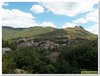
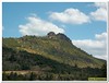
The above images may not be of the site on this page, but were taken nearby. They are loaded from Flickr so please click on them for image credits.
Click here to see more info for this site
Nearby sites
Click here to view sites on an interactive map of the areaKey: Red: member's photo, Blue: 3rd party photo, Yellow: other image, Green: no photo - please go there and take one, Grey: site destroyed
Download sites to:
KML (Google Earth)
GPX (GPS waypoints)
CSV (Garmin/Navman)
CSV (Excel)
To unlock full downloads you need to sign up as a Contributory Member. Otherwise downloads are limited to 50 sites.
Turn off the page maps and other distractions
Nearby sites listing. In the following links * = Image available
115m WNW 289° Dolmen dit Peyre Cabucelade* Burial Chamber or Dolmen
2.0km S 186° Arques Dolmen* Burial Chamber or Dolmen
2.2km SSE 158° Menhir de Landre 1* Standing Stone (Menhir)
2.3km SSW 200° Combes Menhir* Standing Stone (Menhir)
2.4km SSW 205° Avernat menhir* Standing Stone (Menhir)
2.4km SSE 158° Menhir de Landre 2* Standing Stone (Menhir)
2.8km WNW 283° Dolmen d'Aurières 2* Burial Chamber or Dolmen
2.8km WNW 281° Menhir du Col d'Aurières* Standing Stone (Menhir)
3.2km WSW 250° Dolmen d'Airoles 2 Burial Chamber or Dolmen
3.2km WSW 251° Dolmen d'Airoles 1* Burial Chamber or Dolmen
3.2km W 273° Dolmen d'Aurières 1 Burial Chamber or Dolmen
3.3km SSW 201° Lacam de la Rigalderie* Stone Circle
3.4km SSW 200° Lacam de la Rigalderie 2* Stone Circle
3.5km SSE 159° Menhir Sotch de Génièvres* Standing Stone (Menhir)
3.8km SSE 148° Lacam de Peyrarines* Stone Circle
3.9km SE 140° Planàs Dolmen* Burial Chamber or Dolmen
3.9km SE 140° Menhir de Planàs* Standing Stone (Menhir)
3.9km SE 140° Planàs cromlech* Stone Circle
4.1km SE 140° Serre de la Gleisa* Standing Stone (Menhir)
4.4km NNW 340° Troulhas menhir* Standing Stone (Menhir)
4.4km NNW 343° Menhir du Col-de-Vernes 2* Standing Stone (Menhir)
4.4km NNW 334° Arrigas Dolmen* Burial Chamber or Dolmen
4.5km NNW 344° Menhir du Col-de-Vernes 1* Standing Stone (Menhir)
4.8km SE 142° Regos Dolmen* Burial Chamber or Dolmen
4.8km S 173° Cave of the Menhir* Cave or Rock Shelter
View more nearby sites and additional images


 We would like to know more about this location. Please feel free to add a brief description and any relevant information in your own language.
 Wir möchten mehr über diese Stätte erfahren. Bitte zögern Sie nicht, eine kurze Beschreibung und relevante Informationen in Deutsch hinzuzufügen.
 Nous aimerions en savoir encore un peu sur les lieux. S'il vous plaît n'hesitez pas à ajouter une courte description et tous les renseignements pertinents dans votre propre langue.
 Quisieramos informarnos un poco más de las lugares. No dude en añadir una breve descripción y otros datos relevantes en su propio idioma.