


<< Our Photo Pages >> Tumulus du Trou de Billemont - Artificial Mound in Belgium in Hainaut
Submitted by Alta-Falisa on Monday, 19 May 2014 Page Views: 3865
Multi-periodSite Name: Tumulus du Trou de Billemont Alternative Name: Parc archéologique d'AntoingCountry: Belgium
NOTE: This site is 0.936 km away from the location you searched for.
Province: Hainaut Type: Artificial Mound
Nearest Town: Antoing
Latitude: 50.570880N Longitude: 3.461480E
Condition:
| 5 | Perfect |
| 4 | Almost Perfect |
| 3 | Reasonable but with some damage |
| 2 | Ruined but still recognisable as an ancient site |
| 1 | Pretty much destroyed, possibly visible as crop marks |
| 0 | No data. |
| -1 | Completely destroyed |
| 5 | Superb |
| 4 | Good |
| 3 | Ordinary |
| 2 | Not Good |
| 1 | Awful |
| 0 | No data. |
| 5 | Can be driven to, probably with disabled access |
| 4 | Short walk on a footpath |
| 3 | Requiring a bit more of a walk |
| 2 | A long walk |
| 1 | In the middle of nowhere, a nightmare to find |
| 0 | No data. |
| 5 | co-ordinates taken by GPS or official recorded co-ordinates |
| 4 | co-ordinates scaled from a detailed map |
| 3 | co-ordinates scaled from a bad map |
| 2 | co-ordinates of the nearest village |
| 1 | co-ordinates of the nearest town |
| 0 | no data |
Internal Links:
External Links:
")
This tumulus is the south-westernmost one of the region. The majority of the tumuli are concentrated in Limburg (both the Belgian province of Limburg and the Dutch province of the same name), they all have been kept as they have come down to us.
You may be viewing yesterday's version of this page. To see the most up to date information please register for a free account.
")
Do not use the above information on other web sites or publications without permission of the contributor.
Nearby Images from Flickr
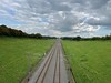

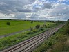
The above images may not be of the site on this page, but were taken nearby. They are loaded from Flickr so please click on them for image credits.
Click here to see more info for this site
Nearby sites
Click here to view sites on an interactive map of the areaKey: Red: member's photo, Blue: 3rd party photo, Yellow: other image, Green: no photo - please go there and take one, Grey: site destroyed
Download sites to:
KML (Google Earth)
GPX (GPS waypoints)
CSV (Garmin/Navman)
CSV (Excel)
To unlock full downloads you need to sign up as a Contributory Member. Otherwise downloads are limited to 50 sites.
Turn off the page maps and other distractions
Nearby sites listing. In the following links * = Image available
5.9km SSW 213° Brunehault* Standing Stone (Menhir)
6.9km NW 307° Musée archéologique de Tournai* Museum
15.0km E 88° Archéosite* Museum
16.5km SE 128° Bernissart, Jardin Géologique* Museum
20.2km W 278° Mont des Tombes Hillfort
21.1km N 6° Peetje en Meetje * Burial Chamber or Dolmen
21.2km N 9° Kluisberg* Natural Stone / Erratic / Other Natural Feature
23.6km NNE 26° Menhir van Jolybos* Modern Stone Circle etc
24.0km NNE 26° Dolmen van Jolybos* Modern Stone Circle etc
29.6km SW 233° Douai Musée d'Archéologie* Museum
33.9km S 174° Menhir dit le Gros Caillou* Standing Stone (Menhir)
34.8km SE 141° Menhir dit la Pierre Croûte* Standing Stone (Menhir)
35.5km SW 216° Menhir dit la Borne-Grand-Père* Marker Stone
38.2km SE 142° Bavay Musée Archéologique* Museum
38.3km SSW 208° Féchain Polissoir* Polissoir
40.5km ESE 114° Silex's* Museum
40.5km SSW 214° La-Pierre-qui-Pousse (Aubigny-au-Bac)* Standing Stone (Menhir)
41.3km ESE 111° Polissoir de Saint-Symphorien* Polissoir
41.4km NNE 33° Provincial Archeological Museum* Museum
42.4km SW 217° Palluel Menhir Statue* Standing Stone (Menhir)
42.5km WSW 254° Tombe de Pont-a-Vendin Burial Chamber or Dolmen
42.9km SW 222° Dolmen dit les Pierres Chavattes* Burial Chamber or Dolmen
43.9km SW 217° Le Gros Caillou (Oisy-le-Verger)* Standing Stone (Menhir)
45.1km NW 314° Porch am Tir Nan Myfyr* Stone Circle
45.5km SW 223° La Pierre du Diable (Lécluse)* Standing Stone (Menhir)
View more nearby sites and additional images


 We would like to know more about this location. Please feel free to add a brief description and any relevant information in your own language.
 Wir möchten mehr über diese Stätte erfahren. Bitte zögern Sie nicht, eine kurze Beschreibung und relevante Informationen in Deutsch hinzuzufügen.
 Nous aimerions en savoir encore un peu sur les lieux. S'il vous plaît n'hesitez pas à ajouter une courte description et tous les renseignements pertinents dans votre propre langue.
 Quisieramos informarnos un poco más de las lugares. No dude en añadir una breve descripción y otros datos relevantes en su propio idioma.