


<< Our Photo Pages >> Sa Ferradura - Ancient Village or Settlement in Spain in Balearic Isles (Mallorca / Majorca)
Submitted by Talaiotik on Sunday, 22 March 2020 Page Views: 733
Multi-periodSite Name: Sa Ferradura Alternative Name: Sa Carrotja des Mitjà de MarCountry: Spain
NOTE: This site is 0.318 km away from the location you searched for.
Region: Balearic Isles (Mallorca / Majorca) Type: Ancient Village or Settlement
Nearest Town: Manacor Nearest Village: Porto Cristo
Latitude: 39.544620N Longitude: 3.350750E
Condition:
| 5 | Perfect |
| 4 | Almost Perfect |
| 3 | Reasonable but with some damage |
| 2 | Ruined but still recognisable as an ancient site |
| 1 | Pretty much destroyed, possibly visible as crop marks |
| 0 | No data. |
| -1 | Completely destroyed |
| 5 | Superb |
| 4 | Good |
| 3 | Ordinary |
| 2 | Not Good |
| 1 | Awful |
| 0 | No data. |
| 5 | Can be driven to, probably with disabled access |
| 4 | Short walk on a footpath |
| 3 | Requiring a bit more of a walk |
| 2 | A long walk |
| 1 | In the middle of nowhere, a nightmare to find |
| 0 | No data. |
| 5 | co-ordinates taken by GPS or official recorded co-ordinates |
| 4 | co-ordinates scaled from a detailed map |
| 3 | co-ordinates scaled from a bad map |
| 2 | co-ordinates of the nearest village |
| 1 | co-ordinates of the nearest town |
| 0 | no data |
Internal Links:
External Links:
")
The settlement is located on a virgin coastal landscape with low bushes, worthy to walk on. The site itself is located on a peninsula, linked to the main island by a narrow path molded by wind and waves. The structures are very badly damaged by erosion and there are a very few remains over the peninsula of Sa Ferradura (The horseshoe in catalan). There is a single pseudo-squared building with an open courtyard with a fireplace (recently restored). North of this building there are the remains of a wall that once closed the only path that allows the access.
This site was excavated by the same team that also excavated at the site of 'Cap de Cala Morell' (Ciutadella, Menorca), with the aim of to link the late bronze age periods of both islands. This site was inhabited arround late bronze age navetiform period (ca. 1100-900 a.C), a period in which the bronze age typical settlements beggin to be abandoned and the fist talayots are build. The site of Sa Ferradura seems to have been used as a defensive point that separated a small community from others on the main island, maybe attesting conflicts between that communities. The occupation of the site was sporadic and only could host a very small group of people.
Sa Ferradura has a public entrance with no fee and is open all year round. In order to access the site, we have to park our car at the street 'carrer del Llaüt', in the urbanization of Porto Cristo, just in front of the sea. From this street, we have to take a dirt path that leads directly to the site, after 350 metres of the walk.
You may be viewing yesterday's version of this page. To see the most up to date information please register for a free account.
")
Do not use the above information on other web sites or publications without permission of the contributor.
Nearby Images from Flickr

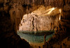
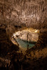

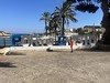

The above images may not be of the site on this page, but were taken nearby. They are loaded from Flickr so please click on them for image credits.
Click here to see more info for this site
Nearby sites
Click here to view sites on an interactive map of the areaKey: Red: member's photo, Blue: 3rd party photo, Yellow: other image, Green: no photo - please go there and take one, Grey: site destroyed
Download sites to:
KML (Google Earth)
GPX (GPS waypoints)
CSV (Garmin/Navman)
CSV (Excel)
To unlock full downloads you need to sign up as a Contributory Member. Otherwise downloads are limited to 50 sites.
Turn off the page maps and other distractions
Nearby sites listing. In the following links * = Image available
3.3km NE 34° S'Illot* Ancient Village or Settlement
4.2km NNE 19° Na Pol* Ancient Village or Settlement
4.4km N 6° Na Gatera* Ancient Village or Settlement
10.4km SW 228° Hospitalet Vell* Ancient Village or Settlement
10.7km NNE 19° Talaiot de Mestre Ramón* Broch or Nuraghe
11.0km NNE 16° Turó de s'Olivar* Ancient Village or Settlement
15.9km N 1° Ses Paisses* Ancient Village or Settlement
16.7km SSW 213° Closos de Ca'n Gaià* Ancient Village or Settlement
19.9km NNW 338° Sa Canova de Morell* Broch or Nuraghe
20.2km NNW 338° Sa Clova Des Xot* Broch or Nuraghe
23.2km N 350° Aigua Dolça* Burial Chamber or Dolmen
23.3km NNW 329° Son Serra de Marina* Broch or Nuraghe
23.7km W 271° Es Pagos* Broch or Nuraghe
25.3km NW 326° Es Figueral* Ancient Village or Settlement
26.2km SW 225° Talaies de Can Jordi* Ancient Village or Settlement
26.5km SW 235° Es Rossells III* Ancient Village or Settlement
26.9km SW 235° Es Rossells I.* Ancient Village or Settlement
27.1km NNW 329° Sa Coveta* Burial Chamber or Dolmen
27.2km NNW 329° Illot des Parros Necropolis* Barrow Cemetery
27.5km NNW 328° Son Real Necropolis* Barrow Cemetery
28.5km NW 325° Son Bauló D'Alt* Burial Chamber or Dolmen
31.3km W 276° Archaeological Museum of Son Fornés* Museum
31.7km NW 318° Son Serra (Can Picafort)* Ancient Village or Settlement
32.0km W 278° Campanari des Moros* Broch or Nuraghe
33.2km W 278° Son Fornes Settlement* Ancient Village or Settlement
View more nearby sites and additional images


 We would like to know more about this location. Please feel free to add a brief description and any relevant information in your own language.
 Wir möchten mehr über diese Stätte erfahren. Bitte zögern Sie nicht, eine kurze Beschreibung und relevante Informationen in Deutsch hinzuzufügen.
 Nous aimerions en savoir encore un peu sur les lieux. S'il vous plaît n'hesitez pas à ajouter une courte description et tous les renseignements pertinents dans votre propre langue.
 Quisieramos informarnos un poco más de las lugares. No dude en añadir una breve descripción y otros datos relevantes en su propio idioma.