


<< Other Photo Pages >> Musée d'Art et d'Archéologie - Museum in France in Auvergne:Allier (03)
Submitted by TheCaptain on Saturday, 16 April 2005 Page Views: 3183
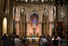
MuseumsSite Name: Musée d'Art et d'ArchéologieCountry: France
NOTE: This site is 3.039 km away from the location you searched for.
Département: Auvergne:Allier (03) Type: Museum
Nearest Town: Moulins
Latitude: 46.567185N Longitude: 3.330340E
Condition:
| 5 | Perfect |
| 4 | Almost Perfect |
| 3 | Reasonable but with some damage |
| 2 | Ruined but still recognisable as an ancient site |
| 1 | Pretty much destroyed, possibly visible as crop marks |
| 0 | No data. |
| -1 | Completely destroyed |
| 5 | Superb |
| 4 | Good |
| 3 | Ordinary |
| 2 | Not Good |
| 1 | Awful |
| 0 | No data. |
| 5 | Can be driven to, probably with disabled access |
| 4 | Short walk on a footpath |
| 3 | Requiring a bit more of a walk |
| 2 | A long walk |
| 1 | In the middle of nowhere, a nightmare to find |
| 0 | No data. |
| 5 | co-ordinates taken by GPS or official recorded co-ordinates |
| 4 | co-ordinates scaled from a detailed map |
| 3 | co-ordinates scaled from a bad map |
| 2 | co-ordinates of the nearest village |
| 1 | co-ordinates of the nearest town |
| 0 | no data |
Be the first person to rate this site - see the 'Contribute!' box in the right hand menu.
Internal Links:
External Links:
Museum in Allier
Address: Place du Colonel-Laussedat, 3000
Phone: 04 70 20 48 47
You may be viewing yesterday's version of this page. To see the most up to date information please register for a free account.
Do not use the above information on other web sites or publications without permission of the contributor.
davidmorgan has found this location on Google Street View:
Nearby Images from Flickr

The above images may not be of the site on this page, but were taken nearby. They are loaded from Flickr so please click on them for image credits.
Click here to see more info for this site
Nearby sites
Click here to view sites on an interactive map of the areaKey: Red: member's photo, Blue: 3rd party photo, Yellow: other image, Green: no photo - please go there and take one, Grey: site destroyed
Download sites to:
KML (Google Earth)
GPX (GPS waypoints)
CSV (Garmin/Navman)
CSV (Excel)
To unlock full downloads you need to sign up as a Contributory Member. Otherwise downloads are limited to 50 sites.
Turn off the page maps and other distractions
Nearby sites listing. In the following links * = Image available
14.8km SSE 165° Tumulus de Bessay-sur-Allier Round Barrow(s)
26.1km NNW 337° Oppidum d'Azy-le-Vif Ancient Village or Settlement
28.5km SSW 194° Menhir de Bransat Standing Stone (Menhir)
29.2km SE 126° Grotte des Fées (Châtelperron)* Cave or Rock Shelter
40.8km W 269° Menhir du Vilhain* Standing Stone (Menhir)
40.9km N 355° Menhir dit le Chaillou Magnien Standing Stone (Menhir)
42.9km SE 137° Pierre Druidique de La Bruyère Rock Outcrop
44.6km WSW 258° Menhir de Venas Standing Stone (Menhir)
44.8km W 272° Menhir des Autais* Standing Stone (Menhir)
45.9km W 261° Dolmen du Malroch Burial Chamber or Dolmen
47.8km SE 141° Rocher à Cupules de Droiturier Rock Art
48.7km WSW 254° Menhir de Pirolet Standing Stone (Menhir)
49.0km WSW 254° Menhir du Mont* Standing Stone (Menhir)
49.0km SW 232° Les Pierres Fougères Rock Outcrop
49.1km WSW 251° Dolmen de la Table du Loup Burial Chamber or Dolmen
50.2km WSW 253° Cupules du Petit Mazeau Rock Art
50.7km SSW 196° Menhir de Bègues Standing Stone (Menhir)
50.7km ENE 66° Chigy Menhir* Standing Stone (Menhir)
51.7km WSW 239° Dolmen dit la Cabane du Loup (Doyet)* Burial Chamber or Dolmen
53.7km WSW 257° Menhir de Givarlais* Standing Stone (Menhir)
54.9km WSW 254° Menhir de la Croix Brouzeau Standing Stone (Menhir)
56.6km SSW 205° Table de Péraclos* Rock Outcrop
56.9km NE 49° Menhir dit la Pierre Aiguë (Villapourçon) Standing Stone (Menhir)
57.2km S 189° Pierre Sanglante Rock Art
60.1km NNE 12° Dolmen de la Pierre-du-Sacrifice Burial Chamber or Dolmen
View more nearby sites and additional images


 We would like to know more about this location. Please feel free to add a brief description and any relevant information in your own language.
 Wir möchten mehr über diese Stätte erfahren. Bitte zögern Sie nicht, eine kurze Beschreibung und relevante Informationen in Deutsch hinzuzufügen.
 Nous aimerions en savoir encore un peu sur les lieux. S'il vous plaît n'hesitez pas à ajouter une courte description et tous les renseignements pertinents dans votre propre langue.
 Quisieramos informarnos un poco más de las lugares. No dude en añadir una breve descripción y otros datos relevantes en su propio idioma.