 with our Megalithic Portal iPhone app")


<< Our Photo Pages >> Dolmen des Roudanergues - Burial Chamber or Dolmen in France in Languedoc:Hérault (34)
Submitted by TheCaptain on Thursday, 10 February 2005 Page Views: 3884
Neolithic and Bronze AgeSite Name: Dolmen des RoudanerguesCountry: France
NOTE: This site is 2.365 km away from the location you searched for.
Département: Languedoc:Hérault (34) Type: Burial Chamber or Dolmen
Nearest Town: Béziers Nearest Village: Bédarieux
Latitude: 43.612485N Longitude: 3.239137E
Condition:
| 5 | Perfect |
| 4 | Almost Perfect |
| 3 | Reasonable but with some damage |
| 2 | Ruined but still recognisable as an ancient site |
| 1 | Pretty much destroyed, possibly visible as crop marks |
| 0 | No data. |
| -1 | Completely destroyed |
| 5 | Superb |
| 4 | Good |
| 3 | Ordinary |
| 2 | Not Good |
| 1 | Awful |
| 0 | No data. |
| 5 | Can be driven to, probably with disabled access |
| 4 | Short walk on a footpath |
| 3 | Requiring a bit more of a walk |
| 2 | A long walk |
| 1 | In the middle of nowhere, a nightmare to find |
| 0 | No data. |
| 5 | co-ordinates taken by GPS or official recorded co-ordinates |
| 4 | co-ordinates scaled from a detailed map |
| 3 | co-ordinates scaled from a bad map |
| 2 | co-ordinates of the nearest village |
| 1 | co-ordinates of the nearest town |
| 0 | no data |
Be the first person to rate this site - see the 'Contribute!' box in the right hand menu.
Internal Links:
External Links:
")
Location Source: T4T35.fr
You may be viewing yesterday's version of this page. To see the most up to date information please register for a free account.
")
")
Do not use the above information on other web sites or publications without permission of the contributor.
Nearby Images from Flickr
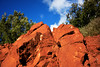
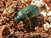
The above images may not be of the site on this page, but were taken nearby. They are loaded from Flickr so please click on them for image credits.
Click here to see more info for this site
Nearby sites
Click here to view sites on an interactive map of the areaKey: Red: member's photo, Blue: 3rd party photo, Yellow: other image, Green: no photo - please go there and take one, Grey: site destroyed
Download sites to:
KML (Google Earth)
GPX (GPS waypoints)
CSV (Garmin/Navman)
CSV (Excel)
To unlock full downloads you need to sign up as a Contributory Member. Otherwise downloads are limited to 50 sites.
Turn off the page maps and other distractions
Nearby sites listing. In the following links * = Image available
4.5km ESE 103° Menhir dit la Pierre des Clapisses* Standing Stone (Menhir)
5.7km NNE 32° Menhir de Basse* Standing Stone (Menhir)
8.1km NE 35° Toucou Dolmens* Barrow Cemetery
8.1km NE 35° Dolmen dit de Toucou 6* Burial Chamber or Dolmen
8.1km NE 35° Menhirs de Lacade* Standing Stone (Menhir)
8.2km NE 36° Dolmen dit de Toucou 3* Burial Chamber or Dolmen
8.2km NE 36° Dolmen dit de Toucou 4* Burial Chamber or Dolmen
8.2km NE 36° Dolmen dit de Toucou 5* Burial Chamber or Dolmen
8.2km NE 35° Dolmen dit de Toucou 2 Burial Chamber or Dolmen
8.3km NE 34° Dolmen dit de Toucou 1 Burial Chamber or Dolmen
8.3km NE 45° Menhir de Carols Standing Stone (Menhir)
8.7km ENE 73° Menhir dit la Pierre Droite de l'Ouïsse* Standing Stone (Menhir)
9.1km NNE 12° Dolmen de Lavalette* Burial Chamber or Dolmen
9.4km NNE 12° Dolmens du Mas Trinquier* Burial Chamber or Dolmen
9.5km NE 35° Dolmen de la Fourille* Burial Chamber or Dolmen
11.1km E 95° Dolmen de Mougno* Burial Chamber or Dolmen
11.3km ESE 109° Pioch Farrus Mine* Ancient Mine, Quarry or other Industry
12.7km NE 34° Grotte de Tréviols Cave or Rock Shelter
13.1km SW 217° Lenthéric menhir Standing Stone (Menhir)
13.8km SE 130° Dolmen de Peyreficade* Burial Chamber or Dolmen
14.1km SE 131° Menhir de Peyreficade* Standing Stone (Menhir)
14.4km NNW 346° Dolmen de la Planquette Burial Chamber or Dolmen
14.8km NNE 27° Grotte fermée Cave or Rock Shelter
15.3km S 183° Magalas Oppidum Ancient Village or Settlement
15.6km SE 138° Dolmen de Caux Burial Chamber or Dolmen
View more nearby sites and additional images


 We would like to know more about this location. Please feel free to add a brief description and any relevant information in your own language.
 Wir möchten mehr über diese Stätte erfahren. Bitte zögern Sie nicht, eine kurze Beschreibung und relevante Informationen in Deutsch hinzuzufügen.
 Nous aimerions en savoir encore un peu sur les lieux. S'il vous plaît n'hesitez pas à ajouter une courte description et tous les renseignements pertinents dans votre propre langue.
 Quisieramos informarnos un poco más de las lugares. No dude en añadir una breve descripción y otros datos relevantes en su propio idioma.