


<< Our Photo Pages >> Colossae - Ancient Village or Settlement in Turkey
Submitted by davidmorgan on Tuesday, 18 December 2012 Page Views: 1956
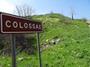
Multi-periodSite Name: ColossaeCountry: Turkey Type: Ancient Village or Settlement
Nearest Town: Denizli
Latitude: 37.786555N Longitude: 29.260023E
Condition:
| 5 | Perfect |
| 4 | Almost Perfect |
| 3 | Reasonable but with some damage |
| 2 | Ruined but still recognisable as an ancient site |
| 1 | Pretty much destroyed, possibly visible as crop marks |
| 0 | No data. |
| -1 | Completely destroyed |
| 5 | Superb |
| 4 | Good |
| 3 | Ordinary |
| 2 | Not Good |
| 1 | Awful |
| 0 | No data. |
| 5 | Can be driven to, probably with disabled access |
| 4 | Short walk on a footpath |
| 3 | Requiring a bit more of a walk |
| 2 | A long walk |
| 1 | In the middle of nowhere, a nightmare to find |
| 0 | No data. |
| 5 | co-ordinates taken by GPS or official recorded co-ordinates |
| 4 | co-ordinates scaled from a detailed map |
| 3 | co-ordinates scaled from a bad map |
| 2 | co-ordinates of the nearest village |
| 1 | co-ordinates of the nearest town |
| 0 | no data |
Internal Links:
External Links:
I have visited· I would like to visit
davidmorgan has visited here
")
A Phrygian city possibly dating from the 5th century BCE. It is now very ruined but the theatre and some walls on the acropolis can be seen.
You may be viewing yesterday's version of this page. To see the most up to date information please register for a free account.
")
Do not use the above information on other web sites or publications without permission of the contributor.
Nearby Images from Flickr
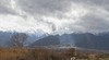
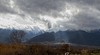
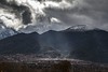
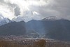
The above images may not be of the site on this page, but were taken nearby. They are loaded from Flickr so please click on them for image credits.
Click here to see more info for this site
Nearby sites
Click here to view sites on an interactive map of the areaKey: Red: member's photo, Blue: 3rd party photo, Yellow: other image, Green: no photo - please go there and take one, Grey: site destroyed
Download sites to:
KML (Google Earth)
GPX (GPS waypoints)
CSV (Garmin/Navman)
CSV (Excel)
To unlock full downloads you need to sign up as a Contributory Member. Otherwise downloads are limited to 50 sites.
Turn off the page maps and other distractions
Nearby sites listing. In the following links * = Image available
14.4km WNW 292° Laodikeia* Ancient Village or Settlement
19.4km NW 322° Hierapolis* Ancient Village or Settlement
20.9km NW 324° Hierapolis Mausoleums* Rock Cut Tomb
26.4km SW 228° Herakleia Hieron Ancient Temple
39.1km NW 316° Tripolis* Ancient Village or Settlement
40.9km NE 36° Eksi Hoyuk Ancient Village or Settlement
47.9km W 260° Aphrodisias* Ancient Village or Settlement
65.0km NE 36° Beycesultan* Ancient Village or Settlement
72.0km SE 134° Camur Hoyuk Ancient Village or Settlement
72.6km SSE 164° Kibyra* Ancient Village or Settlement
75.9km ESE 107° Hacilar* Ancient Village or Settlement
81.5km ESE 102° Kurucay Hoyuk* Ancient Village or Settlement
86.1km WSW 249° Hyllarima* Ancient Village or Settlement
89.3km NW 314° Gavurtepe Ancient Village or Settlement
90.5km E 94° Burdur Museum Museum
91.7km S 172° Boubon Ancient Village or Settlement
96.8km SSE 163° Balboura* Ancient Village or Settlement
98.7km W 278° Nysa* Ancient Village or Settlement
101.8km W 277° Acharaca Ancient Village or Settlement
103.7km SSE 158° Caltilar Höyük Ancient Village or Settlement
111.3km E 96° Sagalassos* Ancient Village or Settlement
111.7km SSE 167° Oinoanda* Ancient Village or Settlement
114.3km W 259° Alabanda* Ancient Village or Settlement
116.2km S 175° Araxa (Lycia)* Rock Cut Tomb
116.7km WSW 248° Lagina Temple of Hecate* Ancient Temple
View more nearby sites and additional images


 We would like to know more about this location. Please feel free to add a brief description and any relevant information in your own language.
 Wir möchten mehr über diese Stätte erfahren. Bitte zögern Sie nicht, eine kurze Beschreibung und relevante Informationen in Deutsch hinzuzufügen.
 Nous aimerions en savoir encore un peu sur les lieux. S'il vous plaît n'hesitez pas à ajouter une courte description et tous les renseignements pertinents dans votre propre langue.
 Quisieramos informarnos un poco más de las lugares. No dude en añadir una breve descripción y otros datos relevantes en su propio idioma.