


<< Our Photo Pages >> Pydnai - Ancient Village or Settlement in Turkey
Submitted by lycianroy on Saturday, 07 May 2016 Page Views: 2547
Multi-periodSite Name: Pydnai Alternative Name: PydnaeCountry: Turkey Type: Ancient Village or Settlement
Nearest Town: Kalkan Nearest Village: Karadere
Latitude: 36.333267N Longitude: 29.231719E
Condition:
| 5 | Perfect |
| 4 | Almost Perfect |
| 3 | Reasonable but with some damage |
| 2 | Ruined but still recognisable as an ancient site |
| 1 | Pretty much destroyed, possibly visible as crop marks |
| 0 | No data. |
| -1 | Completely destroyed |
| 5 | Superb |
| 4 | Good |
| 3 | Ordinary |
| 2 | Not Good |
| 1 | Awful |
| 0 | No data. |
| 5 | Can be driven to, probably with disabled access |
| 4 | Short walk on a footpath |
| 3 | Requiring a bit more of a walk |
| 2 | A long walk |
| 1 | In the middle of nowhere, a nightmare to find |
| 0 | No data. |
| 5 | co-ordinates taken by GPS or official recorded co-ordinates |
| 4 | co-ordinates scaled from a detailed map |
| 3 | co-ordinates scaled from a bad map |
| 2 | co-ordinates of the nearest village |
| 1 | co-ordinates of the nearest town |
| 0 | no data |
Internal Links:
External Links:
I have visited· I would like to visit
Kuba visited on 31st Dec 2021 - their rating: Cond: 2 Amb: 3 Access: 4
")
Pydnai was built as a fortress to guard the Western extremes of Patara and the deep water harbor which would have probably have been present in those times considering the standard of build. It is just off the small Özlen River. It is now near an area of marshland.
It is made of well-preserved polygonal masonry with 11 rectangular towers at its corners and mid-way along the walls. It also has 7 protruding stairways which allowed soldiers to quickly scale its walls from the inside. Battlements were later added on upper walls. The only sign of construction within the walls is a small Byzantine Church. Four or five inscriptions have been found in and around the fort; all are of Imperial date and one links Pydnai with Xanthos.
The area within the walls is neglected and very much overgrown.
You may be viewing yesterday's version of this page. To see the most up to date information please register for a free account.
")
")
")
Do not use the above information on other web sites or publications without permission of the contributor.
Nearby Images from Flickr
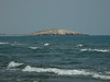


The above images may not be of the site on this page, but were taken nearby. They are loaded from Flickr so please click on them for image credits.
Click here to see more info for this site
Nearby sites
Click here to view sites on an interactive map of the areaKey: Red: member's photo, Blue: 3rd party photo, Yellow: other image, Green: no photo - please go there and take one, Grey: site destroyed
Download sites to:
KML (Google Earth)
GPX (GPS waypoints)
CSV (Garmin/Navman)
CSV (Excel)
To unlock full downloads you need to sign up as a Contributory Member. Otherwise downloads are limited to 50 sites.
Turn off the page maps and other distractions
Nearby sites listing. In the following links * = Image available
5.1km E 93° Letoon* Ancient Village or Settlement
8.2km ENE 72° Xanthos* Ancient Village or Settlement
9.1km NNW 338° Sidyma* Ancient Village or Settlement
10.9km SE 136° Patara* Ancient Village or Settlement
17.6km N 7° Pinara* Ancient Village or Settlement
29.1km ESE 110° Gökçeören* Rock Cut Tomb
29.9km NE 34° Tlos Settlement* Ancient Village or Settlement
33.3km NNW 342° Telmessos* Ancient Village or Settlement
33.8km NNW 342° Fethiye Museum Museum
38.4km ESE 122° Kastellorizo Lycian Tomb* Rock Cut Tomb
39.1km ESE 112° Antiphellos* Ancient Village or Settlement
39.6km E 92° Kandyba* Ancient Village or Settlement
39.9km ESE 104° Phellos.* Ancient Village or Settlement
42.1km N 360° Cadianda* Ancient Village or Settlement
43.4km NE 42° Kastabara* Ancient Village or Settlement
46.3km NW 314° Lydae* Ancient Village or Settlement
47.3km NW 323° Telandros Ancient Village or Settlement
47.4km NNE 15° Araxa (Lycia)* Rock Cut Tomb
50.4km ESE 109° Apollonia (Turkey)* Ancient Village or Settlement
52.2km E 95° Korba (Turkey) Ancient Village or Settlement
53.0km ESE 111° Aperlai Ancient Village or Settlement
53.2km E 100° Cyaneae* Ancient Village or Settlement
57.3km ESE 102° Bucak* Rock Cut Tomb
57.5km ESE 105° Teimiussa* Ancient Village or Settlement
58.7km ESE 105° Simena* Ancient Village or Settlement
View more nearby sites and additional images


 We would like to know more about this location. Please feel free to add a brief description and any relevant information in your own language.
 Wir möchten mehr über diese Stätte erfahren. Bitte zögern Sie nicht, eine kurze Beschreibung und relevante Informationen in Deutsch hinzuzufügen.
 Nous aimerions en savoir encore un peu sur les lieux. S'il vous plaît n'hesitez pas à ajouter une courte description et tous les renseignements pertinents dans votre propre langue.
 Quisieramos informarnos un poco más de las lugares. No dude en añadir una breve descripción y otros datos relevantes en su propio idioma.