

<< Text Pages >> Gavurtepe - Ancient Village or Settlement in Turkey
Submitted by davidmorgan on Tuesday, 13 June 2017 Page Views: 779
Multi-periodSite Name: GavurtepeCountry: Turkey
NOTE: This site is 1.118 km away from the location you searched for.
Type: Ancient Village or Settlement
Nearest Town: Alaşehir
Latitude: 38.339000N Longitude: 28.520000E
Condition:
| 5 | Perfect |
| 4 | Almost Perfect |
| 3 | Reasonable but with some damage |
| 2 | Ruined but still recognisable as an ancient site |
| 1 | Pretty much destroyed, possibly visible as crop marks |
| 0 | No data. |
| -1 | Completely destroyed |
| 5 | Superb |
| 4 | Good |
| 3 | Ordinary |
| 2 | Not Good |
| 1 | Awful |
| 0 | No data. |
| 5 | Can be driven to, probably with disabled access |
| 4 | Short walk on a footpath |
| 3 | Requiring a bit more of a walk |
| 2 | A long walk |
| 1 | In the middle of nowhere, a nightmare to find |
| 0 | No data. |
| 5 | co-ordinates taken by GPS or official recorded co-ordinates |
| 4 | co-ordinates scaled from a detailed map |
| 3 | co-ordinates scaled from a bad map |
| 2 | co-ordinates of the nearest village |
| 1 | co-ordinates of the nearest town |
| 0 | no data |
Internal Links:
External Links:
Ancient Settlement in Manisa Province, Turkey
A large mound with 6 levels of habitation going back to the Chalcolithic Age. Probably a major settlement of the Seha River Lands in the Late Bronze Age.
You may be viewing yesterday's version of this page. To see the most up to date information please register for a free account.
Do not use the above information on other web sites or publications without permission of the contributor.
Nearby Images from Flickr
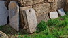
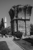


The above images may not be of the site on this page, but were taken nearby. They are loaded from Flickr so please click on them for image credits.
Click here to see more info for this site
Nearby sites
Click here to view sites on an interactive map of the areaKey: Red: member's photo, Blue: 3rd party photo, Yellow: other image, Green: no photo - please go there and take one, Grey: site destroyed
Download sites to:
KML (Google Earth)
GPX (GPS waypoints)
CSV (Garmin/Navman)
CSV (Excel)
To unlock full downloads you need to sign up as a Contributory Member. Otherwise downloads are limited to 50 sites.
Turn off the page maps and other distractions
Nearby sites listing. In the following links * = Image available
45.1km WNW 292° Sardis* Ancient Village or Settlement
45.3km WNW 290° Sardis Temple of Artemis* Ancient Temple
48.8km WNW 302° Alyattes Tomb* Round Barrow(s)
50.3km SE 131° Tripolis* Ancient Village or Settlement
51.6km WNW 300° Bin Tepe Tumuli* Round Barrow(s)
58.5km SW 214° Nysa* Ancient Village or Settlement
60.3km WNW 302° Kaymakci Hill Ancient Village or Settlement
60.9km SW 216° Acharaca Ancient Village or Settlement
68.8km SE 130° Hierapolis Mausoleums* Rock Cut Tomb
70.2km SE 131° Hierapolis* Ancient Village or Settlement
72.5km SSE 166° Aphrodisias* Ancient Village or Settlement
75.4km NW 315° Kulaksizlar* Ancient Mine, Quarry or other Industry
76.1km SE 137° Laodikeia* Ancient Village or Settlement
79.4km SW 227° Aydin Archaeological Museum* Museum
80.0km SW 229° Tralleis Ancient Village or Settlement
87.8km NW 318° Thyateira* Ancient Village or Settlement
89.3km SE 133° Colossae* Ancient Village or Settlement
91.1km SSE 150° Herakleia Hieron Ancient Temple
91.6km WNW 288° Yarik Kaya Rock Carvings Rock Art
92.7km WNW 288° Yarik Kaya Rock Cut Tomb* Rock Cut Tomb
92.8km W 272° Karabel Rock Relief* Carving
93.0km ESE 107° Eksi Hoyuk Ancient Village or Settlement
93.3km WNW 288° Manisa Kybele Rock Relief Rock Art
93.9km S 189° Hyllarima* Ancient Village or Settlement
95.4km SSW 210° Alabanda* Ancient Village or Settlement
View more nearby sites and additional images


 We would like to know more about this location. Please feel free to add a brief description and any relevant information in your own language.
 Wir möchten mehr über diese Stätte erfahren. Bitte zögern Sie nicht, eine kurze Beschreibung und relevante Informationen in Deutsch hinzuzufügen.
 Nous aimerions en savoir encore un peu sur les lieux. S'il vous plaît n'hesitez pas à ajouter une courte description et tous les renseignements pertinents dans votre propre langue.
 Quisieramos informarnos un poco más de las lugares. No dude en añadir una breve descripción y otros datos relevantes en su propio idioma.