


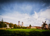
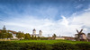
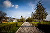
<< Other Photo Pages >> Telita-Celic Dere - Barrow Cemetery in Romania
Submitted by davidmorgan on Friday, 30 January 2015 Page Views: 3376
Neolithic and Bronze AgeSite Name: Telita-Celic Dere Alternative Name: Teliţa-Celic DereCountry: Romania
NOTE: This site is 59.291 km away from the location you searched for.
Type: Barrow Cemetery
Nearest Town: Teliţa
Latitude: 45.137372N Longitude: 28.559983E
Condition:
| 5 | Perfect |
| 4 | Almost Perfect |
| 3 | Reasonable but with some damage |
| 2 | Ruined but still recognisable as an ancient site |
| 1 | Pretty much destroyed, possibly visible as crop marks |
| 0 | No data. |
| -1 | Completely destroyed |
| 5 | Superb |
| 4 | Good |
| 3 | Ordinary |
| 2 | Not Good |
| 1 | Awful |
| 0 | No data. |
| 5 | Can be driven to, probably with disabled access |
| 4 | Short walk on a footpath |
| 3 | Requiring a bit more of a walk |
| 2 | A long walk |
| 1 | In the middle of nowhere, a nightmare to find |
| 0 | No data. |
| 5 | co-ordinates taken by GPS or official recorded co-ordinates |
| 4 | co-ordinates scaled from a detailed map |
| 3 | co-ordinates scaled from a bad map |
| 2 | co-ordinates of the nearest village |
| 1 | co-ordinates of the nearest town |
| 0 | no data |
Internal Links:
External Links:
")
Note: Archaeologists study Thracian burial ground and settlement in Romania
You may be viewing yesterday's version of this page. To see the most up to date information please register for a free account.
")
Do not use the above information on other web sites or publications without permission of the contributor.
Nearby Images from Flickr

![F91972[6]-Firebug (Pyrrhocoris apterus)](https://farm66.static.flickr.com/65535/49213535581_62f207081d_t.jpg)

The above images may not be of the site on this page, but were taken nearby. They are loaded from Flickr so please click on them for image credits.
Click here to see more info for this site
Nearby sites
Click here to view sites on an interactive map of the areaKey: Red: member's photo, Blue: 3rd party photo, Yellow: other image, Green: no photo - please go there and take one, Grey: site destroyed
Download sites to:
KML (Google Earth)
GPX (GPS waypoints)
CSV (Garmin/Navman)
CSV (Excel)
To unlock full downloads you need to sign up as a Contributory Member. Otherwise downloads are limited to 50 sites.
Turn off the page maps and other distractions
Nearby sites listing. In the following links * = Image available
51.7km SE 144° Argamum* Ancient Village or Settlement
64.5km SSE 166° Istria burial site* Barrow Cemetery
65.9km SSE 162° Fertility menhir* Standing Stone (Menhir)
67.7km SSE 165° Histria* Ancient Village or Settlement
67.8km SSE 166° Histria Museum of History* Museum
80.6km SSW 208° Capidava* Ancient Village or Settlement
107.4km S 176° Constanta Museum of National History and Archaeology* Museum
124.7km SSW 203° Tropaeum Traiani* Sculptured Stone
126.5km SSW 203° Adamclisi Museum of Antiquities* Museum
146.8km S 179° Callatis* Ancient Village or Settlement
147.0km S 179° Callatis Museum of Archaeology Museum
148.1km N 351° Upper Trajan's Wall Misc. Earthwork
168.2km WNW 282° Turtudui menhir* Standing Stone (Menhir)
168.9km WNW 282° Menhir near Fundul Pesterii* Standing Stone (Menhir)
168.9km WNW 282° Fundul Pesterii Cave* Rock Art
182.6km NE 49° Tira (Ukraine) Ancient Village or Settlement
195.1km S 189° Cybele Temple* Ancient Temple
198.0km WSW 247° Cernica Neolithic Tombs* Barrow Cemetery
209.6km WSW 249° National Museum of Romanian History Museum
210.3km SW 223° Sveshtari Thracian Tomb* Chambered Cairn
210.6km N 6° National Museum of History of Moldova* Museum
220.7km SSW 194° Varna Museum of Archaeology Museum
223.2km SSW 198° Pobiti Kamani* Natural Stone / Erratic / Other Natural Feature
225.3km SSW 211° Pliska Mound Artificial Mound
228.9km SSW 211° Pliska Menhirs* Standing Stones
View more nearby sites and additional images


 We would like to know more about this location. Please feel free to add a brief description and any relevant information in your own language.
 Wir möchten mehr über diese Stätte erfahren. Bitte zögern Sie nicht, eine kurze Beschreibung und relevante Informationen in Deutsch hinzuzufügen.
 Nous aimerions en savoir encore un peu sur les lieux. S'il vous plaît n'hesitez pas à ajouter une courte description et tous les renseignements pertinents dans votre propre langue.
 Quisieramos informarnos un poco más de las lugares. No dude en añadir una breve descripción y otros datos relevantes en su propio idioma.