 with our Megalithic Portal iPhone app")


<< Other Photo Pages >> Çantaköy - Round Barrow(s) in Turkey
Submitted by davidmorgan on Tuesday, 07 June 2016 Page Views: 2628
Neolithic and Bronze AgeSite Name: ÇantaköyCountry: Turkey
NOTE: This site is 47.715 km away from the location you searched for.
Type: Round Barrow(s)
Nearest Town: Silivri Nearest Village: Çantaköy
Latitude: 41.116711N Longitude: 28.080092E
Condition:
| 5 | Perfect |
| 4 | Almost Perfect |
| 3 | Reasonable but with some damage |
| 2 | Ruined but still recognisable as an ancient site |
| 1 | Pretty much destroyed, possibly visible as crop marks |
| 0 | No data. |
| -1 | Completely destroyed |
| 5 | Superb |
| 4 | Good |
| 3 | Ordinary |
| 2 | Not Good |
| 1 | Awful |
| 0 | No data. |
| 5 | Can be driven to, probably with disabled access |
| 4 | Short walk on a footpath |
| 3 | Requiring a bit more of a walk |
| 2 | A long walk |
| 1 | In the middle of nowhere, a nightmare to find |
| 0 | No data. |
| 5 | co-ordinates taken by GPS or official recorded co-ordinates |
| 4 | co-ordinates scaled from a detailed map |
| 3 | co-ordinates scaled from a bad map |
| 2 | co-ordinates of the nearest village |
| 1 | co-ordinates of the nearest town |
| 0 | no data |
Be the first person to rate this site - see the 'Contribute!' box in the right hand menu.
Internal Links:
External Links:
")
A kurgan is a circular burial mound constructed over a pit grave that often contains grave vessels, weapons and the bodies of horses as well as a single human body. The type of tomb was originally used on the Russian steppes but later spread to eastern, central and northern Europe in the 3rd millennium B.C. The type of grave was holy in Turkic and Altay culture.
The skeleton of a person who was believed to have been an important warrior was found inside the tomb alongside an arrowhead.
See the comment below for more details
You may be viewing yesterday's version of this page. To see the most up to date information please register for a free account.
Do not use the above information on other web sites or publications without permission of the contributor.
Nearby Images from Flickr
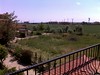
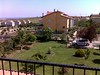
The above images may not be of the site on this page, but were taken nearby. They are loaded from Flickr so please click on them for image credits.
Click here to see more info for this site
Nearby sites
Click here to view sites on an interactive map of the areaKey: Red: member's photo, Blue: 3rd party photo, Yellow: other image, Green: no photo - please go there and take one, Grey: site destroyed
Download sites to:
KML (Google Earth)
GPX (GPS waypoints)
CSV (Garmin/Navman)
CSV (Excel)
To unlock full downloads you need to sign up as a Contributory Member. Otherwise downloads are limited to 50 sites.
Turn off the page maps and other distractions
Nearby sites listing. In the following links * = Image available
35.0km WSW 249° Heraion-Teikhos* Ancient Village or Settlement
50.1km WSW 252° Tekirdag Museum of Archaeology* Museum
55.6km E 99° Bathonea Ancient Village or Settlement
74.6km E 99° Yenikapi Ancient Village or Settlement
74.7km E 99° Istanbul University Archaeological Museum Museum
75.7km E 99° Column of Constantine* Standing Stone (Menhir)
76.1km E 99° Spiral Column* Carving
76.1km E 99° Istanbul Amenhotep III Obelisk* Standing Stone (Menhir)
76.2km E 99° The Basilica Cistern, Istanbul* Ancient Mine, Quarry or other Industry
76.4km E 98° Istanbul Archaeological Museum* Museum
83.0km SSW 192° Cyzicus Ancient Village or Settlement
97.9km NW 314° Asagipinar* Ancient Village or Settlement
109.5km S 181° Daskyleion* Ancient Village or Settlement
115.3km SW 228° Parion Ancient Village or Settlement
116.9km SSE 154° Apollonia ad Rhyndacum* Ancient Village or Settlement
118.7km N 351° Ancient Tsarevo Ancient Village or Settlement
119.9km SSE 151° Aktopraklik Hoyuk Ancient Village or Settlement
131.2km NW 313° Berberoglu Ayazmasi Standing Stones
132.0km NW 326° Dolmen Belevren 2* Burial Chamber or Dolmen
132.4km NW 326° Dolmen Belevren 1* Burial Chamber or Dolmen
133.1km NW 326° Dolmen Belevren 3* Burial Chamber or Dolmen
133.2km NW 326° Dolmen Belevren 4* Burial Chamber or Dolmen
135.4km NNW 348° Perla Dolmen 1* Burial Chamber or Dolmen
135.4km N 349° Beglik Tash* Natural Stone / Erratic / Other Natural Feature
135.5km NW 311° Kircesme Multiple Stone Rows Multiple Stone Rows / Avenue
View more nearby sites and additional images


 We would like to know more about this location. Please feel free to add a brief description and any relevant information in your own language.
 Wir möchten mehr über diese Stätte erfahren. Bitte zögern Sie nicht, eine kurze Beschreibung und relevante Informationen in Deutsch hinzuzufügen.
 Nous aimerions en savoir encore un peu sur les lieux. S'il vous plaît n'hesitez pas à ajouter une courte description et tous les renseignements pertinents dans votre propre langue.
 Quisieramos informarnos un poco más de las lugares. No dude en añadir una breve descripción y otros datos relevantes en su propio idioma.