

<< Other Photo Pages >> Blombos Cave - Cave or Rock Shelter in South Africa
Submitted by Andy B on Tuesday, 23 November 2010 Page Views: 10402
Natural PlacesSite Name: Blombos CaveCountry: South Africa
NOTE: This site is 20.66 km away from the location you searched for.
Type: Cave or Rock Shelter
Latitude: 34.414103S Longitude: 21.217689E
Condition:
| 5 | Perfect |
| 4 | Almost Perfect |
| 3 | Reasonable but with some damage |
| 2 | Ruined but still recognisable as an ancient site |
| 1 | Pretty much destroyed, possibly visible as crop marks |
| 0 | No data. |
| -1 | Completely destroyed |
| 5 | Superb |
| 4 | Good |
| 3 | Ordinary |
| 2 | Not Good |
| 1 | Awful |
| 0 | No data. |
| 5 | Can be driven to, probably with disabled access |
| 4 | Short walk on a footpath |
| 3 | Requiring a bit more of a walk |
| 2 | A long walk |
| 1 | In the middle of nowhere, a nightmare to find |
| 0 | No data. |
| 5 | co-ordinates taken by GPS or official recorded co-ordinates |
| 4 | co-ordinates scaled from a detailed map |
| 3 | co-ordinates scaled from a bad map |
| 2 | co-ordinates of the nearest village |
| 1 | co-ordinates of the nearest town |
| 0 | no data |
Be the first person to rate this site - see the 'Contribute!' box in the right hand menu.
Internal Links:
External Links:
")
Excavations carried out since 1991 at Blombos Cave provide snapshots of life in the African Middle Stone Age (MSA) in the southern Cape, South Africa. Three phases of MSA occupation have been identified and named M1, M2 and M3. Dating by the optically stimulated luminescence (OSL) and thermoluminescence (TL) methods have provided occupation dates for each phase: these are about 71,000 BCE for the M1 phase, about 78,000 BCE for the M2 phase and between 100,000 and 140,000 BCE for the M3 phase.
Read More at Wikipedia
Note: Stone Age people sharpened skills 55,000 years earlier than thought
You may be viewing yesterday's version of this page. To see the most up to date information please register for a free account.
Do not use the above information on other web sites or publications without permission of the contributor.
Nearby Images from Flickr

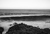
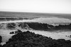

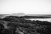
The above images may not be of the site on this page, but were taken nearby. They are loaded from Flickr so please click on them for image credits.
Click here to see more info for this site
Nearby sites
Click here to view sites on an interactive map of the areaKey: Red: member's photo, Blue: 3rd party photo, Yellow: other image, Green: no photo - please go there and take one, Grey: site destroyed
Download sites to:
KML (Google Earth)
GPX (GPS waypoints)
CSV (Garmin/Navman)
CSV (Excel)
To unlock full downloads you need to sign up as a Contributory Member. Otherwise downloads are limited to 50 sites.
Turn off the page maps and other distractions
Nearby sites listing. In the following links * = Image available
83.3km ENE 74° Pinnacle Point* Cave or Rock Shelter
263.4km W 281° Iziko South African Museum Museum
293.3km E 84° Klasies River Caves* Cave or Rock Shelter
341.6km NW 311° Diepkloof* Rock Outcrop
627.4km NNE 29° Thomas' Farm Belmont Rock Art Rock Art
671.6km NNE 26° Driekopseiland Rock Art Rock Art
714.4km NNE 29° McGregor Museum Museum
717.0km NNE 28° Wildebeestkuil* Rock Art
722.0km NNE 27° Nooitgedacht Rock art Rock Art
731.7km NNW 326° Spitzkloof* Cave or Rock Shelter
763.5km NNE 18° Wonderwerk Cave* Cave or Rock Shelter
766.7km NNE 14° Kathu Pan* Ancient Mine, Quarry or other Industry
816.5km NNE 29° Stowlands Rock art Rock Art
834.5km NE 54° Lesob 1 Rock Art
835.2km NE 54° Lesob 3 Rock Art
835.2km NE 54° Lesob 2 Rock Art
835.8km NE 54° Lesob 4 Rock Art
835.9km NE 54° Lesob 5 Rock Art
841.8km NNW 331° Apollo 11 Cave* Cave or Rock Shelter
869.1km N 349° The Lost City of Kalahari* Ancient Village or Settlement
921.6km NNE 31° Wolmaransstad Rock Art Rock Art
942.1km ENE 58° Ikanti Shelter I Rock Art
973.0km ENE 57° Kamberg rock art Rock Art
1077.4km ENE 62° Sibudu Cave* Cave or Rock Shelter
1123.7km NE 36° Sterkfontein* Cave or Rock Shelter
View more nearby sites and additional images


 We would like to know more about this location. Please feel free to add a brief description and any relevant information in your own language.
 Wir möchten mehr über diese Stätte erfahren. Bitte zögern Sie nicht, eine kurze Beschreibung und relevante Informationen in Deutsch hinzuzufügen.
 Nous aimerions en savoir encore un peu sur les lieux. S'il vous plaît n'hesitez pas à ajouter une courte description et tous les renseignements pertinents dans votre propre langue.
 Quisieramos informarnos un poco más de las lugares. No dude en añadir una breve descripción y otros datos relevantes en su propio idioma.