

, Aubrey Burl")
<< Text Pages >> Ahvenkoski Harbour - Ancient Village or Settlement in Finland
Submitted by bat400 on Wednesday, 23 October 2013 Page Views: 2935
Multi-periodSite Name: Ahvenkoski HarbourCountry: Finland
NOTE: This site is 24.477 km away from the location you searched for.
Type: Ancient Village or Settlement
Nearest Town: Kotca Nearest Village: Ahvenkoski
Latitude: 60.500000N Longitude: 26.485000E
Condition:
| 5 | Perfect |
| 4 | Almost Perfect |
| 3 | Reasonable but with some damage |
| 2 | Ruined but still recognisable as an ancient site |
| 1 | Pretty much destroyed, possibly visible as crop marks |
| 0 | No data. |
| -1 | Completely destroyed |
| 5 | Superb |
| 4 | Good |
| 3 | Ordinary |
| 2 | Not Good |
| 1 | Awful |
| 0 | No data. |
| 5 | Can be driven to, probably with disabled access |
| 4 | Short walk on a footpath |
| 3 | Requiring a bit more of a walk |
| 2 | A long walk |
| 1 | In the middle of nowhere, a nightmare to find |
| 0 | No data. |
| 5 | co-ordinates taken by GPS or official recorded co-ordinates |
| 4 | co-ordinates scaled from a detailed map |
| 3 | co-ordinates scaled from a bad map |
| 2 | co-ordinates of the nearest village |
| 1 | co-ordinates of the nearest town |
| 0 | no data |
Be the first person to rate this site - see the 'Contribute!' box in the right hand menu.
Internal Links:
External Links:
Ancient Settlement in Kymenlaakos, Finland.
Discovered in 2010. A large harbor, dating from around 1000–1200 AD at the mouth of western branch of the Kymijoki River in Finland. Findings include a smithy, a iron smelting furnace, forceps, as well as hundreds of iron objects such as boat rivets.
Note: Iron Age Site Discovered in Finland
You may be viewing yesterday's version of this page. To see the most up to date information please register for a free account.
Do not use the above information on other web sites or publications without permission of the contributor.
Nearby Images from Flickr

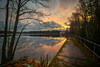
The above images may not be of the site on this page, but were taken nearby. They are loaded from Flickr so please click on them for image credits.
Click here to see more info for this site
Nearby sites
Click here to view sites on an interactive map of the areaKey: Red: member's photo, Blue: 3rd party photo, Yellow: other image, Green: no photo - please go there and take one, Grey: site destroyed
Download sites to:
KML (Google Earth)
GPX (GPS waypoints)
CSV (Garmin/Navman)
CSV (Excel)
To unlock full downloads you need to sign up as a Contributory Member. Otherwise downloads are limited to 50 sites.
Turn off the page maps and other distractions
Nearby sites listing. In the following links * = Image available
55.3km SSE 151° Megaliths of Hogland Island* Standing Stones
76.0km E 92° Labyrinth Krutoyar* Turf Maze
86.4km WSW 251° Pihlajamäki Hiidenkirnu Natural Stone / Erratic / Other Natural Feature
90.6km WSW 250° Käpylä Hiidenkirnu* Natural Stone / Erratic / Other Natural Feature
92.8km WSW 248° National Museum of Finland Museum
95.0km NE 48° Lemin Heiluvakivi* Natural Stone / Erratic / Other Natural Feature
102.9km S 187° Kaarnakivi* Natural Stone / Erratic / Other Natural Feature
104.5km NNW 347° Liikkuva kivi* Natural Stone / Erratic / Other Natural Feature
105.8km S 177° Ehalkivi* Natural Stone / Erratic / Other Natural Feature
105.9km SSW 198° Saadumetsa suurkivi* Natural Stone / Erratic / Other Natural Feature
107.6km SSW 202° Jaani-Tooma Suurkivi* Natural Stone / Erratic / Other Natural Feature
110.9km SSW 200° Tammispea rändrahn* Natural Stone / Erratic / Other Natural Feature
119.2km NNE 28° Astuvansalmi rock paintings* Rock Art
123.4km NW 308° Hovin Manor Stone Rock Art
123.8km SSW 206° Hundikangrud* Cist
124.5km WNW 297° Kauriala Uhrikivi Rock Art
128.9km SSW 211° Augusuurkivi* Natural Stone / Erratic / Other Natural Feature
130.6km SSW 207° Lauritsakivi* Natural Stone / Erratic / Other Natural Feature
139.3km SW 215° Rebala* Barrow Cemetery
139.8km SSW 213° Jõelähtme* Barrow Cemetery
142.0km SSW 213° Kostivere Sliding Stone* Natural Stone / Erratic / Other Natural Feature
152.2km NE 43° Strange rock Kummakivi* Natural Stone / Erratic / Other Natural Feature
152.7km WNW 302° Rapola* Hillfort
152.9km SW 219° Linda Kivi* Natural Stone / Erratic / Other Natural Feature
162.7km SSE 163° Iisaku Muuseum* Museum
View more nearby sites and additional images


 We would like to know more about this location. Please feel free to add a brief description and any relevant information in your own language.
 Wir möchten mehr über diese Stätte erfahren. Bitte zögern Sie nicht, eine kurze Beschreibung und relevante Informationen in Deutsch hinzuzufügen.
 Nous aimerions en savoir encore un peu sur les lieux. S'il vous plaît n'hesitez pas à ajouter une courte description et tous les renseignements pertinents dans votre propre langue.
 Quisieramos informarnos un poco más de las lugares. No dude en añadir una breve descripción y otros datos relevantes en su propio idioma.