


<< Text Pages >> Mykonos Archaeological Museum - Museum in Greece in Greek Islands
Submitted by davidmorgan on Thursday, 09 March 2017 Page Views: 1001
MuseumsSite Name: Mykonos Archaeological MuseumCountry: Greece
NOTE: This site is 33.179 km away from the location you searched for.
Region: Greek Islands Type: Museum
Nearest Town: Mykonos
Latitude: 37.449996N Longitude: 25.329431E
Condition:
| 5 | Perfect |
| 4 | Almost Perfect |
| 3 | Reasonable but with some damage |
| 2 | Ruined but still recognisable as an ancient site |
| 1 | Pretty much destroyed, possibly visible as crop marks |
| 0 | No data. |
| -1 | Completely destroyed |
| 5 | Superb |
| 4 | Good |
| 3 | Ordinary |
| 2 | Not Good |
| 1 | Awful |
| 0 | No data. |
| 5 | Can be driven to, probably with disabled access |
| 4 | Short walk on a footpath |
| 3 | Requiring a bit more of a walk |
| 2 | A long walk |
| 1 | In the middle of nowhere, a nightmare to find |
| 0 | No data. |
| 5 | co-ordinates taken by GPS or official recorded co-ordinates |
| 4 | co-ordinates scaled from a detailed map |
| 3 | co-ordinates scaled from a bad map |
| 2 | co-ordinates of the nearest village |
| 1 | co-ordinates of the nearest town |
| 0 | no data |
Internal Links:
External Links:
Museum in Greek Islands (Aegean etc)
The Archaeological Museum of Mykonos was built in 1902, in order to house the finds from the "Purification Pit" of 426/5 B.C., which was discovered in 1898 on the islet of Rheneia, by D. Stavropoulos.
Website: Greek Ministry of Culture.
You may be viewing yesterday's version of this page. To see the most up to date information please register for a free account.
Do not use the above information on other web sites or publications without permission of the contributor.
Nearby Images from Flickr

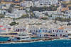
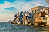

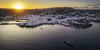
The above images may not be of the site on this page, but were taken nearby. They are loaded from Flickr so please click on them for image credits.
Click here to see more info for this site
Nearby sites
Click here to view sites on an interactive map of the areaKey: Red: member's photo, Blue: 3rd party photo, Yellow: other image, Green: no photo - please go there and take one, Grey: site destroyed
Download sites to:
KML (Google Earth)
GPX (GPS waypoints)
CSV (Garmin/Navman)
CSV (Excel)
To unlock full downloads you need to sign up as a Contributory Member. Otherwise downloads are limited to 50 sites.
Turn off the page maps and other distractions
Nearby sites listing. In the following links * = Image available
3.1km SSE 156° Leno Tower* Stone Fort or Dun
3.3km SSE 166° Platys Gialos Trilithon* Ancient Village or Settlement
5.3km E 84° Paleokastro* Hillfort
7.6km SW 224° Delos Archaeological Museum* Museum
7.7km SW 225° Delos (Greece)* Ancient Temple
35.8km SSE 147° Apollonas Kouros* Carving
38.0km S 174° Portara* Ancient Temple
41.7km S 174° Yria Temple* Ancient Temple
42.2km SSE 165° Flerio Kouros* Carving
42.5km SSE 165° Potami Kouros* Carving
44.1km SSE 165° Menhir of Naxos* Standing Stone (Menhir)
45.3km SSE 158° Archaeological Museum of Apiranthos* Museum
47.7km S 169° Dimitras Temple* Ancient Temple
48.6km SSE 162° Zeus' Cave* Cave or Rock Shelter
56.4km SSW 205° Spileo Stalaktiton* Cave or Rock Shelter
67.6km S 171° Irakleia Spiral shaped petroglyph 2* Rock Art
67.8km S 171° Irakleia spiral shaped Petroglyph 4* Rock Art
67.8km S 171° Irakleia - Cyclades Petroglyph 1* Rock Art
67.9km S 171° Iracleia Calculation Grid* Carving
68.3km SSE 155° Keros* Sculptured Stone
69.1km S 171° Irakleia Spiral shaped petroglyphs 3 * Rock Art
79.3km W 270° Maroula Ancient Village or Settlement
89.0km W 278° Karthea Temple* Ancient Village or Settlement
89.3km SSW 194° Episkopi (Sikinos)* Ancient Temple
99.4km NNE 32° Chios Temple of Apollo Ancient Temple
View more nearby sites and additional images


 We would like to know more about this location. Please feel free to add a brief description and any relevant information in your own language.
 Wir möchten mehr über diese Stätte erfahren. Bitte zögern Sie nicht, eine kurze Beschreibung und relevante Informationen in Deutsch hinzuzufügen.
 Nous aimerions en savoir encore un peu sur les lieux. S'il vous plaît n'hesitez pas à ajouter une courte description et tous les renseignements pertinents dans votre propre langue.
 Quisieramos informarnos un poco más de las lugares. No dude en añadir una breve descripción y otros datos relevantes en su propio idioma.