


<< Our Photo Pages >> Käpylä Hiidenkirnu - Natural Stone / Erratic / Other Natural Feature in Finland
Submitted by TimPrevett on Sunday, 24 April 2011 Page Views: 9898
Natural PlacesSite Name: Käpylä Hiidenkirnu Alternative Name: Devil's Kettle, Devil's Cauldron, Giant's Kettle, Giant's CauldronCountry: Finland
NOTE: This site is 2.328 km away from the location you searched for.
Type: Natural Stone / Erratic / Other Natural Feature
Nearest Town: Helsinki Nearest Village: Käpylä
Latitude: 60.214789N Longitude: 24.941193E
Condition:
| 5 | Perfect |
| 4 | Almost Perfect |
| 3 | Reasonable but with some damage |
| 2 | Ruined but still recognisable as an ancient site |
| 1 | Pretty much destroyed, possibly visible as crop marks |
| 0 | No data. |
| -1 | Completely destroyed |
| 5 | Superb |
| 4 | Good |
| 3 | Ordinary |
| 2 | Not Good |
| 1 | Awful |
| 0 | No data. |
| 5 | Can be driven to, probably with disabled access |
| 4 | Short walk on a footpath |
| 3 | Requiring a bit more of a walk |
| 2 | A long walk |
| 1 | In the middle of nowhere, a nightmare to find |
| 0 | No data. |
| 5 | co-ordinates taken by GPS or official recorded co-ordinates |
| 4 | co-ordinates scaled from a detailed map |
| 3 | co-ordinates scaled from a bad map |
| 2 | co-ordinates of the nearest village |
| 1 | co-ordinates of the nearest town |
| 0 | no data |
Internal Links:
External Links:
")
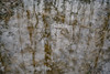
During a trip to Helsinki, the capital of Finland, I found out about these Hiidenkirnu - large holes created during the time of the Ice Age. Much research unlocked potential visits around the outer areas of the city - free things to do, which are actually really interesting.
I did eventually find one of the glaical rock-bore holes; in Finnish folklore they are attributed to giants, goblins, and are entrances to the otherworld - places of liminality and to be approached, if at all, with care. (Assuming I've got the understanding of the Finnish translation correct from using Google Translate).
It's a few minutes walk from the bus stop, in the Käpylä area of Helinski , east of Tuusulantie, Vaakalinnuntie, Tursontie, Louhentie, and off the corner of Louhenkuja and Ilmatarvägen, behind a school and what was once a ski slope.
A number of other Hiidenkirnu exist in the Helsinki area, the most impressive being the Pihlajamäki Hiidenkirnu, some 6.9 metres in diameter and 8.45 metres deep.
You may be viewing yesterday's version of this page. To see the most up to date information please register for a free account.
")
")
")
")
Do not use the above information on other web sites or publications without permission of the contributor.
Nearby Images from Flickr


The above images may not be of the site on this page, but were taken nearby. They are loaded from Flickr so please click on them for image credits.
Click here to see more info for this site
Nearby sites
Click here to view sites on an interactive map of the areaKey: Red: member's photo, Blue: 3rd party photo, Yellow: other image, Green: no photo - please go there and take one, Grey: site destroyed
Download sites to:
KML (Google Earth)
GPX (GPS waypoints)
CSV (Garmin/Navman)
CSV (Excel)
To unlock full downloads you need to sign up as a Contributory Member. Otherwise downloads are limited to 50 sites.
Turn off the page maps and other distractions
Nearby sites listing. In the following links * = Image available
4.4km NE 52° Pihlajamäki Hiidenkirnu Natural Stone / Erratic / Other Natural Feature
4.5km S 187° National Museum of Finland Museum
81.7km SSE 166° Augusuurkivi* Natural Stone / Erratic / Other Natural Feature
82.5km SE 146° Jaani-Tooma Suurkivi* Natural Stone / Erratic / Other Natural Feature
84.3km S 174° Rebala* Barrow Cemetery
85.8km SSE 158° Hundikangrud* Cist
86.8km S 173° Jõelähtme* Barrow Cemetery
87.7km SE 146° Tammispea rändrahn* Natural Stone / Erratic / Other Natural Feature
87.8km SE 142° Saadumetsa suurkivi* Natural Stone / Erratic / Other Natural Feature
88.3km S 174° Kostivere Sliding Stone* Natural Stone / Erratic / Other Natural Feature
88.9km S 186° Linda Kivi* Natural Stone / Erratic / Other Natural Feature
89.4km SSE 162° Lauritsakivi* Natural Stone / Erratic / Other Natural Feature
90.6km ENE 69° Ahvenkoski Harbour Ancient Village or Settlement
91.6km NNW 343° Kauriala Uhrikivi Rock Art
100.1km W 269° Lupaja* Barrow Cemetery
100.7km WNW 283° Puonti* Cairn
102.6km SE 133° Kaarnakivi* Natural Stone / Erratic / Other Natural Feature
107.1km N 352° Hovin Manor Stone Rock Art
111.3km S 177° Blue Springs of Saula* Holy Well or Sacred Spring
113.7km E 97° Megaliths of Hogland Island* Standing Stones
117.9km SE 128° Ehalkivi* Natural Stone / Erratic / Other Natural Feature
119.6km NNW 337° Rapola* Hillfort
135.4km NNW 337° Järvensuo I* Ancient Village or Settlement
144.2km WNW 283° Old Castle of Lieto* Hillfort
146.1km NNE 24° Liikkuva kivi* Natural Stone / Erratic / Other Natural Feature
View more nearby sites and additional images


 We would like to know more about this location. Please feel free to add a brief description and any relevant information in your own language.
 Wir möchten mehr über diese Stätte erfahren. Bitte zögern Sie nicht, eine kurze Beschreibung und relevante Informationen in Deutsch hinzuzufügen.
 Nous aimerions en savoir encore un peu sur les lieux. S'il vous plaît n'hesitez pas à ajouter une courte description et tous les renseignements pertinents dans votre propre langue.
 Quisieramos informarnos un poco más de las lugares. No dude en añadir una breve descripción y otros datos relevantes en su propio idioma.