


<< Our Photo Pages >> Matala - Rock Cut Tomb in Greece in Crete
Submitted by Klingon on Friday, 19 February 2010 Page Views: 8525
Multi-periodSite Name: Matala Alternative Name: ΜάταλαCountry: Greece
NOTE: This site is 8.258 km away from the location you searched for.
Region: Crete Type: Rock Cut Tomb
Nearest Town: Matala
Latitude: 34.995100N Longitude: 24.747800E
Condition:
| 5 | Perfect |
| 4 | Almost Perfect |
| 3 | Reasonable but with some damage |
| 2 | Ruined but still recognisable as an ancient site |
| 1 | Pretty much destroyed, possibly visible as crop marks |
| 0 | No data. |
| -1 | Completely destroyed |
| 5 | Superb |
| 4 | Good |
| 3 | Ordinary |
| 2 | Not Good |
| 1 | Awful |
| 0 | No data. |
| 5 | Can be driven to, probably with disabled access |
| 4 | Short walk on a footpath |
| 3 | Requiring a bit more of a walk |
| 2 | A long walk |
| 1 | In the middle of nowhere, a nightmare to find |
| 0 | No data. |
| 5 | co-ordinates taken by GPS or official recorded co-ordinates |
| 4 | co-ordinates scaled from a detailed map |
| 3 | co-ordinates scaled from a bad map |
| 2 | co-ordinates of the nearest village |
| 1 | co-ordinates of the nearest town |
| 0 | no data |
Internal Links:
External Links:
I have visited· I would like to visit
43559959 would like to visit
Klingon visited - their rating: Cond: 4 Amb: 3 Access: 4
davidmorgan have visited here
")
Note: 130,000 year old stone tools found on southern shore of Crete, indicating very ancient mariners, see comment
You may be viewing yesterday's version of this page. To see the most up to date information please register for a free account.
")
")
")
Do not use the above information on other web sites or publications without permission of the contributor.
Nearby Images from Flickr
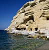


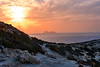
The above images may not be of the site on this page, but were taken nearby. They are loaded from Flickr so please click on them for image credits.
Click here to see more info for this site
Nearby sites
Click here to view sites on an interactive map of the areaKey: Red: member's photo, Blue: 3rd party photo, Yellow: other image, Green: no photo - please go there and take one, Grey: site destroyed
Download sites to:
KML (Google Earth)
GPX (GPS waypoints)
CSV (Garmin/Navman)
CSV (Excel)
To unlock full downloads you need to sign up as a Contributory Member. Otherwise downloads are limited to 50 sites.
Turn off the page maps and other distractions
Nearby sites listing. In the following links * = Image available
2.2km NNE 34° Kommos* Ancient Village or Settlement
4.8km NE 47° Pitsidia Ancient Village or Settlement
5.2km ESE 115° Odiyitra Passage Grave
6.6km NNE 32° Kamilari Tholos Tomb* Chambered Tomb
8.2km NNE 30° Agia Triada* Ancient Village or Settlement
8.7km NE 44° Phaistos* Ancient Palace
9.4km SE 132° Lasaia Ancient Village or Settlement
15.4km ESE 115° Yerokampos Passage Grave
16.8km ESE 114° Papoura Passage Grave
17.5km ESE 113° Lebena Ancient Village or Settlement
18.4km N 356° Apodoulou (Tomb) Passage Grave
18.6km N 353° Apodoulou (Settlement) Ancient Village or Settlement
19.6km ENE 67° Gortys* Ancient Village or Settlement
22.7km ESE 106° Trypiti Ancient Village or Settlement
24.2km E 93° Koumasa Chambered Tomb
24.8km NNE 17° Ideon Andron* Cave or Rock Shelter
30.9km NNE 24° Zominthos* Ancient Village or Settlement
33.2km NNW 331° Ancient Sanctuary of Hermes* Ancient Temple
35.6km NNE 14° Tihio (Axos)* Rock Cut Tomb
35.9km NNE 14° Ancient Axos* Ancient Village or Settlement
35.9km NNE 13° Dimitra Sanctuary* Rock Cut Tomb
36.0km NNE 15° Panagia (Axos)* Ancient Village or Settlement
37.5km N 350° Elefderna* Ancient Village or Settlement
38.1km N 350° Orthi Petra Rock Cut Tomb
38.5km NNE 30° Sklavokampos* Ancient Village or Settlement
View more nearby sites and additional images


 We would like to know more about this location. Please feel free to add a brief description and any relevant information in your own language.
 Wir möchten mehr über diese Stätte erfahren. Bitte zögern Sie nicht, eine kurze Beschreibung und relevante Informationen in Deutsch hinzuzufügen.
 Nous aimerions en savoir encore un peu sur les lieux. S'il vous plaît n'hesitez pas à ajouter une courte description et tous les renseignements pertinents dans votre propre langue.
 Quisieramos informarnos un poco más de las lugares. No dude en añadir una breve descripción y otros datos relevantes en su propio idioma.