 with our Megalithic Portal iPhone app")


<< Text Pages >> Phylakopi - Ancient Village or Settlement in Greece in Greek Islands
Submitted by davidmorgan on Friday, 12 May 2017 Page Views: 881
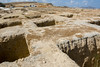
Multi-periodSite Name: PhylakopiCountry: Greece
NOTE: This site is 11.012 km away from the location you searched for.
Region: Greek Islands Type: Ancient Village or Settlement
Nearest Town: Adamantas
Latitude: 36.755143N Longitude: 24.504753E
Condition:
| 5 | Perfect |
| 4 | Almost Perfect |
| 3 | Reasonable but with some damage |
| 2 | Ruined but still recognisable as an ancient site |
| 1 | Pretty much destroyed, possibly visible as crop marks |
| 0 | No data. |
| -1 | Completely destroyed |
| 5 | Superb |
| 4 | Good |
| 3 | Ordinary |
| 2 | Not Good |
| 1 | Awful |
| 0 | No data. |
| 5 | Can be driven to, probably with disabled access |
| 4 | Short walk on a footpath |
| 3 | Requiring a bit more of a walk |
| 2 | A long walk |
| 1 | In the middle of nowhere, a nightmare to find |
| 0 | No data. |
| 5 | co-ordinates taken by GPS or official recorded co-ordinates |
| 4 | co-ordinates scaled from a detailed map |
| 3 | co-ordinates scaled from a bad map |
| 2 | co-ordinates of the nearest village |
| 1 | co-ordinates of the nearest town |
| 0 | no data |
Internal Links:
External Links:
Ancient Settlement in Milos, Greek Islands (Aegean etc)
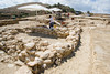
An important Bronze Age site originally settled in the EBA around 2500 BCE and inhabited in 3 phases over the next 1400 years.
You may be viewing yesterday's version of this page. To see the most up to date information please register for a free account.
Do not use the above information on other web sites or publications without permission of the contributor.
Nearby Images from Flickr
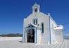
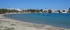
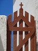

The above images may not be of the site on this page, but were taken nearby. They are loaded from Flickr so please click on them for image credits.
Click here to see more info for this site
Nearby sites
Click here to view sites on an interactive map of the areaKey: Red: member's photo, Blue: 3rd party photo, Yellow: other image, Green: no photo - please go there and take one, Grey: site destroyed
Download sites to:
KML (Google Earth)
GPX (GPS waypoints)
CSV (Garmin/Navman)
CSV (Excel)
To unlock full downloads you need to sign up as a Contributory Member. Otherwise downloads are limited to 50 sites.
Turn off the page maps and other distractions
Nearby sites listing. In the following links * = Image available
7.3km W 260° Milos Archaeological Museum Museum
53.2km E 100° Episkopi (Sikinos)* Ancient Temple
55.9km ENE 62° Spileo Stalaktiton* Cave or Rock Shelter
77.2km N 355° Maroula Ancient Village or Settlement
84.6km E 84° Irakleia Spiral shaped petroglyphs 3 * Rock Art
84.8km E 83° Irakleia Spiral shaped petroglyph 2* Rock Art
85.1km E 83° Irakleia - Cyclades Petroglyph 1* Rock Art
85.1km E 83° Irakleia spiral shaped Petroglyph 4* Rock Art
85.1km E 83° Iracleia Calculation Grid* Carving
85.7km ENE 65° Yria Temple* Ancient Temple
86.6km ENE 63° Portara* Ancient Temple
87.8km ENE 69° Dimitras Temple* Ancient Temple
90.7km ESE 119° Akrotiri Stone Natural Stone / Erratic / Other Natural Feature
90.9km N 350° Karthea Temple* Ancient Village or Settlement
91.0km ESE 114° Museum of Prehistoric Thera* Museum
91.7km ENE 68° Menhir of Naxos* Standing Stone (Menhir)
91.8km ENE 66° Flerio Kouros* Carving
91.8km ESE 119° Akrotiri* Ancient Village or Settlement
91.8km ENE 66° Potami Kouros* Carving
93.8km ENE 70° Zeus' Cave* Cave or Rock Shelter
95.5km ESE 119° Thira Temple of Diana* Ancient Temple
95.6km ESE 119° Gavrilos* Rock Cut Tomb
95.7km ESE 119° Echendra* Rock Cut Tomb
96.4km ESE 116° Episkopi Gonia cemetery* Rock Cut Tomb
96.8km ESE 116° Zoodochos Pigi* Rock Cut Tomb
View more nearby sites and additional images

")
 We would like to know more about this location. Please feel free to add a brief description and any relevant information in your own language.
 Wir möchten mehr über diese Stätte erfahren. Bitte zögern Sie nicht, eine kurze Beschreibung und relevante Informationen in Deutsch hinzuzufügen.
 Nous aimerions en savoir encore un peu sur les lieux. S'il vous plaît n'hesitez pas à ajouter une courte description et tous les renseignements pertinents dans votre propre langue.
 Quisieramos informarnos un poco más de las lugares. No dude en añadir una breve descripción y otros datos relevantes en su propio idioma.