


<< Our Photo Pages >> Juozapavos akmuo - Natural Stone / Erratic / Other Natural Feature in Lithuania
Submitted by Alta-Falisa on Saturday, 12 December 2015 Page Views: 1462
Natural PlacesSite Name: Juozapavos akmuoCountry: Lithuania Type: Natural Stone / Erratic / Other Natural Feature
Nearest Town: Kaunas Nearest Village: Vepriai
Latitude: 55.138850N Longitude: 24.592560E
Condition:
| 5 | Perfect |
| 4 | Almost Perfect |
| 3 | Reasonable but with some damage |
| 2 | Ruined but still recognisable as an ancient site |
| 1 | Pretty much destroyed, possibly visible as crop marks |
| 0 | No data. |
| -1 | Completely destroyed |
| 5 | Superb |
| 4 | Good |
| 3 | Ordinary |
| 2 | Not Good |
| 1 | Awful |
| 0 | No data. |
| 5 | Can be driven to, probably with disabled access |
| 4 | Short walk on a footpath |
| 3 | Requiring a bit more of a walk |
| 2 | A long walk |
| 1 | In the middle of nowhere, a nightmare to find |
| 0 | No data. |
| 5 | co-ordinates taken by GPS or official recorded co-ordinates |
| 4 | co-ordinates scaled from a detailed map |
| 3 | co-ordinates scaled from a bad map |
| 2 | co-ordinates of the nearest village |
| 1 | co-ordinates of the nearest town |
| 0 | no data |
Internal Links:
External Links:
")
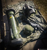
The place of Vepriai has delivered traces of Stone Age settlement (the artefacts being preserved in Vilnius, National Museum).
The boulder has been listed as Geological monument in 1985 to guarantee its protection.
Visited June 2015.
You may be viewing yesterday's version of this page. To see the most up to date information please register for a free account.
")
")
")
Do not use the above information on other web sites or publications without permission of the contributor.
Nearby Images from Flickr


The above images may not be of the site on this page, but were taken nearby. They are loaded from Flickr so please click on them for image credits.
Click here to see more info for this site
Nearby sites
Click here to view sites on an interactive map of the areaKey: Red: member's photo, Blue: 3rd party photo, Yellow: other image, Green: no photo - please go there and take one, Grey: site destroyed
Download sites to:
KML (Google Earth)
GPX (GPS waypoints)
CSV (Garmin/Navman)
CSV (Excel)
To unlock full downloads you need to sign up as a Contributory Member. Otherwise downloads are limited to 50 sites.
Turn off the page maps and other distractions
Nearby sites listing. In the following links * = Image available
16.6km NE 42° Ukmergės piliakalnis* Artificial Mound
26.3km SSE 167° Laukagalio akmuo su dubenėliais* Rock Art
27.3km SSE 165° Zasliai Footprint Stone* Rock Art
42.4km S 184° Girelių akmuo* Natural Stone / Erratic / Other Natural Feature
48.5km NE 37° Puntuko akmuo* Natural Stone / Erratic / Other Natural Feature
51.2km WNW 300° Dotnuvo akmuo* Modern Stone Circle etc
52.8km WSW 240° Santakos parkas* Modern Stone Circle etc
57.5km W 270° Karalgirio akmuo* Natural Stone / Erratic / Other Natural Feature
63.0km NE 53° Kilėviškių akmuo su dubeniu* Holed Stone
63.0km NE 53° Zarasų akmuo su dubeniu* Holed Stone
66.9km ESE 114° Nemenčinės Bilith* Modern Stone Circle etc
82.1km SE 145° Marijampolio akmuo* Natural Stone / Erratic / Other Natural Feature
87.0km SW 222° Šakališkių piliakalnis* Artificial Mound
89.6km SW 221° Gudelių akmuo* Natural Stone / Erratic / Other Natural Feature
93.7km SW 219° Riečių piliakalnis* Artificial Mound
96.9km NE 54° Lūžų akmuo su dubeniu* Holed Stone
99.0km SW 224° Varnupių piliakalnis* Artificial Mound
99.2km SW 224° Varnupių akmuo* Natural Stone / Erratic / Other Natural Feature
101.3km SW 219° Bambininkų piliakalnis* Artificial Mound
101.6km SW 227° Padovinio piliakalnis* Artificial Mound
101.6km E 85° Bajorų akmuo* Natural Stone / Erratic / Other Natural Feature
101.7km E 86° Šventos akmuo* Natural Stone / Erratic / Other Natural Feature
103.1km SSW 201° Didysis Dzūkijos akmuo* Natural Stone / Erratic / Other Natural Feature
103.1km S 187° Perlojos akmuo* Marker Stone
106.1km S 173° Kalesninkų akmuo* Standing Stone (Menhir)
View more nearby sites and additional images


 We would like to know more about this location. Please feel free to add a brief description and any relevant information in your own language.
 Wir möchten mehr über diese Stätte erfahren. Bitte zögern Sie nicht, eine kurze Beschreibung und relevante Informationen in Deutsch hinzuzufügen.
 Nous aimerions en savoir encore un peu sur les lieux. S'il vous plaît n'hesitez pas à ajouter une courte description et tous les renseignements pertinents dans votre propre langue.
 Quisieramos informarnos un poco más de las lugares. No dude en añadir una breve descripción y otros datos relevantes en su propio idioma.