


<< Our Photo Pages >> Sendoukia - Rock Cut Tomb in Greece in Greek Islands
Submitted by Doc_Oakley on Monday, 29 July 2013 Page Views: 4483
Multi-periodSite Name: SendoukiaCountry: Greece
NOTE: This site is 14.004 km away from the location you searched for.
Region: Greek Islands Type: Rock Cut Tomb
Nearest Town: Skopelos Town Nearest Village: Karya
Latitude: 39.136300N Longitude: 23.690400E
Condition:
| 5 | Perfect |
| 4 | Almost Perfect |
| 3 | Reasonable but with some damage |
| 2 | Ruined but still recognisable as an ancient site |
| 1 | Pretty much destroyed, possibly visible as crop marks |
| 0 | No data. |
| -1 | Completely destroyed |
| 5 | Superb |
| 4 | Good |
| 3 | Ordinary |
| 2 | Not Good |
| 1 | Awful |
| 0 | No data. |
| 5 | Can be driven to, probably with disabled access |
| 4 | Short walk on a footpath |
| 3 | Requiring a bit more of a walk |
| 2 | A long walk |
| 1 | In the middle of nowhere, a nightmare to find |
| 0 | No data. |
| 5 | co-ordinates taken by GPS or official recorded co-ordinates |
| 4 | co-ordinates scaled from a detailed map |
| 3 | co-ordinates scaled from a bad map |
| 2 | co-ordinates of the nearest village |
| 1 | co-ordinates of the nearest town |
| 0 | no data |
Internal Links:
External Links:
")
You may be viewing yesterday's version of this page. To see the most up to date information please register for a free account.
")
")
Do not use the above information on other web sites or publications without permission of the contributor.
Nearby Images from Flickr
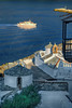
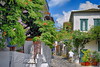
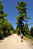
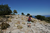
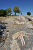
The above images may not be of the site on this page, but were taken nearby. They are loaded from Flickr so please click on them for image credits.
Click here to see more info for this site
Nearby sites
Click here to view sites on an interactive map of the areaKey: Red: member's photo, Blue: 3rd party photo, Yellow: other image, Green: no photo - please go there and take one, Grey: site destroyed
Download sites to:
KML (Google Earth)
GPX (GPS waypoints)
CSV (Garmin/Navman)
CSV (Excel)
To unlock full downloads you need to sign up as a Contributory Member. Otherwise downloads are limited to 50 sites.
Turn off the page maps and other distractions
Nearby sites listing. In the following links * = Image available
46.8km ENE 56° Cyclops Cave Cave or Rock Shelter
69.2km WNW 290° Demetria Temple* Ancient Temple
73.1km WNW 290° Dimini* Ancient Village or Settlement
73.3km WNW 290° Dimini Mycenaean Tholos* Cairn
77.0km WNW 289° Sesklo* Ancient Village or Settlement
78.6km S 186° Aulis Sanctuary of Artemis* Ancient Village or Settlement
80.8km S 181° Xeropolis Ancient Village or Settlement
82.5km S 174° Eretria* Ancient Village or Settlement
84.4km SSW 207° Sanctuary of Apollo Ptoios* Ancient Temple
84.7km SSW 211° Gla.* Hillfort
86.3km WNW 289° Pherai* Ancient Temple
88.4km SW 231° Hyampolis Sanctuary of Artemis and Apollo* Ancient Temple
90.7km SW 229° Hyampolis* Ancient Village or Settlement
91.1km SW 228° Abai (Greece)* Ancient Village or Settlement
92.8km SW 235° Elateia Temple of Athena Kranaia Ancient Temple
94.7km SW 221° Treasury of Minyas* Cairn
94.8km SW 221° Orchomenos Temple Ancient Temple
95.0km S 172° Amfiaraio* Ancient Temple
95.2km N 11° Torone Temple of Athena Ancient Temple
95.4km SSE 155° Ancient Dystos Ancient Village or Settlement
95.8km NNW 344° Temple of Poseidon, Posseidi* Ancient Temple
96.0km SSW 200° Thebes Museum* Museum
96.1km SSW 200° Thebes Mycenaean Tomb* Rock Cut Tomb
96.7km SSW 199° Temple of Apollo Ismenios Ancient Temple
99.8km SW 225° Macedonian Tumulus at Chaeronea Chambered Tomb
View more nearby sites and additional images

")
 We would like to know more about this location. Please feel free to add a brief description and any relevant information in your own language.
 Wir möchten mehr über diese Stätte erfahren. Bitte zögern Sie nicht, eine kurze Beschreibung und relevante Informationen in Deutsch hinzuzufügen.
 Nous aimerions en savoir encore un peu sur les lieux. S'il vous plaît n'hesitez pas à ajouter une courte description et tous les renseignements pertinents dans votre propre langue.
 Quisieramos informarnos un poco más de las lugares. No dude en añadir una breve descripción y otros datos relevantes en su propio idioma.