 with our Megalithic Portal iPhone app")


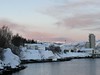
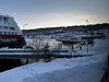
<< Our Photo Pages >> Amtmannsnes - Carving in Norway in Finnmark
Submitted by kenntha88 on Sunday, 09 December 2007 Page Views: 3706
Multi-periodSite Name: Amtmannsnes Alternative Name: UrnesbuktaCountry: Norway
NOTE: This site is 1.553 km away from the location you searched for.
Fylke: Finnmark Type: Carving
Nearest Town: Alta
Latitude: 69.988148N Longitude: 23.285608E
Condition:
| 5 | Perfect |
| 4 | Almost Perfect |
| 3 | Reasonable but with some damage |
| 2 | Ruined but still recognisable as an ancient site |
| 1 | Pretty much destroyed, possibly visible as crop marks |
| 0 | No data. |
| -1 | Completely destroyed |
| 5 | Superb |
| 4 | Good |
| 3 | Ordinary |
| 2 | Not Good |
| 1 | Awful |
| 0 | No data. |
| 5 | Can be driven to, probably with disabled access |
| 4 | Short walk on a footpath |
| 3 | Requiring a bit more of a walk |
| 2 | A long walk |
| 1 | In the middle of nowhere, a nightmare to find |
| 0 | No data. |
| 5 | co-ordinates taken by GPS or official recorded co-ordinates |
| 4 | co-ordinates scaled from a detailed map |
| 3 | co-ordinates scaled from a bad map |
| 2 | co-ordinates of the nearest village |
| 1 | co-ordinates of the nearest town |
| 0 | no data |
Internal Links:
External Links:
")
But what makes them different from the rock carvings at Alta is that they seem to be of a totally different "style"!
The human figures are carved in a strange "rib bone" pattern with lines across the chest and not fully carved as the human figures of the Alta site! The animal figures are also completely different. They are bigger than in the Alta site, and they are more stylized with a lot of details.
There are also some strange wave-shaped lines, and a lot of figures of reindeer.
This carvings have not been painted red as the ones in Alta, and they are more difficult to see and to photograph.
Note: Finnmark county
You may be viewing yesterday's version of this page. To see the most up to date information please register for a free account.
")
")
")
")
Do not use the above information on other web sites or publications without permission of the contributor.
Nearby Images from Flickr
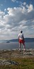
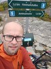
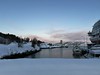
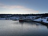
The above images may not be of the site on this page, but were taken nearby. They are loaded from Flickr so please click on them for image credits.
Click here to see more info for this site
Nearby sites
Click here to view sites on an interactive map of the areaKey: Red: member's photo, Blue: 3rd party photo, Yellow: other image, Green: no photo - please go there and take one, Grey: site destroyed
Download sites to:
KML (Google Earth)
GPX (GPS waypoints)
CSV (Garmin/Navman)
CSV (Excel)
To unlock full downloads you need to sign up as a Contributory Member. Otherwise downloads are limited to 50 sites.
Turn off the page maps and other distractions
Nearby sites listing. In the following links * = Image available
510m WNW 281° Komsa sacrificial site* Natural Stone / Erratic / Other Natural Feature
5.9km SW 220° Hjemmeluft stone age settlement* Ancient Village or Settlement
5.9km SW 221° Alta (Norway)* Rock Art
8.0km E 88° Transfardalen* Cave or Rock Shelter
8.7km NNE 22° Djupvika sacrificial site* Natural Stone / Erratic / Other Natural Feature
14.3km NNE 13° Kviby sacrificial site* Natural Stone / Erratic / Other Natural Feature
15.2km NNE 12° Slottsbergkjerringa* Natural Stone / Erratic / Other Natural Feature
61.9km NNE 20° Stallogargo sacrificial site* Natural Stone / Erratic / Other Natural Feature
143.6km WSW 255° Skarmunken* Natural Stone / Erratic / Other Natural Feature
167.0km WSW 241° Nordkjosbotn sacrificial site* Natural Stone / Erratic / Other Natural Feature
170.2km WSW 246° Balsfjord rock carvings* Carving
172.3km W 259° University Museum, Tromso* Museum
176.8km W 260° Håkøya* Ancient Village or Settlement
180.8km WSW 257° Skavberget* Rock Art
190.4km WSW 246° Mårfjellskardet sacrificial site* Natural Stone / Erratic / Other Natural Feature
195.0km SE 125° Ukonkivi Round Cairn
202.0km WSW 258° Greipstad* Ancient Village or Settlement
204.0km W 261° Sandvik* Ancient Village or Settlement
204.4km WSW 259° Buvika* Barrow Cemetery
205.0km W 261° Brensholmen stone age settlement* Ancient Village or Settlement
205.5km W 261° Sommarøy* Ancient Village or Settlement
206.2km W 261° Brensholmen iron age settlement* Ancient Village or Settlement
249.7km WSW 237° Lapphaugen sacrificial site* Natural Stone / Erratic / Other Natural Feature
250.4km WSW 243° Andasteinen* Natural Stone / Erratic / Other Natural Feature
253.2km WSW 241° Lavangen* Barrow Cemetery
View more nearby sites and additional images


 We would like to know more about this location. Please feel free to add a brief description and any relevant information in your own language.
 Wir möchten mehr über diese Stätte erfahren. Bitte zögern Sie nicht, eine kurze Beschreibung und relevante Informationen in Deutsch hinzuzufügen.
 Nous aimerions en savoir encore un peu sur les lieux. S'il vous plaît n'hesitez pas à ajouter une courte description et tous les renseignements pertinents dans votre propre langue.
 Quisieramos informarnos un poco más de las lugares. No dude en añadir una breve descripción y otros datos relevantes en su propio idioma.