


<< Our Photo Pages >> Malthi - Chambered Tomb in Greece in Peloponnese Peninsula
Submitted by Armand on Thursday, 03 January 2019 Page Views: 952
Neolithic and Bronze AgeSite Name: MalthiCountry: Greece
NOTE: This site is 4.482 km away from the location you searched for.
Region: Peloponnese Peninsula Type: Chambered Tomb
Nearest Village: Vasiliko
Latitude: 37.263800N Longitude: 21.877000E
Condition:
| 5 | Perfect |
| 4 | Almost Perfect |
| 3 | Reasonable but with some damage |
| 2 | Ruined but still recognisable as an ancient site |
| 1 | Pretty much destroyed, possibly visible as crop marks |
| 0 | No data. |
| -1 | Completely destroyed |
| 5 | Superb |
| 4 | Good |
| 3 | Ordinary |
| 2 | Not Good |
| 1 | Awful |
| 0 | No data. |
| 5 | Can be driven to, probably with disabled access |
| 4 | Short walk on a footpath |
| 3 | Requiring a bit more of a walk |
| 2 | A long walk |
| 1 | In the middle of nowhere, a nightmare to find |
| 0 | No data. |
| 5 | co-ordinates taken by GPS or official recorded co-ordinates |
| 4 | co-ordinates scaled from a detailed map |
| 3 | co-ordinates scaled from a bad map |
| 2 | co-ordinates of the nearest village |
| 1 | co-ordinates of the nearest town |
| 0 | no data |
Internal Links:
External Links:
")
You may be viewing yesterday's version of this page. To see the most up to date information please register for a free account.
")
")
Do not use the above information on other web sites or publications without permission of the contributor.
Nearby Images from Flickr


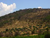
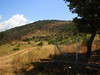
The above images may not be of the site on this page, but were taken nearby. They are loaded from Flickr so please click on them for image credits.
Click here to see more info for this site
Nearby sites
Click here to view sites on an interactive map of the areaKey: Red: member's photo, Blue: 3rd party photo, Yellow: other image, Green: no photo - please go there and take one, Grey: site destroyed
Download sites to:
KML (Google Earth)
GPX (GPS waypoints)
CSV (Garmin/Navman)
CSV (Excel)
To unlock full downloads you need to sign up as a Contributory Member. Otherwise downloads are limited to 50 sites.
Turn off the page maps and other distractions
Nearby sites listing. In the following links * = Image available
9.1km SSE 159° Arkadian Gate* Hillfort
9.6km SSE 154° Sanctuary of Zeus Ithomatas Ancient Temple
10.3km SSE 154° Eileithyia* Ancient Temple
10.5km SSE 159° Ancient Messene* Ancient Village or Settlement
10.6km SSE 154° Artemis Limnatis* Ancient Temple
11.0km SSE 151° Lakonian Gate* Hillfort
12.2km W 276° Peristeria* Passage Grave
18.6km N 6° Bassae Temple of Apollo* Ancient Temple
19.5km NE 44° Lykosoura Despoina Sanctuary* Ancient Temple
22.6km NNE 26° Sanctuary of Zeus (Mount Lykaion)* Ancient Temple
23.1km NNE 27° Lykaion Lower Sanctuary* Ancient Temple
23.7km NW 325° Lepreon* Ancient Temple
26.1km ENE 58° Despoina Sanctuary.* Ancient Temple
27.2km SSW 211° Archaeological Museum of Chora* Museum
27.5km NE 54° Ancient theater of Megalopolis* Ancient Village or Settlement
27.7km NE 53° Ancient Megalopoli* Ancient Temple
29.1km S 174° Nichoria* Ancient Village or Settlement
29.5km N 358° Alipheira Temple of Athena Ancient Temple
29.8km N 358° Alipheira Sanctuary of Asclepius Ancient Temple
30.7km SSW 212° Nestors Palace Tholos Tomb* Passage Grave
30.9km SSW 212° Mycenaean Palace of Nestor* Ancient Palace
31.7km SSW 212° Mycenaean Tholos Tomb near Nestors Palace* Passage Grave
33.2km SSW 206° Iklaina* Ancient Village or Settlement
34.1km NNE 26° Gortyna Ancient Temple
34.3km S 172° Petalidi* Ancient Temple
View more nearby sites and additional images


 We would like to know more about this location. Please feel free to add a brief description and any relevant information in your own language.
 Wir möchten mehr über diese Stätte erfahren. Bitte zögern Sie nicht, eine kurze Beschreibung und relevante Informationen in Deutsch hinzuzufügen.
 Nous aimerions en savoir encore un peu sur les lieux. S'il vous plaît n'hesitez pas à ajouter une courte description et tous les renseignements pertinents dans votre propre langue.
 Quisieramos informarnos un poco más de las lugares. No dude en añadir una breve descripción y otros datos relevantes en su propio idioma.