


<< Text Pages >> Timisoara Modern Stone Circle - Modern Stone Circle etc in Romania
Submitted by mfrincu on Sunday, 12 June 2016 Page Views: 1031
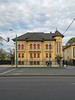
Modern SitesSite Name: Timisoara Modern Stone CircleCountry: Romania
NOTE: This site is 37.717 km away from the location you searched for.
Type: Modern Stone Circle etc
Nearest Town: Timisoara
Latitude: 45.760000N Longitude: 21.259556E
Condition:
| 5 | Perfect |
| 4 | Almost Perfect |
| 3 | Reasonable but with some damage |
| 2 | Ruined but still recognisable as an ancient site |
| 1 | Pretty much destroyed, possibly visible as crop marks |
| 0 | No data. |
| -1 | Completely destroyed |
| 5 | Superb |
| 4 | Good |
| 3 | Ordinary |
| 2 | Not Good |
| 1 | Awful |
| 0 | No data. |
| 5 | Can be driven to, probably with disabled access |
| 4 | Short walk on a footpath |
| 3 | Requiring a bit more of a walk |
| 2 | A long walk |
| 1 | In the middle of nowhere, a nightmare to find |
| 0 | No data. |
| 5 | co-ordinates taken by GPS or official recorded co-ordinates |
| 4 | co-ordinates scaled from a detailed map |
| 3 | co-ordinates scaled from a bad map |
| 2 | co-ordinates of the nearest village |
| 1 | co-ordinates of the nearest town |
| 0 | no data |
Internal Links:
External Links:
Modern Stone Circle / Monolith in Romania
Modern stone circle on the shores of the Bega river in Timisoara.
You may be viewing yesterday's version of this page. To see the most up to date information please register for a free account.
Do not use the above information on other web sites or publications without permission of the contributor.
Nearby Images from Flickr

The above images may not be of the site on this page, but were taken nearby. They are loaded from Flickr so please click on them for image credits.
Click here to see more info for this site
Nearby sites
Click here to view sites on an interactive map of the areaKey: Red: member's photo, Blue: 3rd party photo, Yellow: other image, Green: no photo - please go there and take one, Grey: site destroyed
Download sites to:
KML (Google Earth)
GPX (GPS waypoints)
CSV (Garmin/Navman)
CSV (Excel)
To unlock full downloads you need to sign up as a Contributory Member. Otherwise downloads are limited to 50 sites.
Turn off the page maps and other distractions
Nearby sites listing. In the following links * = Image available
2.6km WSW 253° Museum of Banat Museum
18.5km SW 217° Parta Neolithic Sanctuary* Ancient Temple
19.2km N 355° Cornesti-Iarcuri Bronze Age Fortification Misc. Earthwork
48.5km NNW 334° Ziridava Ancient Village or Settlement
64.0km NW 313° Bekai halom Ancient Village or Settlement
103.1km N 353° Kevermesi sztélé* Standing Stones
107.3km N 358° Dobozi Kő* Modern Stone Circle etc
114.2km S 181° Viminacium* Ancient Village or Settlement
121.6km SSW 204° Vinca Belo Brdo* Ancient Village or Settlement
122.1km SSW 211° National Museum in Belgrade* Museum
128.2km SSE 163° Chindiei 2 Cave* Rock Art
131.2km N 359° Veszto-Magor Tell Ancient Village or Settlement
132.8km NNW 332° Gödény-halom* Ancient Village or Settlement
134.3km NE 48° Bears Cave Cave or Rock Shelter
138.8km E 85° Simeria mound* Artificial Mound
138.9km E 85° Magura Uroiului* Ancient Village or Settlement
146.7km SSE 156° Lepenski Vir* Ancient Village or Settlement
147.3km E 93° Costesti-Cetatuie Dacian citadel* Hillfort
147.7km E 96° Luncani-Piatra Rosie Dacian citadel* Hillfort
147.7km SE 146° Tabula Traiana* Carving
148.0km E 93° Ardeu Dacian Hillfort* Hillfort
148.0km E 93° Mihu Tower* Stone Fort or Dun
148.1km E 93° Costesti-Blidaru Dacian citadel* Hillfort
148.4km SSE 147° The face of Dacian King Decebalus* Sculptured Stone
152.8km NW 323° Tiszaug-Kemenyteto Tell Ancient Village or Settlement
View more nearby sites and additional images


 We would like to know more about this location. Please feel free to add a brief description and any relevant information in your own language.
 Wir möchten mehr über diese Stätte erfahren. Bitte zögern Sie nicht, eine kurze Beschreibung und relevante Informationen in Deutsch hinzuzufügen.
 Nous aimerions en savoir encore un peu sur les lieux. S'il vous plaît n'hesitez pas à ajouter une courte description et tous les renseignements pertinents dans votre propre langue.
 Quisieramos informarnos un poco más de las lugares. No dude en añadir una breve descripción y otros datos relevantes en su propio idioma.