


<< Text Pages >> Ptolemais Museum - Ancient Village or Settlement in Libya
Submitted by AlexHunger on Wednesday, 16 April 2008 Page Views: 2573
Multi-periodSite Name: Ptolemais MuseumCountry: Libya
NOTE: This site is 107.702 km away from the location you searched for.
Type: Ancient Village or Settlement
Nearest Town: Banghazi Nearest Village: Tulmaythay
Latitude: 32.709810N Longitude: 20.946011E
Condition:
| 5 | Perfect |
| 4 | Almost Perfect |
| 3 | Reasonable but with some damage |
| 2 | Ruined but still recognisable as an ancient site |
| 1 | Pretty much destroyed, possibly visible as crop marks |
| 0 | No data. |
| -1 | Completely destroyed |
| 5 | Superb |
| 4 | Good |
| 3 | Ordinary |
| 2 | Not Good |
| 1 | Awful |
| 0 | No data. |
| 5 | Can be driven to, probably with disabled access |
| 4 | Short walk on a footpath |
| 3 | Requiring a bit more of a walk |
| 2 | A long walk |
| 1 | In the middle of nowhere, a nightmare to find |
| 0 | No data. |
| 5 | co-ordinates taken by GPS or official recorded co-ordinates |
| 4 | co-ordinates scaled from a detailed map |
| 3 | co-ordinates scaled from a bad map |
| 2 | co-ordinates of the nearest village |
| 1 | co-ordinates of the nearest town |
| 0 | no data |
Internal Links:
External Links:
Ancient Village or Settlement in Libya
Museum between Tulmaythay and the ruins of Ptolemais. It contains Statues, columns, mosaics and Sarcophagi.
You may be viewing yesterday's version of this page. To see the most up to date information please register for a free account.
Do not use the above information on other web sites or publications without permission of the contributor.
Nearby Images from Flickr
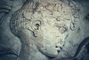
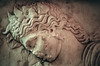
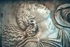
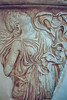

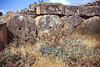
The above images may not be of the site on this page, but were taken nearby. They are loaded from Flickr so please click on them for image credits.
Click here to see more info for this site
Nearby sites
Click here to view sites on an interactive map of the areaKey: Red: member's photo, Blue: 3rd party photo, Yellow: other image, Green: no photo - please go there and take one, Grey: site destroyed
Download sites to:
KML (Google Earth)
GPX (GPS waypoints)
CSV (Garmin/Navman)
CSV (Excel)
To unlock full downloads you need to sign up as a Contributory Member. Otherwise downloads are limited to 50 sites.
Turn off the page maps and other distractions
Nearby sites listing. In the following links * = Image available
475m ESE 105° Ptolemais Ancient Village or Settlement
40.6km WSW 241° Taucheira Ancient Village or Settlement
76.2km E 85° Al Bayda' Asklepieion Ancient Temple
79.0km E 96° Slonta Grotto Cave or Rock Shelter
85.7km E 81° Cyrene Rock Cut Tombs* Rock Cut Tomb
85.7km E 81° Cyrene Sacred Spring* Holy Well or Sacred Spring
85.7km E 81° Cyrene Temple of Apollo* Ancient Temple
85.7km E 81° Cyrene Temple of Artemis* Ancient Temple
85.7km E 81° Cyrene Sanctuary of Apollo* Ancient Temple
86.0km E 82° Cyrene Temple of Demeter* Ancient Temple
86.0km E 81° Cyrene Necropolis* Rock Cut Tomb
86.2km E 82° Cyrene* Ancient Village or Settlement
86.6km E 81° Cyrene Temple of Zeus* Ancient Temple
98.2km ENE 77° Apollonia (Libya)* Ancient Village or Settlement
105.3km SW 232° Euesperides* Ancient Village or Settlement
115.4km E 83° Snibat al-Awila Tombs Portal Tomb
384.6km NE 42° Lissos (Crete)* Ancient Village or Settlement
388.7km NE 42° Elyros* Ancient Village or Settlement
393.9km NE 37° Falasarna* Ancient Village or Settlement
418.6km NE 38° Diktynnaion Ancient Temple
421.0km NE 41° Chania Archaeological Museum* Museum
421.3km NE 41° Kydonia* Ancient Village or Settlement
422.6km NE 43° Stylos Tholos Tomb* Chambered Tomb
422.8km NE 43° Stylos Settlement* Ancient Village or Settlement
424.7km NE 43° Aptera* Ancient Village or Settlement
View more nearby sites and additional images


 We would like to know more about this location. Please feel free to add a brief description and any relevant information in your own language.
 Wir möchten mehr über diese Stätte erfahren. Bitte zögern Sie nicht, eine kurze Beschreibung und relevante Informationen in Deutsch hinzuzufügen.
 Nous aimerions en savoir encore un peu sur les lieux. S'il vous plaît n'hesitez pas à ajouter une courte description et tous les renseignements pertinents dans votre propre langue.
 Quisieramos informarnos un poco más de las lugares. No dude en añadir una breve descripción y otros datos relevantes en su propio idioma.