


<< Our Photo Pages >> Kaliningrad Regional Museum of History and Art - Museum in Russia
Submitted by Ogneslav on Wednesday, 02 July 2014 Page Views: 2145
MuseumsSite Name: Kaliningrad Regional Museum of History and ArtCountry: Russia
NOTE: This site is 9.632 km away from the location you searched for.
Type: Museum
Nearest Town: Kaliningrad
Latitude: 54.713789N Longitude: 20.518161E
Condition:
| 5 | Perfect |
| 4 | Almost Perfect |
| 3 | Reasonable but with some damage |
| 2 | Ruined but still recognisable as an ancient site |
| 1 | Pretty much destroyed, possibly visible as crop marks |
| 0 | No data. |
| -1 | Completely destroyed |
| 5 | Superb |
| 4 | Good |
| 3 | Ordinary |
| 2 | Not Good |
| 1 | Awful |
| 0 | No data. |
| 5 | Can be driven to, probably with disabled access |
| 4 | Short walk on a footpath |
| 3 | Requiring a bit more of a walk |
| 2 | A long walk |
| 1 | In the middle of nowhere, a nightmare to find |
| 0 | No data. |
| 5 | co-ordinates taken by GPS or official recorded co-ordinates |
| 4 | co-ordinates scaled from a detailed map |
| 3 | co-ordinates scaled from a bad map |
| 2 | co-ordinates of the nearest village |
| 1 | co-ordinates of the nearest town |
| 0 | no data |
Internal Links:
External Links:
")
A rich collection (more than 5000 objects) of the museum's archaeological department encompasses material from Late Stone Age through to the 12th century AD gathered mostly in Kaliningrad Oblast.
Address: Klinicheskaya Str., 21, Kaliningrad
Opening hours: Tuesday to Sunday 10-18 (box-office: 10-17), closed: Monday
Phones: +7 (4012) 453844; 453710; 453644
Admission: Adults - 150Rub (2016).
Official Web Site: Тhe Kaliningrad Regional Museum of History and Art
You may be viewing yesterday's version of this page. To see the most up to date information please register for a free account.
Do not use the above information on other web sites or publications without permission of the contributor.
Nearby Images from Flickr
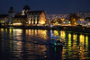
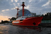

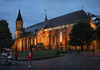
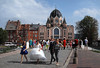

The above images may not be of the site on this page, but were taken nearby. They are loaded from Flickr so please click on them for image credits.
Click here to see more info for this site
Nearby sites
Click here to view sites on an interactive map of the areaKey: Red: member's photo, Blue: 3rd party photo, Yellow: other image, Green: no photo - please go there and take one, Grey: site destroyed
Download sites to:
KML (Google Earth)
GPX (GPS waypoints)
CSV (Garmin/Navman)
CSV (Excel)
To unlock full downloads you need to sign up as a Contributory Member. Otherwise downloads are limited to 50 sites.
Turn off the page maps and other distractions
Nearby sites listing. In the following links * = Image available
14.5km E 96° Waldau Castle Museum* Museum
24.5km N 353° Kaup Barrows* Barrow Cemetery
27.5km N 354° Zelenogradsk Museum of Regional Studies* Museum
32.4km NW 325° Rantawa Museum* Museum
32.6km NW 323° The Lie Stone* Natural Stone / Erratic / Other Natural Feature
32.7km NW 325° Pionersky* Hillfort
33.3km NW 319° Svetlogorsk* Hillfort
35.7km NW 315° Otradnoe* Barrow Cemetery
36.7km NNE 14° Curonian Spit Museum* Museum
45.1km SSE 162° Grodzisko Bezledy Hillfort
49.0km S 174° Grodzisko Wiewiórki Hillfort
56.0km SSE 164° Grodzisko Ardapy Promontory Fort / Cliff Castle
68.0km SW 220° Kurhany Piórkowo Barrow Cemetery
68.9km S 183° Grodzisko Łaniewo Hillfort
72.9km S 177° Grodzisko Jarandowo Hillfort
74.2km SSE 160° Bisztynek - Diabelski Kamień Natural Stone / Erratic / Other Natural Feature
79.1km SE 125° Grodzisko Bajory Wielkie Hillfort
81.6km SE 145° Kurhan Tołkiny Round Barrow(s)
89.2km S 182° Grodzisko Kabikiejmy Górne Promontory Fort / Cliff Castle
104.7km ENE 66° Rambyno kalno akmuo* Marker Stone
109.0km SW 221° Grodzisko Kwietniewo Hillfort
116.4km S 173° Kurhan Miłuki Round Barrow(s)
118.1km SW 219° Grodzisko Stare Miasto* Hillfort
119.2km SSW 207° Kurhan Mozgowo Round Barrow(s)
119.4km SSW 207° Grodzisko Duba Hillfort
View more nearby sites and additional images


 We would like to know more about this location. Please feel free to add a brief description and any relevant information in your own language.
 Wir möchten mehr über diese Stätte erfahren. Bitte zögern Sie nicht, eine kurze Beschreibung und relevante Informationen in Deutsch hinzuzufügen.
 Nous aimerions en savoir encore un peu sur les lieux. S'il vous plaît n'hesitez pas à ajouter une courte description et tous les renseignements pertinents dans votre propre langue.
 Quisieramos informarnos un poco más de las lugares. No dude en añadir una breve descripción y otros datos relevantes en su propio idioma.