 with our Megalithic Portal iPhone app")

<< Our Photo Pages >> Menhir des Parrots - Standing Stone (Menhir) in France in Midi:Tarn (81)
Submitted by TheCaptain on Saturday, 16 April 2005 Page Views: 2253
Neolithic and Bronze AgeSite Name: Menhir des ParrotsCountry: France
NOTE: This site is 4.922 km away from the location you searched for.
Département: Midi:Tarn (81) Type: Standing Stone (Menhir)
Nearest Town: Mazamet Nearest Village: Murat-sur-Vèbre
Latitude: 43.689000N Longitude: 2.900000E
Condition:
| 5 | Perfect |
| 4 | Almost Perfect |
| 3 | Reasonable but with some damage |
| 2 | Ruined but still recognisable as an ancient site |
| 1 | Pretty much destroyed, possibly visible as crop marks |
| 0 | No data. |
| -1 | Completely destroyed |
| 5 | Superb |
| 4 | Good |
| 3 | Ordinary |
| 2 | Not Good |
| 1 | Awful |
| 0 | No data. |
| 5 | Can be driven to, probably with disabled access |
| 4 | Short walk on a footpath |
| 3 | Requiring a bit more of a walk |
| 2 | A long walk |
| 1 | In the middle of nowhere, a nightmare to find |
| 0 | No data. |
| 5 | co-ordinates taken by GPS or official recorded co-ordinates |
| 4 | co-ordinates scaled from a detailed map |
| 3 | co-ordinates scaled from a bad map |
| 2 | co-ordinates of the nearest village |
| 1 | co-ordinates of the nearest town |
| 0 | no data |
Be the first person to rate this site - see the 'Contribute!' box in the right hand menu.
Internal Links:
External Links:
")
IMPORTANT NOTE: Positional co-ordinates scaled from a map source
You may be viewing yesterday's version of this page. To see the most up to date information please register for a free account.
Do not use the above information on other web sites or publications without permission of the contributor.
Nearby Images from Flickr

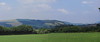
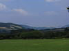
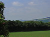
The above images may not be of the site on this page, but were taken nearby. They are loaded from Flickr so please click on them for image credits.
Click here to see more info for this site
Nearby sites
Click here to view sites on an interactive map of the areaKey: Red: member's photo, Blue: 3rd party photo, Yellow: other image, Green: no photo - please go there and take one, Grey: site destroyed
Download sites to:
KML (Google Earth)
GPX (GPS waypoints)
CSV (Garmin/Navman)
CSV (Excel)
To unlock full downloads you need to sign up as a Contributory Member. Otherwise downloads are limited to 50 sites.
Turn off the page maps and other distractions
Nearby sites listing. In the following links * = Image available
2.3km W 267° Montaigut menhir* Standing Stone (Menhir)
3.7km W 263° Murat-sur-Vèbre Centre d'Interprétation* Museum
3.7km W 263° Dévès-de-Félines statue menhir Sculptured Stone
3.7km W 263° Favarels statue-menhir* Sculptured Stone
4.3km SW 225° Col-des-Saints statue-menhir* Sculptured Stone
4.5km W 263° Dolmen de Lagarde* Burial Chamber or Dolmen
5.0km WSW 248° Dolmen de Castelsec* Burial Chamber or Dolmen
5.1km NW 326° Pailhemalbiau statue menhir* Sculptured Stone
5.2km WSW 253° Candoubre menhir* Standing Stone (Menhir)
5.3km WSW 253° Menhir de Candoubre 2* Standing Stone (Menhir)
5.4km WNW 284° Plos statue menhir 1 Sculptured Stone
5.5km WSW 258° Pré-de-Roi Menhir* Standing Stone (Menhir)
5.6km WNW 299° Plos statue menhir 2* Sculptured Stone
5.7km S 177° Salverguettes statue menhir* Sculptured Stone
5.8km S 178° Salverguettes 2 statue-menhir Sculptured Stone
6.5km W 259° Paumérou menhir* Standing Stone (Menhir)
7.2km NNW 335° Plan-de-la-Matte menhirs 2 & 3* Standing Stones
7.2km NNW 335° Fabet statue menhir* Sculptured Stone
7.2km NNW 333° Plan-de-la-Matte menhir 1* Standing Stones
7.3km W 268° Lubio-Ferrières statue-menhir* Sculptured Stone
7.5km WSW 251° Croix-de-Condomines menhir* Standing Stone (Menhir)
7.6km SW 227° La Landette statue menhir* Sculptured Stone
7.8km WNW 292° Moulin-de-Louat 1 statue-menhir* Sculptured Stone
7.8km WNW 292° Moulin-de-Louat 2 statue-menhir* Sculptured Stone
8.1km NW 312° La Rasse statue-menhir* Sculptured Stone
View more nearby sites and additional images


 We would like to know more about this location. Please feel free to add a brief description and any relevant information in your own language.
 Wir möchten mehr über diese Stätte erfahren. Bitte zögern Sie nicht, eine kurze Beschreibung und relevante Informationen in Deutsch hinzuzufügen.
 Nous aimerions en savoir encore un peu sur les lieux. S'il vous plaît n'hesitez pas à ajouter une courte description et tous les renseignements pertinents dans votre propre langue.
 Quisieramos informarnos un poco más de las lugares. No dude en añadir una breve descripción y otros datos relevantes en su propio idioma.