


<< Text Pages >> Pierres à Cupules de Fouilho - Rock Art in France in Languedoc:Hérault (34)
Submitted by holger_rix on Saturday, 16 January 2016 Page Views: 745
Rock ArtSite Name: Pierres à Cupules de FouilhoCountry: France
NOTE: This site is 1.123 km away from the location you searched for.
Département: Languedoc:Hérault (34) Type: Rock Art
Nearest Town: Béziers Nearest Village: Prémian
Latitude: 43.533145N Longitude: 2.836955E
Condition:
| 5 | Perfect |
| 4 | Almost Perfect |
| 3 | Reasonable but with some damage |
| 2 | Ruined but still recognisable as an ancient site |
| 1 | Pretty much destroyed, possibly visible as crop marks |
| 0 | No data. |
| -1 | Completely destroyed |
| 5 | Superb |
| 4 | Good |
| 3 | Ordinary |
| 2 | Not Good |
| 1 | Awful |
| 0 | No data. |
| 5 | Can be driven to, probably with disabled access |
| 4 | Short walk on a footpath |
| 3 | Requiring a bit more of a walk |
| 2 | A long walk |
| 1 | In the middle of nowhere, a nightmare to find |
| 0 | No data. |
| 5 | co-ordinates taken by GPS or official recorded co-ordinates |
| 4 | co-ordinates scaled from a detailed map |
| 3 | co-ordinates scaled from a bad map |
| 2 | co-ordinates of the nearest village |
| 1 | co-ordinates of the nearest town |
| 0 | no data |
Be the first person to rate this site - see the 'Contribute!' box in the right hand menu.
Internal Links:
External Links:
Rock Art in Languedoc:Hérault (34)
Riols, Béziers, Hérault, Languedoc-Roussillon-Midi-Pyrénées
Source: T4T35.fr
You may be viewing yesterday's version of this page. To see the most up to date information please register for a free account.
Do not use the above information on other web sites or publications without permission of the contributor.
Nearby Images from Flickr
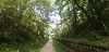

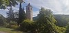
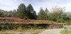
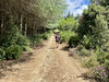

The above images may not be of the site on this page, but were taken nearby. They are loaded from Flickr so please click on them for image credits.
Click here to see more info for this site
Nearby sites
Click here to view sites on an interactive map of the areaKey: Red: member's photo, Blue: 3rd party photo, Yellow: other image, Green: no photo - please go there and take one, Grey: site destroyed
Download sites to:
KML (Google Earth)
GPX (GPS waypoints)
CSV (Garmin/Navman)
CSV (Excel)
To unlock full downloads you need to sign up as a Contributory Member. Otherwise downloads are limited to 50 sites.
Turn off the page maps and other distractions
Nearby sites listing. In the following links * = Image available
1.9km NNW 346° Dolmen du Cailho* Burial Chamber or Dolmen
3.6km NW 304° Menhir du Col Folabric Standing Stone (Menhir)
3.7km WNW 300° Mas Haut menhir* Standing Stone (Menhir)
4.6km WNW 290° Dolmen des Cabanes (Riols) Burial Chamber or Dolmen
5.7km NE 47° Dolmen du Ròc-des-Gòrbs Burial Chamber or Dolmen
5.8km NE 44° Dolmen du Débès Burial Chamber or Dolmen
5.9km E 93° Peiro Escrito Rock Art
7.4km NNW 336° Statue menhir de Picarel* Sculptured Stone
7.8km SW 235° Grotte du Pountil Cave or Rock Shelter
8.0km SW 232° Musée de Préhistoire Régionale du Pays Saint Ponais* Museum
8.6km NNW 339° Statue menhir des Fontanelles* Sculptured Stone
8.7km NNW 339° Statue menhir de La Pomarède* Sculptured Stone
9.3km SE 144° Grotte de Camprafaud Cave or Rock Shelter
9.4km NNW 329° Statue menhir de Cambayssy* Sculptured Stone
10.5km SW 215° Grotte d'Artenac Cave or Rock Shelter
10.7km NW 315° Col-de-la-Bole menhir* Sculptured Stone
11.0km NNW 334° Dolmen de la Frajure* Burial Chamber or Dolmen
11.4km NW 325° Gravures du Roc del Bosc Rock Art
11.4km NW 307° Statue menhir de Cacavel* Sculptured Stone
11.5km NNW 342° Triby-Fabié statue-menhir* Sculptured Stone
11.8km S 185° Sainte-Euphémie tumulus Chambered Tomb
12.1km N 358° La Landette statue menhir* Sculptured Stone
12.7km NNE 24° Salverguettes 2 statue-menhir Sculptured Stone
12.7km NNW 339° Naujac statue menhir* Sculptured Stone
12.8km NW 311° Menhir de Goursolles* Standing Stone (Menhir)
View more nearby sites and additional images


 We would like to know more about this location. Please feel free to add a brief description and any relevant information in your own language.
 Wir möchten mehr über diese Stätte erfahren. Bitte zögern Sie nicht, eine kurze Beschreibung und relevante Informationen in Deutsch hinzuzufügen.
 Nous aimerions en savoir encore un peu sur les lieux. S'il vous plaît n'hesitez pas à ajouter une courte description et tous les renseignements pertinents dans votre propre langue.
 Quisieramos informarnos un poco más de las lugares. No dude en añadir una breve descripción y otros datos relevantes en su propio idioma.