


<< Our Photo Pages >> La Pierre Plantee (Oupia) - Standing Stone (Menhir) in France in Languedoc:Hérault (34)
Submitted by richardfrance on Friday, 13 June 2008 Page Views: 3445
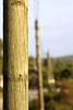
Neolithic and Bronze AgeSite Name: La Pierre Plantee (Oupia)Country: France
NOTE: This site is 2.256 km away from the location you searched for.
Département: Languedoc:Hérault (34) Type: Standing Stone (Menhir)
Nearest Town: Olonzac Nearest Village: Oupia
Latitude: 43.274722N Longitude: 2.784722E
Condition:
| 5 | Perfect |
| 4 | Almost Perfect |
| 3 | Reasonable but with some damage |
| 2 | Ruined but still recognisable as an ancient site |
| 1 | Pretty much destroyed, possibly visible as crop marks |
| 0 | No data. |
| -1 | Completely destroyed |
| 5 | Superb |
| 4 | Good |
| 3 | Ordinary |
| 2 | Not Good |
| 1 | Awful |
| 0 | No data. |
| 5 | Can be driven to, probably with disabled access |
| 4 | Short walk on a footpath |
| 3 | Requiring a bit more of a walk |
| 2 | A long walk |
| 1 | In the middle of nowhere, a nightmare to find |
| 0 | No data. |
| 5 | co-ordinates taken by GPS or official recorded co-ordinates |
| 4 | co-ordinates scaled from a detailed map |
| 3 | co-ordinates scaled from a bad map |
| 2 | co-ordinates of the nearest village |
| 1 | co-ordinates of the nearest town |
| 0 | no data |
Internal Links:
External Links:
 (PID:39615)")
Drive out from Olonzac on 'La Minervoise' - one of the most rewarding roads in Languedoc - towards Beziers. Park in the layby on the right, where the hills crowd in, 3 Km out.
If the 'end of the world as we know it' wasn't quite so nigh, then I'd start bothering La Mairie about moving it. But the end of the world is nigh - so my time is best spent elsewhere. Looking in the rear-view mirror.
You may be viewing yesterday's version of this page. To see the most up to date information please register for a free account.
 (PID:39616)")
Do not use the above information on other web sites or publications without permission of the contributor.
Nearby Images from Flickr

The above images may not be of the site on this page, but were taken nearby. They are loaded from Flickr so please click on them for image credits.
Click here to see more info for this site
Nearby sites
Click here to view sites on an interactive map of the areaKey: Red: member's photo, Blue: 3rd party photo, Yellow: other image, Green: no photo - please go there and take one, Grey: site destroyed
Download sites to:
KML (Google Earth)
GPX (GPS waypoints)
CSV (Garmin/Navman)
CSV (Excel)
To unlock full downloads you need to sign up as a Contributory Member. Otherwise downloads are limited to 50 sites.
Turn off the page maps and other distractions
Nearby sites listing. In the following links * = Image available
3.0km SW 231° Mourrel Ferrat oppidum* Hillfort
4.7km WNW 284° Oppidum protohistorique Ancient Village or Settlement
5.0km NE 37° Oppidum de Cayla Ancient Village or Settlement
5.5km NE 36° Dolmen du Mount-Marcou* Burial Chamber or Dolmen
5.6km WSW 245° Tourouzelle burial chamber Burial Chamber or Dolmen
7.4km NW 316° Cupules de Saint-Salvy Rock Art
7.9km NW 314° Grotte d'Aldène Cave or Rock Shelter
8.5km NW 323° La Cigalière Dolmen* Burial Chamber or Dolmen
9.1km SW 232° Allée Couverte d'Escales Passage Grave
9.2km NNW 338° Bruneau dolmen Burial Chamber or Dolmen
9.3km NW 323° Montcelebre* Standing Stone (Menhir)
9.4km NNW 340° Musée de Paléontologie et d'Archéologie (Minerve) Museum
9.4km WNW 286° Morrel das Fadas replica* Modern Stone Circle etc
9.5km WNW 296° Morrel das Fadas* Passage Grave
9.8km NNW 348° Dolmen de Mayrannes 1 Burial Chamber or Dolmen
10.0km NNW 348° Menhir de Mayranne Standing Stone (Menhir)
10.1km N 349° Pierre de Coupiat 3 Standing Stone (Menhir)
10.1km NE 48° Grotte de Las Fons Cave or Rock Shelter
10.1km NE 48° Grotte du Moulin (Bize-Minervois)* Cave or Rock Shelter
10.2km NNW 349° Pierre de Coupiat 2 Standing Stone (Menhir)
10.3km NNW 347° Dolmen de Coupiat* Burial Chamber or Dolmen
10.4km NNW 349° Alignement de Coupiat Stone Row / Alignment
10.7km NNW 345° Dolmen de Mayrannes 2 Burial Chamber or Dolmen
10.9km NW 323° Minerve la Vieille* Ancient Village or Settlement
11.1km NNW 328° Dolmen des Lacs 4 Burial Chamber or Dolmen
View more nearby sites and additional images


 We would like to know more about this location. Please feel free to add a brief description and any relevant information in your own language.
 Wir möchten mehr über diese Stätte erfahren. Bitte zögern Sie nicht, eine kurze Beschreibung und relevante Informationen in Deutsch hinzuzufügen.
 Nous aimerions en savoir encore un peu sur les lieux. S'il vous plaît n'hesitez pas à ajouter une courte description et tous les renseignements pertinents dans votre propre langue.
 Quisieramos informarnos un poco más de las lugares. No dude en añadir una breve descripción y otros datos relevantes en su propio idioma.