

<< Text Pages >> Menhir del Pla d'Amigó - Standing Stone (Menhir) in Spain in Cataluña
Submitted by holger_rix on Friday, 25 December 2015 Page Views: 904
Neolithic and Bronze AgeSite Name: Menhir del Pla d''AmigóCountry: Spain
NOTE: This site is 2.966 km away from the location you searched for.
Region: Cataluña Type: Standing Stone (Menhir)
Latitude: 42.347317N Longitude: 2.791814E
Condition:
| 5 | Perfect |
| 4 | Almost Perfect |
| 3 | Reasonable but with some damage |
| 2 | Ruined but still recognisable as an ancient site |
| 1 | Pretty much destroyed, possibly visible as crop marks |
| 0 | No data. |
| -1 | Completely destroyed |
| 5 | Superb |
| 4 | Good |
| 3 | Ordinary |
| 2 | Not Good |
| 1 | Awful |
| 0 | No data. |
| 5 | Can be driven to, probably with disabled access |
| 4 | Short walk on a footpath |
| 3 | Requiring a bit more of a walk |
| 2 | A long walk |
| 1 | In the middle of nowhere, a nightmare to find |
| 0 | No data. |
| 5 | co-ordinates taken by GPS or official recorded co-ordinates |
| 4 | co-ordinates scaled from a detailed map |
| 3 | co-ordinates scaled from a bad map |
| 2 | co-ordinates of the nearest village |
| 1 | co-ordinates of the nearest town |
| 0 | no data |
Be the first person to rate this site - see the 'Contribute!' box in the right hand menu.
Internal Links:
External Links:
Standing Stone (Menhir) in Cataluña
You may be viewing yesterday's version of this page. To see the most up to date information please register for a free account.
Do not use the above information on other web sites or publications without permission of the contributor.
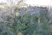
Nearby Images from Flickr
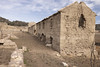
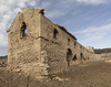
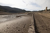
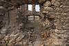
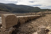
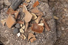
The above images may not be of the site on this page, but were taken nearby. They are loaded from Flickr so please click on them for image credits.
Click here to see more info for this site
Nearby sites
Click here to view sites on an interactive map of the areaKey: Red: member's photo, Blue: 3rd party photo, Yellow: other image, Green: no photo - please go there and take one, Grey: site destroyed
Download sites to:
KML (Google Earth)
GPX (GPS waypoints)
CSV (Garmin/Navman)
CSV (Excel)
To unlock full downloads you need to sign up as a Contributory Member. Otherwise downloads are limited to 50 sites.
Turn off the page maps and other distractions
Nearby sites listing. In the following links * = Image available
4.0km NNE 15° Dolmen Puig de Caneres* Burial Chamber or Dolmen
4.9km NNW 342° Dolmen de Can Vinyes Burial Chamber or Dolmen
5.0km NNE 12° Dolmen del Pardal* Burial Chamber or Dolmen
5.3km NW 323° Menhir de Can Coll Standing Stone (Menhir)
5.4km NW 319° Menhires del Paseo de Maçanet Standing Stone (Menhir)
5.7km NW 313° Menhir Pedra Dreta* Standing Stone (Menhir)
5.8km NE 50° Menhir el Roc del Capellà Standing Stone (Menhir)
5.9km NE 41° Menhir del Roc del Frare* Standing Stone (Menhir)
7.4km NNE 33° Menhir del Camp de la Matalena Standing Stone (Menhir)
7.4km NNE 33° Menhir de Mas del Puig Standing Stone (Menhir)
9.0km NE 48° Menhir de Palaus* Standing Stone (Menhir)
9.3km NE 38° Dolmen de Rocalba* Burial Chamber or Dolmen
9.3km ENE 60° Dolmen La Jaça d´en Torrent* Burial Chamber or Dolmen
9.3km ENE 67° Menhir Pedra Comanera 2 Standing Stone (Menhir)
9.4km ENE 62° Dolmen La Barraca del Lladre* Burial Chamber or Dolmen
9.4km ENE 70° Menhir Pedra Comanera 1 Standing Stone (Menhir)
9.4km ENE 70° Menhir Vidal* Standing Stone (Menhir)
9.8km ENE 72° Pedra dels Sacrificis de Capmany Natural Stone / Erratic / Other Natural Feature
10.1km NNE 29° Menhir dels Planers de la Serafina* Standing Stone (Menhir)
10.2km NNE 29° Dolmen dels Planers de la Serafina Burial Chamber or Dolmen
10.2km ENE 66° Dolmen El Mirgoler Burial Chamber or Dolmen
10.4km NW 311° Menhir del Coll de la Dona Morta Standing Stone (Menhir)
10.7km ENE 61° Menhir dels Estanys 2* Standing Stone (Menhir)
10.8km ENE 60° Dolmen dels Estanys 2* Burial Chamber or Dolmen
10.8km ENE 60° Dolmen dels Estanys 1* Burial Chamber or Dolmen
View more nearby sites and additional images


 We would like to know more about this location. Please feel free to add a brief description and any relevant information in your own language.
 Wir möchten mehr über diese Stätte erfahren. Bitte zögern Sie nicht, eine kurze Beschreibung und relevante Informationen in Deutsch hinzuzufügen.
 Nous aimerions en savoir encore un peu sur les lieux. S'il vous plaît n'hesitez pas à ajouter une courte description et tous les renseignements pertinents dans votre propre langue.
 Quisieramos informarnos un poco más de las lugares. No dude en añadir una breve descripción y otros datos relevantes en su propio idioma.