

<< Text Pages >> Le Mouton Noir - Passage Grave in France in Ile-de-France:Seine-et-Marne 77
Submitted by TheCaptain on Wednesday, 08 September 2010 Page Views: 1916
Neolithic and Bronze AgeSite Name: Le Mouton NoirCountry: France
NOTE: This site is 4.253 km away from the location you searched for.
Département: Ile-de-France:Seine-et-Marne 77 Type: Passage Grave
Nearest Town: Paris Nearest Village: Esbly
Latitude: 48.901000N Longitude: 2.813000E
Condition:
| 5 | Perfect |
| 4 | Almost Perfect |
| 3 | Reasonable but with some damage |
| 2 | Ruined but still recognisable as an ancient site |
| 1 | Pretty much destroyed, possibly visible as crop marks |
| 0 | No data. |
| -1 | Completely destroyed |
| 5 | Superb |
| 4 | Good |
| 3 | Ordinary |
| 2 | Not Good |
| 1 | Awful |
| 0 | No data. |
| 5 | Can be driven to, probably with disabled access |
| 4 | Short walk on a footpath |
| 3 | Requiring a bit more of a walk |
| 2 | A long walk |
| 1 | In the middle of nowhere, a nightmare to find |
| 0 | No data. |
| 5 | co-ordinates taken by GPS or official recorded co-ordinates |
| 4 | co-ordinates scaled from a detailed map |
| 3 | co-ordinates scaled from a bad map |
| 2 | co-ordinates of the nearest village |
| 1 | co-ordinates of the nearest town |
| 0 | no data |
Be the first person to rate this site - see the 'Contribute!' box in the right hand menu.
Internal Links:
External Links:
Sepulture-en-fosse in Ile-de-France:Seine-et-Marne 77
Le Mouton Noir is a Sepulture-en-fosse in the community of Esbly, Departement of Seine-et-Marne, Region of Ile-de-France
You may be viewing yesterday's version of this page. To see the most up to date information please register for a free account.
Do not use the above information on other web sites or publications without permission of the contributor.
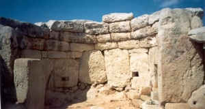
Nearby Images from Flickr


The above images may not be of the site on this page, but were taken nearby. They are loaded from Flickr so please click on them for image credits.
Click here to see more info for this site
Nearby sites
Click here to view sites on an interactive map of the areaKey: Red: member's photo, Blue: 3rd party photo, Yellow: other image, Green: no photo - please go there and take one, Grey: site destroyed
Download sites to:
KML (Google Earth)
GPX (GPS waypoints)
CSV (Garmin/Navman)
CSV (Excel)
To unlock full downloads you need to sign up as a Contributory Member. Otherwise downloads are limited to 50 sites.
Turn off the page maps and other distractions
Nearby sites listing. In the following links * = Image available
2.6km WNW 287° Le Montigny Passage Grave
3.5km N 354° Vignely Sepulture Passage Grave
4.4km NE 49° Fond de Ré Passage Grave
8.0km NE 39° Chemin des Pretres Passage Grave
8.0km NE 39° Le Poteau Vert Passage Grave
8.7km SE 124° Crecy-la-Chapelle 3 Passage Grave
8.7km SE 125° Crecy-la-Chapelle 2 Passage Grave
8.8km SE 125° Crecy-la-Chapelle 1 Passage Grave
10.1km E 81° Menhir dit la Pierre de Fécondité Standing Stone (Menhir)
14.1km NE 43° Germigny-l'Eveque sepulture Passage Grave
22.1km ESE 117° Les Murs Blancs Passage Grave
24.4km NE 51° Dolmen du Bois de Belleville Burial Chamber or Dolmen
26.0km NE 52° Belleville Hypogee Ancient Village or Settlement
26.2km NE 52° Allée Couverte du Bois des Marêts Passage Grave
26.5km WSW 248° Menhir de l'Abbaye* Standing Stone (Menhir)
26.5km SE 132° Pignon de Sainte Aubierge Standing Stone (Menhir)
28.0km SSE 169° Menhir dit la Pierre Couvée Standing Stone (Menhir)
29.1km N 5° Dolmen de Nanteuil-le-Haudouin Burial Chamber or Dolmen
30.7km SE 140° La Chapellerie Passage Grave
30.7km N 2° Pierre Glissoire de Péroy-les-Gombries Standing Stone (Menhir)
31.5km SW 224° Alignement de la Pierre Fritte* Stone Row / Alignment
32.0km NW 310° la Pierre Longue (Bellefontaine)* Standing Stone (Menhir)
32.2km SW 225° Femme et Fille de Loth Alignement* Stone Row / Alignment
32.9km NNW 342° La Queusse de Gargantua* Standing Stone (Menhir)
33.7km NW 311° La Pierre St Martin* Polissoir
View more nearby sites and additional images


 We would like to know more about this location. Please feel free to add a brief description and any relevant information in your own language.
 Wir möchten mehr über diese Stätte erfahren. Bitte zögern Sie nicht, eine kurze Beschreibung und relevante Informationen in Deutsch hinzuzufügen.
 Nous aimerions en savoir encore un peu sur les lieux. S'il vous plaît n'hesitez pas à ajouter une courte description et tous les renseignements pertinents dans votre propre langue.
 Quisieramos informarnos un poco más de las lugares. No dude en añadir una breve descripción y otros datos relevantes en su propio idioma.