


<< Our Photo Pages >> Dolmen de les Closes (Pla de l`Estany) - Burial Chamber or Dolmen in Spain in Cataluña
Submitted by HernetheHunter on Monday, 08 November 2010 Page Views: 7712
Neolithic and Bronze AgeSite Name: Dolmen de les Closes (Pla de l`Estany) Alternative Name: Pujarnol Dolmen, Dolmen de PorqueresCountry: Spain
NOTE: This site is 2.742 km away from the location you searched for.
Region: Cataluña Type: Burial Chamber or Dolmen
Nearest Town: Banyoles Nearest Village: Pujarnal
Latitude: 42.098458N Longitude: 2.732107E
Condition:
| 5 | Perfect |
| 4 | Almost Perfect |
| 3 | Reasonable but with some damage |
| 2 | Ruined but still recognisable as an ancient site |
| 1 | Pretty much destroyed, possibly visible as crop marks |
| 0 | No data. |
| -1 | Completely destroyed |
| 5 | Superb |
| 4 | Good |
| 3 | Ordinary |
| 2 | Not Good |
| 1 | Awful |
| 0 | No data. |
| 5 | Can be driven to, probably with disabled access |
| 4 | Short walk on a footpath |
| 3 | Requiring a bit more of a walk |
| 2 | A long walk |
| 1 | In the middle of nowhere, a nightmare to find |
| 0 | No data. |
| 5 | co-ordinates taken by GPS or official recorded co-ordinates |
| 4 | co-ordinates scaled from a detailed map |
| 3 | co-ordinates scaled from a bad map |
| 2 | co-ordinates of the nearest village |
| 1 | co-ordinates of the nearest town |
| 0 | no data |
Internal Links:
External Links:
I have visited· I would like to visit
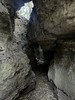
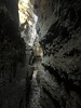
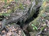
HernetheHunter has visited here
 (PID:69780)")
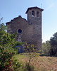
Just off the G-5247 from Pujarnol, take a turn up Avenguda de Puig Suris, though the dolmen is well signed along the main roads. There is place for one or two cars at the site (on the right hand side). Take the trail/path around and up to the right, and you will see the dolmen (The one to the left only leads to a farmhouse).
You may be viewing yesterday's version of this page. To see the most up to date information please register for a free account.
 (PID:69778)")
 (PID:69779)")
 (PID:69777)")
Do not use the above information on other web sites or publications without permission of the contributor.
Nearby Images from Flickr
The above images may not be of the site on this page, but were taken nearby. They are loaded from Flickr so please click on them for image credits.
Click here to see more info for this site
Nearby sites
Click here to view sites on an interactive map of the areaKey: Red: member's photo, Blue: 3rd party photo, Yellow: other image, Green: no photo - please go there and take one, Grey: site destroyed
Download sites to:
KML (Google Earth)
GPX (GPS waypoints)
CSV (Garmin/Navman)
CSV (Excel)
To unlock full downloads you need to sign up as a Contributory Member. Otherwise downloads are limited to 50 sites.
Turn off the page maps and other distractions
Nearby sites listing. In the following links * = Image available
769m ENE 77° Villa Romana de Vilauba Ancient Village or Settlement
3.9km NE 35° La Draga* Ancient Village or Settlement
5.5km SE 146° Dolmen de la Mota Burial Chamber or Dolmen
10.7km SW 214° Dolmen de Sant Roc Burial Chamber or Dolmen
11.5km W 270° Cista del Camí del Raspat Cist
11.7km W 266° Jaciment Prehistòric del Roc de la Melca Rock Outcrop
11.7km SW 217° Jaciment Arqueològic La Balma de la Xemeneia Ancient Village or Settlement
12.6km WNW 298° Menhir de la Pedra del Diable Standing Stone (Menhir)
13.2km ESE 108° Dolmen de la Castellana Burial Chamber or Dolmen
14.1km W 266° Dolmen del Puig dels Moros Burial Chamber or Dolmen
15.8km W 260° Cova Sepulcral del Neolític Antic de l'Avellaner Cave or Rock Shelter
16.5km WNW 287° Menhir Volcan Santa Margarida Standing Stone (Menhir)
16.6km SW 219° Cova del Pasteral Cave or Rock Shelter
17.0km SW 218° Dolmen de Coll de Gria Burial Chamber or Dolmen
24.5km SE 129° Cista del Puig d'Arques* Cist
26.0km WSW 252° Dolmen de la Font de la Vena Burial Chamber or Dolmen
26.2km SE 128° Menhir de Sant Sadurní* Standing Stone (Menhir)
26.8km NNW 341° Cista del Coll de la Creu de Principi Cist
27.1km WSW 250° Dolmen de Sant Corneli* Burial Chamber or Dolmen
28.1km N 10° Menhir del Pla d'Amigó Standing Stone (Menhir)
30.0km WSW 256° Dolmen de Puigsespedres Burial Chamber or Dolmen
30.4km ESE 110° Musée d'Archéologie d'Ullastret* Museum
30.9km SW 215° Menhir a Sant Hilari Sacalm* Standing Stone (Menhir)
31.3km ESE 116° Necròpolis de Canapost* Barrow Cemetery
31.3km ESE 115° Menhir de Canapost* Standing Stone (Menhir)
View more nearby sites and additional images


 We would like to know more about this location. Please feel free to add a brief description and any relevant information in your own language.
 Wir möchten mehr über diese Stätte erfahren. Bitte zögern Sie nicht, eine kurze Beschreibung und relevante Informationen in Deutsch hinzuzufügen.
 Nous aimerions en savoir encore un peu sur les lieux. S'il vous plaît n'hesitez pas à ajouter une courte description et tous les renseignements pertinents dans votre propre langue.
 Quisieramos informarnos un poco más de las lugares. No dude en añadir una breve descripción y otros datos relevantes en su propio idioma.