


<< Our Photo Pages >> Poblat de Montbarbat - Ancient Village or Settlement in Spain in Cataluña
Submitted by holger_rix on Monday, 02 November 2015 Page Views: 929
Multi-periodSite Name: Poblat de MontbarbatCountry: Spain
NOTE: This site is 7.028 km away from the location you searched for.
Region: Cataluña Type: Ancient Village or Settlement
Nearest Town: Lloret de Mar
Latitude: 41.735540N Longitude: 2.778162E
Condition:
| 5 | Perfect |
| 4 | Almost Perfect |
| 3 | Reasonable but with some damage |
| 2 | Ruined but still recognisable as an ancient site |
| 1 | Pretty much destroyed, possibly visible as crop marks |
| 0 | No data. |
| -1 | Completely destroyed |
| 5 | Superb |
| 4 | Good |
| 3 | Ordinary |
| 2 | Not Good |
| 1 | Awful |
| 0 | No data. |
| 5 | Can be driven to, probably with disabled access |
| 4 | Short walk on a footpath |
| 3 | Requiring a bit more of a walk |
| 2 | A long walk |
| 1 | In the middle of nowhere, a nightmare to find |
| 0 | No data. |
| 5 | co-ordinates taken by GPS or official recorded co-ordinates |
| 4 | co-ordinates scaled from a detailed map |
| 3 | co-ordinates scaled from a bad map |
| 2 | co-ordinates of the nearest village |
| 1 | co-ordinates of the nearest town |
| 0 | no data |
Internal Links:
External Links:
I have visited· I would like to visit
kalcoatl visited on 21st May 2018 - their rating: Cond: 2 Amb: 5 Access: 4 Well-signposted by road from before the entrance to the Montbarbat urbanization. Park at water deposit car park and 0.5km walk up to the Poblat (village/settlement).
Some remains en route before you reach the hilltop where a large community clearly once lived. Many dwellings down to ground level but with some walls up to 1m or so. Plenty to explore.
Not exploited by the local town hall, and sadly no attempts at preservation or protection, with one exception: a large rusty sign telling you not to spoil the site. Ambience only spoilt by that and a fenced-in watchtower-style radio antenna on the Maçanet side of a concrete post marking the border with Lloret de Mar, where most of the settlement remains lie.
Splendid views from the coast at Lloret de Mar, Blanes and Malgrat de Mar right along the N-II corridor via Maçanet & Girona, taking in many hills and towers, and modern towns either side. It was a bit hard to tell on a hazy day, but the views probably extend to the Pyrenees.
")
From kalcoatl
Well-signposted by road from before the entrance to the Montbarbat urbanization. Park at water deposit car park and 0.5km walk up to the Poblat (village/settlement). Some remains en route before you reach the hilltop where a large community clearly once lived. Many dwellings down to ground level but with some walls up to 1m or so. Plenty to explore. Not exploited by the local town hall, and sadly no attempts at preservation or protection, with one exception: a large rusty sign telling you not to spoil the site. Ambience only spoilt by that and a fenced-in watchtower-style radio antenna on the Maçanet side of a concrete post marking the border with Lloret de Mar, where most of the settlement remains lie. Splendid views from the coast at Lloret de Mar, Blanes and Malgrat de Mar right along the N-II corridor via Maçanet & Girona, taking in many hills and towers, and modern towns either side. It was a bit hard to tell on a hazy day, but the views probably extend to the Pyrenees.
You may be viewing yesterday's version of this page. To see the most up to date information please register for a free account.
")
")
")
")
Do not use the above information on other web sites or publications without permission of the contributor.
Nearby Images from Flickr
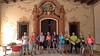
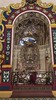
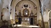
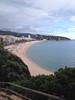

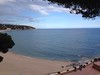
The above images may not be of the site on this page, but were taken nearby. They are loaded from Flickr so please click on them for image credits.
Click here to see more info for this site
Nearby sites
Click here to view sites on an interactive map of the areaKey: Red: member's photo, Blue: 3rd party photo, Yellow: other image, Green: no photo - please go there and take one, Grey: site destroyed
Download sites to:
KML (Google Earth)
GPX (GPS waypoints)
CSV (Garmin/Navman)
CSV (Excel)
To unlock full downloads you need to sign up as a Contributory Member. Otherwise downloads are limited to 50 sites.
Turn off the page maps and other distractions
Nearby sites listing. In the following links * = Image available
485m ENE 63° Dolmen de Montbarbat* Burial Chamber or Dolmen
6.2km ESE 110° Puig de Castellet* Ancient Village or Settlement
10.0km NE 54° Cova d'en Ruira Cave or Rock Shelter
11.2km E 99° Menhir de Cala Llevadó* Standing Stone (Menhir)
11.6km ENE 62° Dolmen Roques de l'Ivet* Burial Chamber or Dolmen
11.6km ENE 66° Cova de Can Rissec* Cave or Rock Shelter
11.9km E 82° Paradolmen de Ses Rates* Burial Chamber or Dolmen
12.0km ENE 70° Dolmen de Tranquinell* Burial Chamber or Dolmen
12.1km E 82° Paradolmen del Reig* Burial Chamber or Dolmen
12.1km E 80° Dolmen Caixa de Vall de Roc Burial Chamber or Dolmen
12.2km ENE 76° Menhir de l'Avi Standing Stone (Menhir)
12.6km E 83° Menhir de Montllor 2 Standing Stone (Menhir)
12.6km E 83° Menhir de Montllor 1* Standing Stone (Menhir)
12.6km E 82° Paradolmen d'en Garcia* Burial Chamber or Dolmen
12.6km E 85° Menhir d'es Morteràs (Murtràs)* Standing Stone (Menhir)
12.6km E 83° Menhir Caigut* Standing Stone (Menhir)
12.8km E 79° Cista de Cadiretes* Burial Chamber or Dolmen
13.0km E 88° Cista de la Mare de Déu de Gràcia* Cist
13.3km ENE 78° Menhir d'en Llach* Standing Stone (Menhir)
13.3km ENE 79° Paradolmen del Senglar* Burial Chamber or Dolmen
13.8km ENE 78° Paradolmen Pedra Sobre Altra* Burial Chamber or Dolmen
13.9km NE 42° Can Cabanyes de Montagut* Standing Stone (Menhir)
14.2km ENE 74° Pedra dels Sacrificis de Can Cabanyes* Natural Stone / Erratic / Other Natural Feature
14.2km ENE 74° Dolmen de Can Cabanyes Burial Chamber or Dolmen
14.3km ENE 73° Abric de Can Cabanyes Burial Chamber or Dolmen
View more nearby sites and additional images

")
 We would like to know more about this location. Please feel free to add a brief description and any relevant information in your own language.
 Wir möchten mehr über diese Stätte erfahren. Bitte zögern Sie nicht, eine kurze Beschreibung und relevante Informationen in Deutsch hinzuzufügen.
 Nous aimerions en savoir encore un peu sur les lieux. S'il vous plaît n'hesitez pas à ajouter une courte description et tous les renseignements pertinents dans votre propre langue.
 Quisieramos informarnos un poco más de las lugares. No dude en añadir una breve descripción y otros datos relevantes en su propio idioma.