


<< Our Photo Pages >> Peyreficade Menhir - Standing Stone (Menhir) in France in Auvergne:Cantal (15)
Submitted by AlexHunger on Tuesday, 07 June 2005 Page Views: 3820
Neolithic and Bronze AgeSite Name: Peyreficade MenhirCountry: France
NOTE: This site is 9.169 km away from the location you searched for.
Département: Auvergne:Cantal (15) Type: Standing Stone (Menhir)
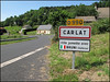
Nearest Town: Aurillac Nearest Village: Carlat
Latitude: 44.881005N Longitude: 2.542671E
Condition:
| 5 | Perfect |
| 4 | Almost Perfect |
| 3 | Reasonable but with some damage |
| 2 | Ruined but still recognisable as an ancient site |
| 1 | Pretty much destroyed, possibly visible as crop marks |
| 0 | No data. |
| -1 | Completely destroyed |
| 5 | Superb |
| 4 | Good |
| 3 | Ordinary |
| 2 | Not Good |
| 1 | Awful |
| 0 | No data. |
| 5 | Can be driven to, probably with disabled access |
| 4 | Short walk on a footpath |
| 3 | Requiring a bit more of a walk |
| 2 | A long walk |
| 1 | In the middle of nowhere, a nightmare to find |
| 0 | No data. |
| 5 | co-ordinates taken by GPS or official recorded co-ordinates |
| 4 | co-ordinates scaled from a detailed map |
| 3 | co-ordinates scaled from a bad map |
| 2 | co-ordinates of the nearest village |
| 1 | co-ordinates of the nearest town |
| 0 | no data |
Internal Links:
External Links:
I have visited· I would like to visit
alchemille has visited here
")
You may be viewing yesterday's version of this page. To see the most up to date information please register for a free account.
")
")
Do not use the above information on other web sites or publications without permission of the contributor.
davidmorgan has found this location on Google Street View:
Nearby Images from Flickr


The above images may not be of the site on this page, but were taken nearby. They are loaded from Flickr so please click on them for image credits.
Click here to see more info for this site
Nearby sites
Click here to view sites on an interactive map of the areaKey: Red: member's photo, Blue: 3rd party photo, Yellow: other image, Green: no photo - please go there and take one, Grey: site destroyed
Download sites to:
KML (Google Earth)
GPX (GPS waypoints)
CSV (Garmin/Navman)
CSV (Excel)
To unlock full downloads you need to sign up as a Contributory Member. Otherwise downloads are limited to 50 sites.
Turn off the page maps and other distractions
Nearby sites listing. In the following links * = Image available
9.4km NNW 344° St Simon menhir* Standing Stone (Menhir)
13.2km W 264° Menhir de Madunhac* Standing Stone (Menhir)
20.0km WNW 298° Dolmen d'Ayrens * Burial Chamber or Dolmen
25.2km SW 218° Cromlech de la Rouquette* Stone Circle
26.2km WNW 296° Nieudan burial chamber* Burial Chamber or Dolmen
26.7km ENE 72° Menhirs de Gourdièges Standing Stone (Menhir)
26.9km WNW 294° Dolmen dit Peyrelevade Burial Chamber or Dolmen
27.1km ESE 103° Menhir de la Baisse des Mazes Standing Stone (Menhir)
31.7km ENE 64° Paulhac burial chamber Burial Chamber or Dolmen
33.4km NW 318° Dolmen dit Pierres des Géants Burial Chamber or Dolmen
34.5km ENE 77° Menhir du Bois des Sagnes Standing Stone (Menhir)
34.7km E 95° Menhir d'Arjalet Standing Stone (Menhir)
35.2km ENE 71° Alleuzet Dolmen* Burial Chamber or Dolmen
35.5km ENE 65° Dolmen de Lapeyre Burial Chamber or Dolmen
36.8km NNW 347° Les Pierres Plates (Anglards-de-Salers)* Burial Chamber or Dolmen
36.9km S 189° Dolmen de Lunel Burial Chamber or Dolmen
37.0km NE 42° Village Fortifie Prehistorique de la Roche Hillfort
38.1km ENE 73° Bargueyrac Menhir* Standing Stone (Menhir)
38.6km ENE 72° La Table au Loup* Burial Chamber or Dolmen
38.7km ENE 60° Pierre-du-Loup (Valuejols)* Burial Chamber or Dolmen
38.9km SSW 208° Menhir de Saint Simon 3* Standing Stone (Menhir)
39.5km SSW 207° Menhir de Saint Simon 2* Standing Stone (Menhir)
39.6km ENE 72° Bois-Grand Dolmen* Burial Chamber or Dolmen
39.7km SSW 207° Menhir de Saint Simon 1* Standing Stone (Menhir)
39.7km NE 47° Cabanes des Fraux Ancient Village or Settlement
View more nearby sites and additional images


 We would like to know more about this location. Please feel free to add a brief description and any relevant information in your own language.
 Wir möchten mehr über diese Stätte erfahren. Bitte zögern Sie nicht, eine kurze Beschreibung und relevante Informationen in Deutsch hinzuzufügen.
 Nous aimerions en savoir encore un peu sur les lieux. S'il vous plaît n'hesitez pas à ajouter une courte description et tous les renseignements pertinents dans votre propre langue.
 Quisieramos informarnos un poco más de las lugares. No dude en añadir una breve descripción y otros datos relevantes en su propio idioma.