


<< Our Photo Pages >> Santa Ponça 20 - Ancient Village or Settlement in Spain in Balearic Isles (Mallorca / Majorca)
Submitted by Ogneslav on Thursday, 20 November 2014 Page Views: 1491
Multi-periodSite Name: Santa Ponça 20Country: Spain
NOTE: This site is 1.963 km away from the location you searched for.
Region: Balearic Isles (Mallorca / Majorca) Type: Ancient Village or Settlement
Nearest Town: Santa Ponça
Latitude: 39.507590N Longitude: 2.488460E
Condition:
| 5 | Perfect |
| 4 | Almost Perfect |
| 3 | Reasonable but with some damage |
| 2 | Ruined but still recognisable as an ancient site |
| 1 | Pretty much destroyed, possibly visible as crop marks |
| 0 | No data. |
| -1 | Completely destroyed |
| 5 | Superb |
| 4 | Good |
| 3 | Ordinary |
| 2 | Not Good |
| 1 | Awful |
| 0 | No data. |
| 5 | Can be driven to, probably with disabled access |
| 4 | Short walk on a footpath |
| 3 | Requiring a bit more of a walk |
| 2 | A long walk |
| 1 | In the middle of nowhere, a nightmare to find |
| 0 | No data. |
| 5 | co-ordinates taken by GPS or official recorded co-ordinates |
| 4 | co-ordinates scaled from a detailed map |
| 3 | co-ordinates scaled from a bad map |
| 2 | co-ordinates of the nearest village |
| 1 | co-ordinates of the nearest town |
| 0 | no data |
Internal Links:
External Links:
")
Text from the information board (in Spanish):
Yacimiento Santa Ponça 20
Yacimiento ubicado en una colina de 46 metros sobre el nivel del mar. Desde este yacimiento se domina toda la llanura de Santa Ponça hast el Puig de Saragossa. También controla difirentes yacimientos entre los que podemos destacar en Puig de Sa Morisca, el Puig de Saragossa, el Puig de Sa Celleta, Es Fornets y el Turó de Ses Abelles.
Se trata de un monumento aislado de planta con tendencia circular y un pequeño adosado. Todo el conjunto está construido con técnica ciclópea de piedras de tamaño mediano clavadas en la tierra. El interior de la estructura está relleno de piedras de derrumbe y vegetación.
You may be viewing yesterday's version of this page. To see the most up to date information please register for a free account.
")
Do not use the above information on other web sites or publications without permission of the contributor.
Nearby Images from Flickr
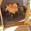
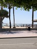
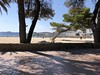
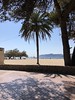
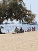
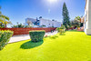
The above images may not be of the site on this page, but were taken nearby. They are loaded from Flickr so please click on them for image credits.
Click here to see more info for this site
Nearby sites
Click here to view sites on an interactive map of the areaKey: Red: member's photo, Blue: 3rd party photo, Yellow: other image, Green: no photo - please go there and take one, Grey: site destroyed
Download sites to:
KML (Google Earth)
GPX (GPS waypoints)
CSV (Garmin/Navman)
CSV (Excel)
To unlock full downloads you need to sign up as a Contributory Member. Otherwise downloads are limited to 50 sites.
Turn off the page maps and other distractions
Nearby sites listing. In the following links * = Image available
269m WNW 286° Santa Ponça 5* Ancient Village or Settlement
308m SW 217° Túmulo de Son Miralles* Artificial Mound
370m SW 225° Talayot de Son Miralles* Broch or Nuraghe
672m W 270° Poblat del Puig de sa Morisca* Ancient Village or Settlement
1.8km SSE 150° Túmulo de Son Ferrer* Round Barrow(s)
3.5km ESE 111° Naveta Alemany* Ancient Village or Settlement
15.4km ENE 65° Museu de Mallorca* Museum
19.4km ENE 79° Son Oms santuario* Ancient Temple
23.4km NNE 20° Son Oleza Ancient Village or Settlement
24.7km NNE 23° The Maze, Mallorca Ancient Village or Settlement
25.0km NNE 23° Son Mas* Ancient Temple
31.3km ESE 113° Capocorb Vell* Ancient Village or Settlement
31.9km E 95° Son Noguera* Broch or Nuraghe
34.3km ESE 116° Talaies de Cala Pi* Ancient Village or Settlement
38.3km NE 50° Es Castellot Ancient Village or Settlement
39.0km E 83° Son Coll Nou Broch or Nuraghe
39.1km ENE 66° Camp del Bisbe* Cave or Rock Shelter
40.0km ENE 65° Son Fred* Broch or Nuraghe
41.2km ENE 69° Binifat* Broch or Nuraghe
41.4km ENE 67° Son Corro* Ancient Village or Settlement
41.9km ENE 78° Son Fornes Settlement* Ancient Village or Settlement
42.3km ENE 69° Es Turassot* Ancient Village or Settlement
43.2km ENE 78° Campanari des Moros* Broch or Nuraghe
43.3km E 80° Archaeological Museum of Son Fornés* Museum
43.5km ESE 110° Talaiot de Ca n'Estela* Broch or Nuraghe
View more nearby sites and additional images


 We would like to know more about this location. Please feel free to add a brief description and any relevant information in your own language.
 Wir möchten mehr über diese Stätte erfahren. Bitte zögern Sie nicht, eine kurze Beschreibung und relevante Informationen in Deutsch hinzuzufügen.
 Nous aimerions en savoir encore un peu sur les lieux. S'il vous plaît n'hesitez pas à ajouter une courte description et tous les renseignements pertinents dans votre propre langue.
 Quisieramos informarnos un poco más de las lugares. No dude en añadir una breve descripción y otros datos relevantes en su propio idioma.