


<< Other Photo Pages >> Menhir dit la Pierre Droite (Villeneuve-Minervois) - Standing Stone (Menhir) in France in Languedoc:Aude (11)
Submitted by TheCaptain on Thursday, 10 February 2005 Page Views: 4553
Neolithic and Bronze AgeSite Name: Menhir dit la Pierre Droite (Villeneuve-Minervois)Country: France
NOTE: This site is 0.554 km away from the location you searched for.
Département: Languedoc:Aude (11) Type: Standing Stone (Menhir)
Nearest Town: Carcassonne Nearest Village: Villeneuve-Minervois
Latitude: 43.321601N Longitude: 2.467659E
Condition:
| 5 | Perfect |
| 4 | Almost Perfect |
| 3 | Reasonable but with some damage |
| 2 | Ruined but still recognisable as an ancient site |
| 1 | Pretty much destroyed, possibly visible as crop marks |
| 0 | No data. |
| -1 | Completely destroyed |
| 5 | Superb |
| 4 | Good |
| 3 | Ordinary |
| 2 | Not Good |
| 1 | Awful |
| 0 | No data. |
| 5 | Can be driven to, probably with disabled access |
| 4 | Short walk on a footpath |
| 3 | Requiring a bit more of a walk |
| 2 | A long walk |
| 1 | In the middle of nowhere, a nightmare to find |
| 0 | No data. |
| 5 | co-ordinates taken by GPS or official recorded co-ordinates |
| 4 | co-ordinates scaled from a detailed map |
| 3 | co-ordinates scaled from a bad map |
| 2 | co-ordinates of the nearest village |
| 1 | co-ordinates of the nearest town |
| 0 | no data |
Be the first person to rate this site - see the 'Contribute!' box in the right hand menu.
Internal Links:
External Links:
I have visited· I would like to visit
TheCaptain couldn't find on 14th Sep 2005 I failed to find this stone on the way down the hill. It is supposedly about 1.5 kilometres from the village of Villeneuve-Minervois, at the side of the road.
This menhir is only 1.7 metres tall despite its large (2.6m) width.
Wikipedia article
Sites mégalithiques de l'Aude
You may be viewing yesterday's version of this page. To see the most up to date information please register for a free account.
Do not use the above information on other web sites or publications without permission of the contributor.
Nearby Images from Flickr
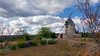


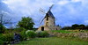
The above images may not be of the site on this page, but were taken nearby. They are loaded from Flickr so please click on them for image credits.
Click here to see more info for this site
Nearby sites
Click here to view sites on an interactive map of the areaKey: Red: member's photo, Blue: 3rd party photo, Yellow: other image, Green: no photo - please go there and take one, Grey: site destroyed
Download sites to:
KML (Google Earth)
GPX (GPS waypoints)
CSV (Garmin/Navman)
CSV (Excel)
To unlock full downloads you need to sign up as a Contributory Member. Otherwise downloads are limited to 50 sites.
Turn off the page maps and other distractions
Nearby sites listing. In the following links * = Image available
2.2km NNE 23° Roque Traoucado* Burial Chamber or Dolmen
2.3km NNE 31° Dolmen de la Jagartière* Burial Chamber or Dolmen
2.3km NNE 28° Tombeau de Roland* Burial Chamber or Dolmen
3.2km NNW 327° Dolmen de la Croux de la Peyro Burial Chamber or Dolmen
3.8km W 277° Grotte du Gazel* Cave or Rock Shelter
4.3km NNW 348° Grotte de Cabrespine* Cave or Rock Shelter
4.5km S 170° Villarlong burial chamber Burial Chamber or Dolmen
4.9km ENE 73° Grotte de Buffens Cave or Rock Shelter
5.4km ESE 120° Allée Couverte de Saint-Eugène* Passage Grave
6.2km SSW 204° Menhir de Bagnoles Standing Stone (Menhir)
6.3km NW 307° Dolmen de la Pierre Plantée (Laferrière)* Burial Chamber or Dolmen
6.7km WNW 303° Peyregat menhir* Standing Stone (Menhir)
6.8km ENE 74° Enceinte du Cros* Hillfort
8.0km SSW 199° Malves Menhir* Standing Stone (Menhir)
8.4km NE 43° Citou 2 burial chamber Burial Chamber or Dolmen
8.5km SSW 212° Villalier burial chamber Burial Chamber or Dolmen
8.5km NE 43° Citou 1 burial chamber Burial Chamber or Dolmen
8.6km NE 44° Citou 3 burial chamber Burial Chamber or Dolmen
9.4km E 86° Allee Couverte de Jappeloup* Passage Grave
9.9km ENE 65° Dolmen de Bel-Soleil 1* Burial Chamber or Dolmen
10.0km ENE 66° Menhir de Bel Soleil* Standing Stone (Menhir)
10.1km ENE 66° Dolmen de Bel-Soleil 2 Burial Chamber or Dolmen
10.2km WNW 303° Dolmen de Mas-Cabardès Burial Chamber or Dolmen
10.2km SSW 193° Bouilhonnac burial chamber Burial Chamber or Dolmen
10.6km NW 314° Ventajous Dolmen Burial Chamber or Dolmen
View more nearby sites and additional images


 We would like to know more about this location. Please feel free to add a brief description and any relevant information in your own language.
 Wir möchten mehr über diese Stätte erfahren. Bitte zögern Sie nicht, eine kurze Beschreibung und relevante Informationen in Deutsch hinzuzufügen.
 Nous aimerions en savoir encore un peu sur les lieux. S'il vous plaît n'hesitez pas à ajouter une courte description et tous les renseignements pertinents dans votre propre langue.
 Quisieramos informarnos un poco más de las lugares. No dude en añadir una breve descripción y otros datos relevantes en su propio idioma.