


<< Text Pages >> Jardin archéologique de Saint-Acheul - Museum in France in Picardie:Somme (80)
Submitted by Hunengrab77 on Tuesday, 08 August 2023 Page Views: 112
MuseumsSite Name: Jardin archéologique de Saint-AcheulCountry: France
NOTE: This site is 8.087 km away from the location you searched for.
Département: Picardie:Somme (80) Type: Museum
Nearest Town: Amiens
Latitude: 49.878590N Longitude: 2.329190E
Condition:
| 5 | Perfect |
| 4 | Almost Perfect |
| 3 | Reasonable but with some damage |
| 2 | Ruined but still recognisable as an ancient site |
| 1 | Pretty much destroyed, possibly visible as crop marks |
| 0 | No data. |
| -1 | Completely destroyed |
| 5 | Superb |
| 4 | Good |
| 3 | Ordinary |
| 2 | Not Good |
| 1 | Awful |
| 0 | No data. |
| 5 | Can be driven to, probably with disabled access |
| 4 | Short walk on a footpath |
| 3 | Requiring a bit more of a walk |
| 2 | A long walk |
| 1 | In the middle of nowhere, a nightmare to find |
| 0 | No data. |
| 5 | co-ordinates taken by GPS or official recorded co-ordinates |
| 4 | co-ordinates scaled from a detailed map |
| 3 | co-ordinates scaled from a bad map |
| 2 | co-ordinates of the nearest village |
| 1 | co-ordinates of the nearest town |
| 0 | no data |
Internal Links:
External Links:
Prehistoric deposits at Saint-Acheul were discovered in the 19th century. In 1872 the district gave its name to one of the most ancient of human industries: Acheulean. Saint-Acheul archaeological garden was laid out to enhance this most ancient of sites, while offering a pleasant place to walk in naturally fragrant surroundings.
Listed as an historical monument since 1947 and open to the public since 1998, the Saint-Acheul site is an excellent illustration of the history of prehistoric discoveries and their recognition by the scientific community.
Source: https://www.visit-somme.com/jardin-archeologique-de-saint-acheul/amiens/pcupic0800010648
You may be viewing yesterday's version of this page. To see the most up to date information please register for a free account.
Do not use the above information on other web sites or publications without permission of the contributor.
Nearby Images from Flickr
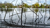
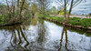

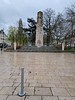

The above images may not be of the site on this page, but were taken nearby. They are loaded from Flickr so please click on them for image credits.
Click here to see more info for this site
Nearby sites
Click here to view sites on an interactive map of the areaKey: Red: member's photo, Blue: 3rd party photo, Yellow: other image, Green: no photo - please go there and take one, Grey: site destroyed
Download sites to:
KML (Google Earth)
GPX (GPS waypoints)
CSV (Garmin/Navman)
CSV (Excel)
To unlock full downloads you need to sign up as a Contributory Member. Otherwise downloads are limited to 50 sites.
Turn off the page maps and other distractions
Nearby sites listing. In the following links * = Image available
2.7km WNW 299° Musée de Picardie* Museum
8.6km SW 234° Au Fossé Gosset Burial Chamber or Dolmen
11.9km NW 317° Les Gres Burial Chamber or Dolmen
12.0km WSW 251° Planchat Not Known (by us)
13.4km NW 307° Oppidum dit Camp de César (Saint-Sauveur) Ancient Village or Settlement
13.7km NW 305° Samara prehistoric park* Museum
16.1km NE 40° Menhir dit la Pierre d'Oblicamp* Standing Stone (Menhir)
17.6km N 349° Underground City of Naours Ancient Mine, Quarry or other Industry
19.3km ENE 62° Ribemont-Sur-Ancre Centre archéologique départemental* Museum
24.3km SW 236° Famechon Fouilles Archeologique Not Known (by us)
30.1km S 184° Vendeuil Gallo-Roman Theatre* Ancient Palace
36.5km NNW 343° Dolmen de Béalcourt* Burial Chamber or Dolmen
42.4km E 89° Neolithic sites of Villers-Carbonnel* Ancient Village or Settlement
45.5km E 83° Le Doigt de Gargantua (Doingt)* Standing Stone (Menhir)
49.4km SSE 150° Gournay-Sur-Aronde* Ancient Village or Settlement
52.7km ESE 106° Alignement d'Eppeville* Stone Row / Alignment
57.6km S 189° Dolmen de la Pierre aux Fées (Villers-St-Sépulcre)* Passage Grave
57.7km NNE 25° Les Pierres Jumelles (Mont-Saint-Éloi)* Standing Stones
58.7km SE 142° Camp de César du Mont Ganelon Ancient Village or Settlement
60.7km E 100° Menhir dit la Pierre à Bénie Standing Stone (Menhir)
61.0km SE 142° Dolmen dit la Pierre Monicart Burial Chamber or Dolmen
61.3km WNW 285° Incheville Oppidum Ancient Village or Settlement
62.3km NNE 17° Le Gal de Gauchin* Standing Stone (Menhir)
62.6km SE 145° Le Hazoy Burial Chamber or Dolmen
63.0km NNE 18° Dolmen dit la Table des Fées* Burial Chamber or Dolmen
View more nearby sites and additional images


 We would like to know more about this location. Please feel free to add a brief description and any relevant information in your own language.
 Wir möchten mehr über diese Stätte erfahren. Bitte zögern Sie nicht, eine kurze Beschreibung und relevante Informationen in Deutsch hinzuzufügen.
 Nous aimerions en savoir encore un peu sur les lieux. S'il vous plaît n'hesitez pas à ajouter une courte description et tous les renseignements pertinents dans votre propre langue.
 Quisieramos informarnos un poco más de las lugares. No dude en añadir una breve descripción y otros datos relevantes en su propio idioma.